Atarjea
"The road into Atarjea loses altitude fast, dropping from pine forest into canyon scrub before the town appears below you — and you get the sense it never much cared whether you found it or not."
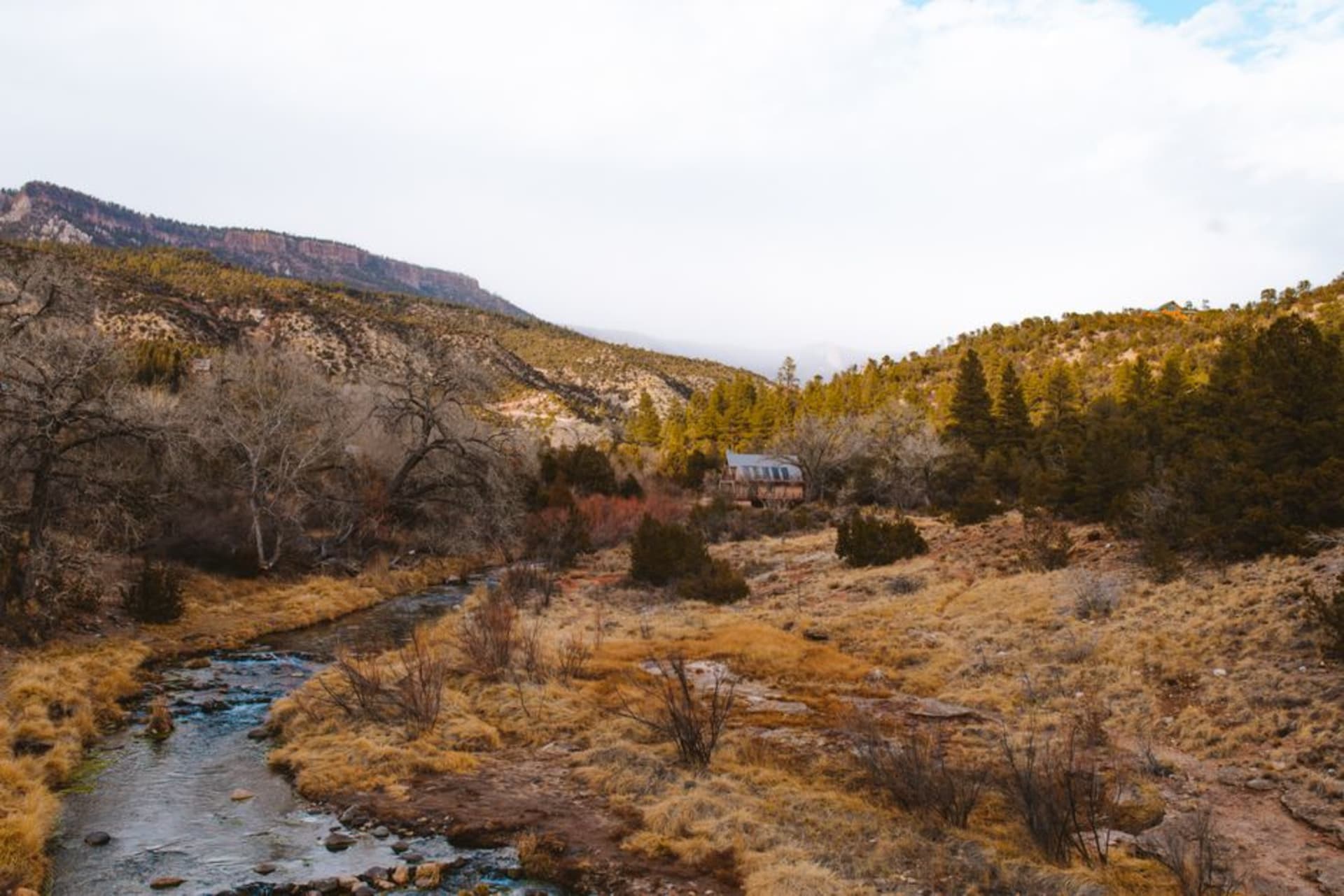
Atarjea sits at the bottom of a canyon where Guanajuato's sierra breaks toward Querétaro, reached by a road that descends through three climate zones in under an hour. It was Chichimec territory — among the last communities in the Bajío to resist Spanish settlement — and the town still carries the quiet weight of somewhere that arrived at its own terms.

I came down from San José Iturbide in the early afternoon, the car losing altitude in a way that registered in my ears before I fully understood what was happening. Pine trees gave way to scrub oak, scrub oak to agave and dry rock, and then — around a bend that offered no particular warning — the canyon opened below me and Atarjea was there, small and unhurried on the floor of the gorge. I stopped the car. Not for a photograph. Just to look at something I hadn’t expected to be quite so serious.
The Gorge the Town Grew Around
The Rio Santa María doesn’t announce itself at first. You hear it before you see it — a presence that belongs to a wetter place, given the dryness everywhere around it. The canyon walls are limestone and shale banded in ochre and grey, and the river works through them with the quiet authority of something that has been at this longer than any human settlement. Atarjea sits on a bench above the flood line, close enough that the sound of the water follows you into the plaza.
The descent from the high sierra to the valley floor drops around 800 meters — which explains the abrupt climate shift, the change in vegetation, the way the air thickens and warms as you wind down. By the time I reached the bottom, the pine forest I’d been driving through twenty minutes earlier felt implausible. In the dry season, the rock walls go orange-gold in the late light, and if you find a spot above the town near dusk, the whole scene takes on a quality that is hard to square with the fact that Guanajuato is two hours away.

The Resistance That Became a Place
The Sierra Gorda — which edges up against this corner of Guanajuato’s northeast — was among the last regions of the colonial north to come under Spanish control. The Chichimec communities here, Pame and Guachichile peoples among them, held out through a war that lasted nearly forty years in the late sixteenth century and was ultimately resolved less by conquest than by negotiation and Franciscan missionary pressure. The town that emerged from that history is not sentimental about it. There is no museum. No explanatory plaques along the main street. But the lineage is there in faces, in surnames, in the particular stubbornness with which Atarjea continues to exist well outside the circuits of Guanajuato’s more visited places.
The church on the plaza — modest, painted white with the usual Baroque ambitions applied to modest materials — stands where a mission once attempted conversion. The plaza itself on a weekday morning is mostly pigeons and two older men on the same bench. There is something in the quality of the silence here that feels earned rather than simply empty.

What the Afternoon Allows
The afternoon I arrived, I found a small comedor near the market — three tables, no menu on the wall, a woman who handed me a bowl of caldo tlalpeño without being asked because that was what there was. It was the right call. The broth had chipotle in it, epazote floating on top, a piece of chicken on the bone — the kind of food that makes sense after driving through altitude changes for two hours. I ate slowly. There was no reason not to.
There are swimming holes in the river accessible from trails below town, and the canyon is worth following on foot for as long as the light holds. The town does not have lodging I could locate with confidence, which makes this a long day trip from San José Iturbide or San Luis de la Paz unless you are comfortable with uncertainty and a sleeping bag.

Getting There
Atarjea is roughly two hours from San José Iturbide and about two and a half from Querétaro city by car. Bus service runs from San Luis de la Paz, the nearest significant town, though schedules are thin. The road is paved and manageable in a standard vehicle. Come in the dry season — October through March — when the canyon light is at its best and the river roads are reliable.
Keep exploring
More of Guanajuato
Keep exploring
More from Guanajuato
 mexico
 Xichú
Xichú sits at the end of a long canyon descent in Guanajuato's Sierra Gorda, far enough from the main circuit that its huapango arribeño tradition has survived nearly intact. Every January, trovadores converge for an overnight verse duel in the central plaza; the rest of the year, the draw is quieter — canyon trails that see almost no traffic, cold-water cascades, and a kitchen built on dried chiles and river fish.
Explore mexico
 San Luis de la Paz
At the northeastern edge of Guanajuato where the Bajío hills roughen into the Sierra Gorda, San Luis de la Paz carries its Pueblo Mágico distinction quietly — colonial arcades, a handsome plaza, and a Sunday tianguis where Chichimec Jonaz artisans still lay out their embroidered work alongside dried chiles and Sierra Gorda produce. The town was founded specifically as a peace settlement after decades of failed military campaigns against the Chichimec confederacy, a history the locals have not forgotten.
Explore mexico
 Mineral de Pozos
A ghost town turned artist colony in the high desert of Guanajuato, where the crumbling ruins of 19th-century silver and copper mines share the landscape with galleries, mezcal bars, and painters who came for the light and quietly never left.
Explore mexico
 San Miguel de Allende
A hilltop colonial gem where pink parroquia bells ring over cobblestones and artists have gathered for decades.
Explore mexico
 Dolores Hidalgo
The town where Miguel Hidalgo rang the church bell on September 16, 1810, and set off a revolution. Today Dolores is better known for hand-painted talavera and the strangest ice cream menu in the republic — shrimp, mole, tequila, and corn, all sold in the shadow of the Parroquia de Nuestra Señora de los Dolores.
Explore mexico
 Dolores Hidalgo
The town where Mexican independence was declared in 1810 is also, improbably, the country's capital of eccentric ice cream — shrimp, beer, chicharrón — and some of the finest Talavera-style ceramics you will find anywhere in Guanajuato. The patriotic drama and the bizarre helado sit side by side on the main plaza, and somehow both feel entirely Mexican.
Explore