Tombstone Territorial Park
"I have seen mountain landscapes on six continents and Tombstone still made me pull over and just stand there."
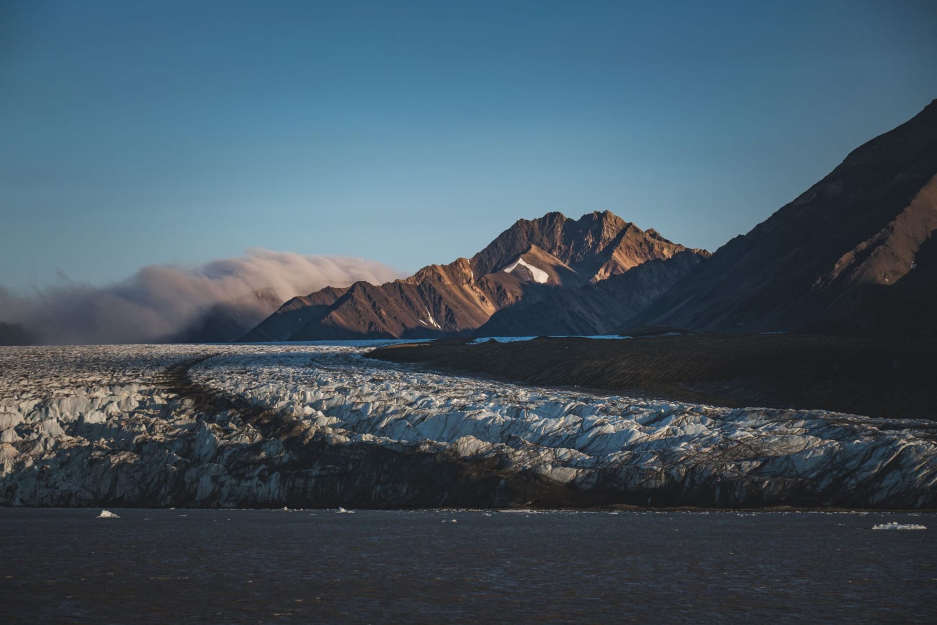
The Tombstone Range is not the tallest or the most remote set of peaks in the Yukon, but it might be the most visually arresting. The granite spires — genuinely jagged, black and sharp in a way that softer rock formations rarely achieve — rise above a tundra plateau that in autumn turns every shade of orange, red, and gold simultaneously. The combination is almost aggressively photogenic. I kept lowering my camera because I felt embarrassed by how easy the composition was.
Tombstone Territorial Park begins about 70 kilometers up the Dempster Highway from the turnoff outside Dawson City. The highway itself is gravel and crosses the Continental Divide. The park has no entrance gate — the mountains simply begin, and then the Tombstone interpretive center appears at Kilometer 71.5, and you stop there because stopping is the only reasonable response.
The Tundra and What Grows There
The plateau landscape around Tombstone is taiga-tundra transition zone, which means dwarf spruce mixed with open heath and meadows of arctic plants I had to look up. Labrador tea. Crowberry. Arctic cotton grass in summer, its white tufts moving in the constant wind. In early September everything was burning — not literally, but the low vegetation had gone to full autumn color and the light in the afternoons caught it from the side and turned the whole hillside into something incandescent.
I hiked out from the visitor center into the Grizzly Lake valley, a trail that stays mostly on the tundra and gives you the spires in profile. The walking is soft underfoot, springy with accumulated vegetation, and slow because the ground is uneven in ways that demand attention. Grizzly bears are genuinely common here. I saw tracks and a distant brown shape moving along a ridge and felt the particular alertness that comes from being in a place where you are not at the top of the food chain.
The Interpretive Centre
Tombstone has one of the better small wilderness visitor centers I’ve encountered. The exhibits on First Nations Tr’ondëk Hwëch’in history and land use are done with real care — not the token inclusion you sometimes find but actual content about how this landscape was and is used and understood. The staff know the park deeply. I asked about multiday backpacking routes and spent forty minutes in conversation that resulted in three pages of notes.
Staying Overnight
The campground at Kilometer 71.5 is basic — firepits, outhouses, tent pads — and requires advance booking in peak season. I arrived on a weekday in early September and had it nearly to myself. Waking up with the Tombstone spires outside the tent door, the air sharp and smelling of frost and tundra, was the kind of morning that makes the logistics of getting somewhere extremely remote feel like a fair exchange.
Backcountry camping is possible with registration. The Divide Lake route is multiday and involves some route-finding across open tundra, and the reward is a lake below the main massif with no maintained trail leading to it. This is the kind of challenge the Yukon keeps offering if you want it.
Light and Weather
September is when Tombstone is at its most spectacular and also its most capricious. I had two days of cold rain and one day of crystalline clarity that lasted about seven hours before clouds moved back in. That one day was enough. The light in the north has a low angle even at midday that makes everything three-dimensional in ways that flat overhead light cannot manage. The shadows across the tundra and the spires were hard-edged and clean.
When to go: Late August to mid-September for autumn color at its peak. July for longer days and wildflowers. The Dempster Highway is manageable in a standard vehicle in dry conditions but can become difficult in sustained rain. Fuel up in Dawson City — the next services are 180 kilometers away.