Kluane National Park
"The mountains here are not scenic. They are geological events that happen to be visible."
Kluane contains Canada’s highest peak, Mount Logan, at 5,959 meters. You cannot see it from the road. The front ranges of the St. Elias Mountains are so massive that they block the view of the interior, where the icefield — 22,000 square kilometers of permanent ice — sits in silence. Everything in Kluane is about scale you cannot fully resolve from where you’re standing, and that is somehow the point.
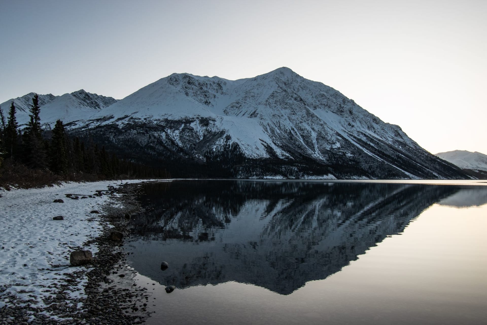
I drove the Alaska Highway along the park’s eastern edge and stopped at every pullout. The lake — Kluane Lake, turquoise and glacially cold — runs for 65 kilometers along the road. The mountains above it push up to 2,000 meters. They look painted but they aren’t. The light in this part of the Yukon in late afternoon turns the rock faces amber and the glaciers blueish-white, and the whole thing just sits there radiating improbability.
The Slims River Valley and Sheep Mountain
The Sheep Mountain visitor center is the first stop that makes sense. It’s a modest Parks Canada facility at the toe of a mountain that’s exactly what it sounds like — dall sheep territory, white dots moving across gray scree if you look long enough with binoculars. The rangers are genuinely enthusiastic and will tell you about the Slims River, which used to flow into Kluane Lake and stopped in 2016 when the Kaskawulsh Glacier retreated enough to redirect its meltwater. A river vanished in a year. They detected the change through stream gauges that simply showed no flow. This is not an abstract story about climate here. It’s that dry riverbed in front of you.
Hiking Into the Front Ranges
The hiking in Kluane is a different animal from most national parks. Most trails are routes, not manicured paths. The Auriol Trail is one of the more manageable loops — twelve kilometers through spruce, willow, and alpine meadow with views back to the lake. I went in early September when the fireweed had gone to seed and the air smelled of cold coming. Bear canisters are not required but strongly suggested, and the signs mean it.
The King’s Throne trail is the one people talk about. It climbs hard to a rock amphitheater above Kathleen Lake, and on a clear day you can see enough mountains to make you lose count. Lia made it to the throne and declared it the most dramatic picnic spot she’d had outside the Alps. The comparison felt accurate.
Flightseeing
This is the only practical way to see the interior. Small aircraft operate from Haines Junction and fly over the icefields, the Logan massif, the glaciers calving into valley lakes. I have complicated feelings about light aircraft but I went and I don’t regret it. The icefield seen from above doesn’t look real. It looks like a topographic map someone made too large. The glaciers are blue in ways I don’t have adequate vocabulary for — not the blue of sky or ocean but something older and more compressed.
Kluane Lake in Late Season
By September the lake is empty of boats and the campground at Congdon Creek is nearly abandoned. I made coffee at the picnic table in the morning fog and watched the mist burn off the water while the mountains above it did nothing at all, which is what mountains do best. There’s a particular quality of silence in big wilderness that isn’t the absence of sound — birds, wind, the lake moving — but the presence of space. Kluane has more of it than almost anywhere I’ve been.
When to go: Mid-June through mid-September for hiking access. August offers the most stable weather and wildflower meadows. Flightseeing requires clear skies — plan to be flexible with your schedule. The Alaska Highway stays open year-round, making winter visits possible for experienced cold-weather travelers.