You need two spare tires for the Dempster. Not one — two. This is the first thing anyone tells you, and the second thing is to call ahead to Eagle Plains, the one fuel stop at the halfway point, to make sure they have diesel. Then you fill up at Dawson City, check your tire pressure, and turn north onto 740 kilometers of crushed gravel, river crossings, and the gradual sensation that the world you left behind was smaller than you thought.
The Dempster Highway runs from the Klondike Highway junction to Inuvik, Northwest Territories. Most of it is in the Yukon. The road crosses the Ogilvie Mountains, drops into the Eagle Plain plateau, climbs through the Richardson Mountains, crosses the Peel River and the Mackenzie River by ferry (or ice bridge in winter), and eventually delivers you to the Mackenzie Delta. I drove the Yukon section over three days and felt the distinct vertigo of arriving somewhere genuinely remote while in a vehicle.
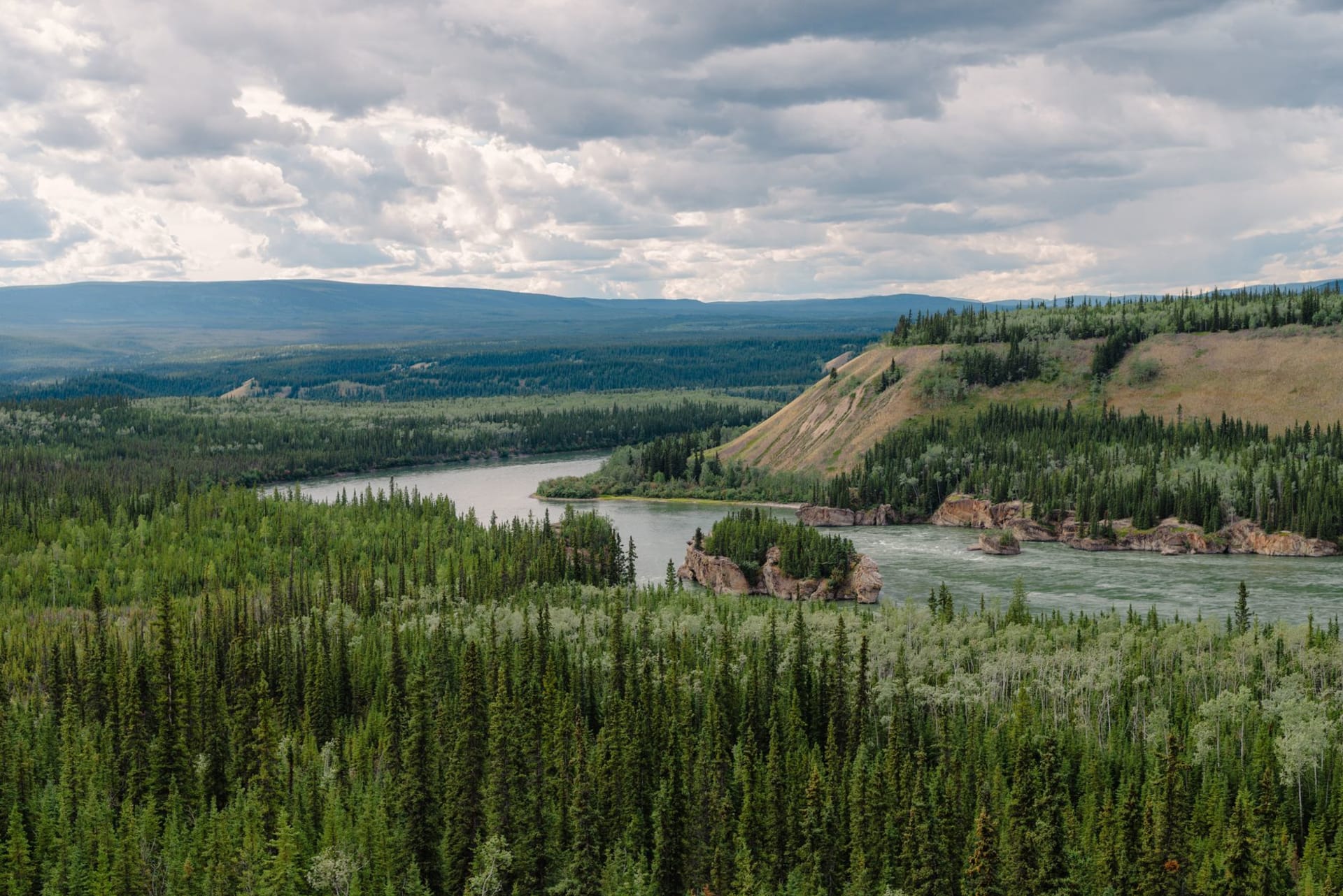
The Ogilvies and the Eagle Plain
The first hundred kilometers give you Tombstone Park and the Ogilvie Mountains. After that the road drops into the Eagle Plain — a broad, almost treeless plateau that in good weather offers horizon-to-horizon sky and in bad weather turns into low cloud and absolute grey. I drove through fog here for two hours and saw perhaps thirty meters in any direction. When it lifted, the tundra stretched out flat and rust-colored and the road ahead was visible for fifteen kilometers.
Eagle Plains Lodge appears at Kilometer 370 like a mirage. It has a hotel, a restaurant, a gas station, and a mechanic. The mechanic’s wall of fame — photos of vehicles that didn’t make it, attached to a board with the year and the cause — is the most honest piece of travel writing I’ve encountered in a roadside establishment.
Crossing the Arctic Circle
There’s a sign. A small wooden sign at the 66th parallel with a stone cairn, accessible via a short pullout. Other vehicles were stopped there — a couple with German plates who’d driven from Whitehorse, two motorcyclists from Québec. We all took photos of each other at the sign in the way that travelers do when the landmark is more about the journey than the place itself. North of the Arctic Circle in the Yukon means the sun doesn’t set in June. At Kilometer 420 or so, in midsummer, you watch the sun do a long, low arc and graze the horizon and come back up. The light is sideways and golden and lasts all night.
Wildlife on the Road
This is one of the better wildlife corridors in North America. Dall sheep appear on the rocky slopes of the Ogilvies in the early sections. Caribou cross the highway in significant numbers during migration — in late summer and fall, herds of the Porcupine caribou can stop traffic for twenty minutes while several hundred animals flow across the road from one drainage to another. I sat in the truck with the engine off while maybe four hundred caribou crossed in front of me, moving north, their hooves clicking on the gravel, smelling of musk and cold. It was fifteen minutes and I didn’t check my phone once.
Grizzlies, wolves, moose, arctic fox — the Dempster is an active landscape. The rule is to stay in or near your vehicle.
The Richardson Mountains
The highway climbs into the Richardsons near the Northwest Territories border, and this is where the road earns its reputation in bad weather. The grades are steep by gravel-road standards and the switchbacks are narrow. In dry weather it’s manageable and dramatic. In rain or early snow it becomes something else. The reward is a pass above treeline with views back into the Yukon and forward into the NWT lowlands, and the feeling of having crossed something real.
When to go: Late June to August for the full experience in reasonable conditions. August offers caribou sightings and wildflowers. September through October can bring early snow and dramatic light. The highway is open year-round, but winter driving requires significant preparation and local knowledge. Ferry service across the Peel and Mackenzie rivers runs when ice-free, roughly June through November.