Capitol Reef National Park
"Capitol Reef exists between the parks everyone knows — and that's precisely its advantage."
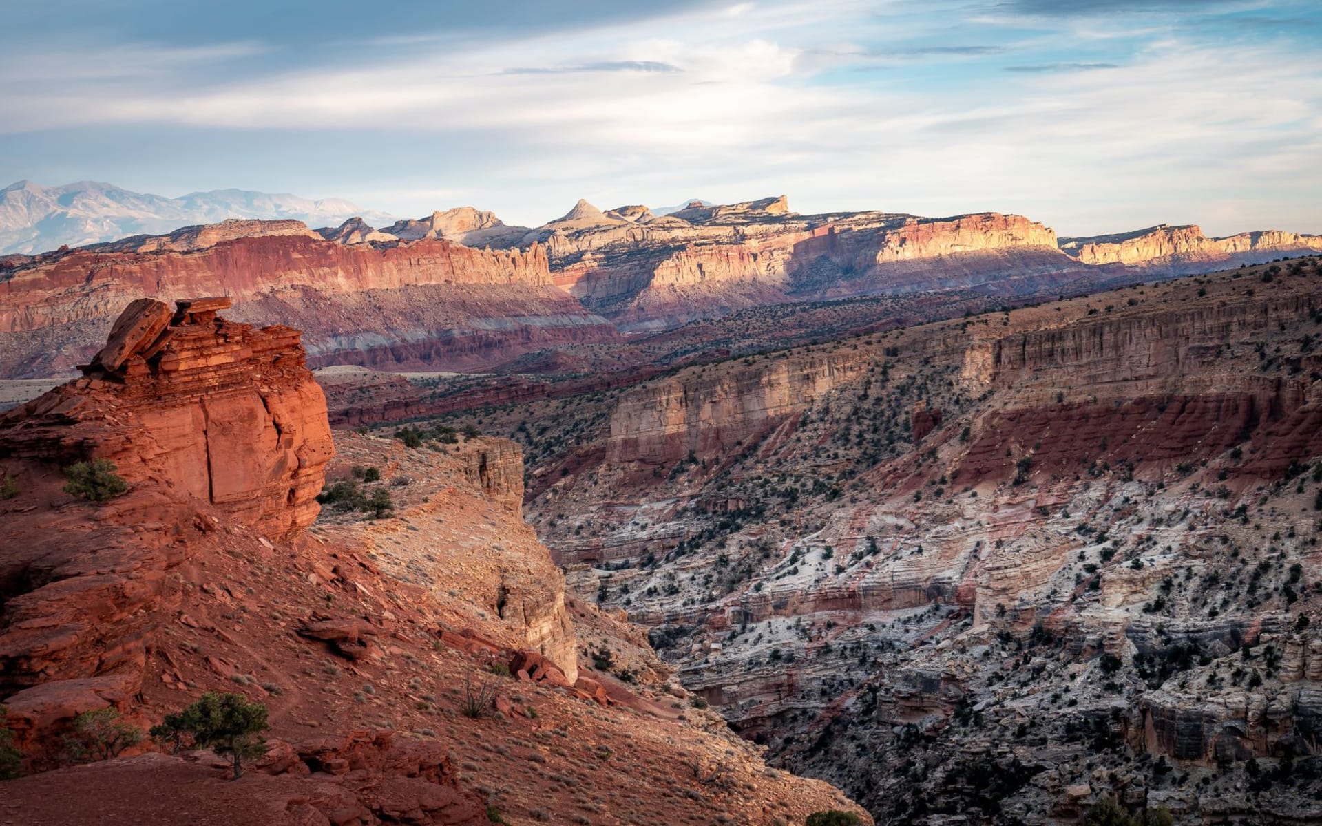
The Waterpocket Fold runs for a hundred miles through south-central Utah — a monocline, which is geologist shorthand for a place where the Earth’s crust buckled and one side slid upward relative to the other, exposing billions of years of rock in a single tilted layer. Capitol Reef National Park sits along this fold, and unlike Arches or Zion, it doesn’t organize itself around a single iconic image. Instead it accumulates: white domes of Navajo sandstone that look like the US Capitol building (hence the name), deep canyons, petroglyphs, pioneer orchards, and a kind of unperformed beauty that rewards slower attention.
I drove into Capitol Reef from Bryce Canyon on a late afternoon in October with the low sun hitting the Fold at a shallow angle that made every layer of rock glow a different color — cream, rust, purple-grey — like a parfait carved out of a hundred million years. I stopped the car twice on Highway 24 and just stood outside staring.
Fruita and the Orchards
The Fruita historic district in the park center is an anomaly I hadn’t expected: a working orchard established by Mormon pioneers in the 1880s and maintained by the park service today. In season — which runs from late June through October depending on the fruit — visitors can pick cherries, apricots, peaches, pears, and apples directly from the trees for a small fee per pound.
I arrived at the tail end of apple season and spent an hour picking from ladders in the late afternoon sun with two other visitors and a park ranger who offered opinions on which varieties were worth picking and which had peaked. The apples were not interesting apples — the varieties are heritage, not supermarket — but eating one warm off the tree in a canyon park in Utah is interesting regardless of the apple.
Hickman Bridge and the White Domes
The Hickman Bridge trail is a 2-mile round trip that climbs through a wash, past a natural bridge 133 feet across, and up onto a bench with views of the Capitol Dome formation and the green ribbon of the Fremont River below. The trail takes about ninety minutes at a reasonable pace, which leaves time to stop at the Fremont Indian petroglyphs along the way — a panel of bighorn sheep and human figures etched into the dark desert varnish of a canyon wall that faces south.
I stood in front of those petroglyphs for longer than I’d planned, trying to decide what I thought about looking at a 700-year-old image while holding a camera. I came to no conclusions. I took the photograph anyway.
The Grand Wash Narrows
Grand Wash runs through the Waterpocket Fold in a narrows that, while not as dramatic as Zion’s, has a different texture — quieter, more intimate, the walls close enough to touch on both sides at points. The canyon floor is sandy and flat, the walls curve rather than slam vertically, and the light that filters in through the slot mid-morning is diffuse and golden. I walked it alone for the first thirty minutes, which felt like a gift.
The remoteness of Capitol Reef is its defining quality. The visitor center parking lot never became crowded in three days. The trailheads in the Scenic Drive had room. I had the orchard essentially to myself. If the larger parks have become exercises in crowd management, Capitol Reef is still, just barely, something else.
When to go: April through June and September through October. The fruit harvest in Fruita runs from late June through fall depending on variety — check the park website for what’s in season before you go. Summer days are hot but the elevation moderates the worst of it. Winter closes the Scenic Drive periodically but the highway corridor remains accessible and the park takes on a different, emptier quality.