Mount Narodnaya
"The highest peak in the Urals is not famous. That's most of what makes it worth going to."
Narodnaya sits in the Nenetsky Autonomous Okrug, in the northern Urals where the mountains meet the beginning of the Arctic tundra. Getting there is the project. The nearest town with any infrastructure is Inta, which you reach by train from Syktyvkar or Moscow — a long haul on the Trans-Ural route where the landscape outside the window gradually empties of everything except birch and then spruce and then nothing but low tundra shrubs. From Inta, you need transport to the trailhead, and from there it’s a multi-day trek.
What Remote Actually Means
I’ve used the word remote carelessly in the past. Narodnaya clarified it. There are no marked trails in the conventional sense, no huts, no mobile signal, no other hikers visible for days at a time. The vegetation shifts from boreal forest to dwarf willow to bare quartzite and lichen as you gain elevation, and above the treeline you are fully inside the kind of landscape that doesn’t notice you. The horizon in every direction is uninhabited.
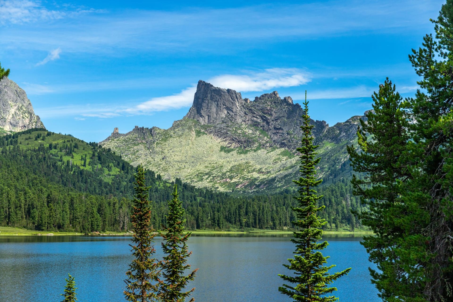
The approach follows the Naroda River valley, which is exactly as beautiful as an Arctic river valley in late July should be: clear water over round stones, sandpipers bobbing at the banks, the river braiding and rejoining over a flood plain that hasn’t been altered by humans. I filtered water directly from it for three days and never hesitated.
The Summit Itself
Narodnaya’s summit is not technical — no ropes, no exposed ridges, no climbing beyond scrambling. What it requires is navigation in poor visibility (which is frequent), stable legs on loose quartzite, and the mental preparation for weather that changes without warning at this latitude. I went up in clear conditions and came back in a brief whiteout that reduced visibility to ten meters. The summit plateau is broad enough that I could have walked off the wrong side.
In clear conditions, the view from the top is one of the genuinely vast ones. The northern Urals extend south in an unbroken ridge. To the west, the taiga runs flat to the horizon. To the east, the Ob River watershed begins. There’s a small metal tripod at the summit with a logbook inside a box, damp at the edges. I signed it. There were perhaps forty entries for the entire summer.
The Tundra World
The flora above 1200 meters is full Arctic tundra: bearberry, mountain avens, dwarf birch in patches that turn red so early in late July they look already autumnal. Ptarmigan moved through the low scrub in pairs, ignoring me completely. At night — which at this latitude in summer is barely distinguishable from evening — the sky went a long gradient from orange to green to blue without ever reaching true dark.
I camped twice on the approach in spots chosen for wind shelter and drainage. The nights were cold even in July, dropping to around five Celsius, but the light made sleeping difficult in a way I didn’t mind.
Logistics and Honesty
This is not a casual destination. You need solid wilderness navigation skills, a full week minimum, guides or very thorough research for the approach routes, and the genuine willingness to be far from help. It rewards people who are looking for that specifically — the summit matters less than the week of moving through unaltered landscape to get there.
When to go: Late June through early August is the only realistic window. Snow lingers on the upper mountain until June and begins returning in September. The days are essentially endless at this latitude in midsummer, which helps with navigation and mood. July is the warmest and most stable month, though stable in the northern Urals is a relative term.