A City That Kept Being Rebuilt
The name Merv belongs to at least five distinct settlements, each raised roughly where the previous one fell, strung along the Murghab River delta in what is now southeastern Turkmenistan. At its medieval peak, it was reputedly one of the largest cities in the world — estimates put the 12th-century population at somewhere between 200,000 and 500,000 people, a number that would have made it comparable to contemporary Constantinople or Kaifeng. The Mongols arrived in 1221 and, depending on which source you trust, killed somewhere between 700,000 and 1.3 million inhabitants. What rose afterward was never quite the same.
Walking the UNESCO site now, the scale is the first thing that defeats comprehension. The ruins cover roughly 1,000 square kilometers in aggregate. The main archaeological zone, Ancient Merv State Historical and Cultural Park, contains walled city remains from different eras that you can stand on a mound and see simultaneously — mud-brick enclosures dissolving back into the desert at one horizon, the intact dome of Sultan Sanjar’s mausoleum rising from the flatness at another.
Sultan Sanjar’s Mausoleum
This is the monument that earns the trip. Built in the 12th century for the last great Seljuk sultan, the mausoleum is one of the best-preserved medieval Islamic buildings in Central Asia — a cube surmounted by a double dome, the inner shell visible through the open upper portions of the walls. The turquoise tiles that originally covered the exterior dome are mostly gone, but what remains is the brickwork, and it is extraordinary: intricate geometric patterns in fired brick that create a texture more like weaving than construction.
Inside, the air is cool and still in a way that feels earned after the heat of the site. The cenotaph is in the center. The light enters through windows high in the drum and falls in long parallels across the floor. I stayed longer than I planned.
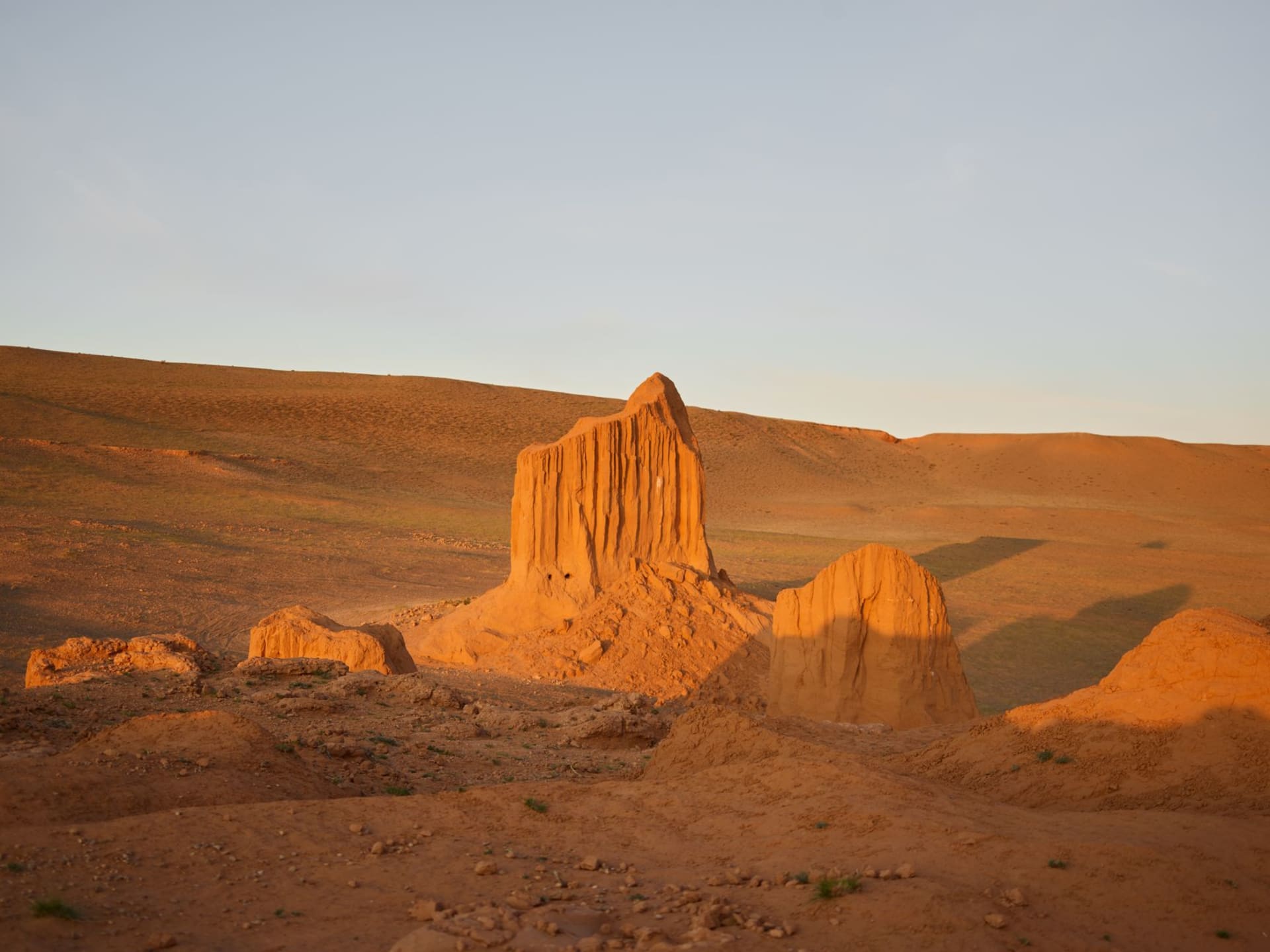
Erk Kala and the Oldest Layers
The oldest part of Merv is Erk Kala, a circular fortification that may date to the 6th century BCE — Achaemenid era, possibly earlier. It’s now a large raised oval of eroded mud-brick, maybe fifteen meters high in places, more like a natural landform than a human structure. You can climb the outside slope and stand on top, looking across the desert to the remains of Gyaur Kala (the Sassanid-era city) and beyond to the mausoleum’s dome.
The landscape here has an emptiness that doesn’t feel desolate — it feels patient. The brick dissolves, the walls sink, but the outlines persist for centuries after occupation ends.
Bayramaly and the Logistics
The modern town of Bayramaly sits a few kilometers from the ancient site and serves as a practical base — basic guesthouses, some restaurants serving plov and tea. Mary (the regional capital, 30km west) has better accommodations and a small museum with excavated objects from the site, including some beautiful Seljuk-era ceramics and coins that provide useful context for what you’re walking through.
When to go: March through May is ideal — warm but not punishing, and the light on the ruins in morning and late afternoon is exceptional. October is also good. Avoid summer entirely: the Karakum desert climate means temperatures above 42°C are common from June through August, and there’s almost no shade in the archaeological zone.