Magdalenefjorden
"Someone counted the graves on the beach once. Stopped at 130. There were more."
Short Fjord, Long History
Magdalenefjorden is only eight kilometers long, but it earns more attention per square kilometer than almost anywhere on Svalbard. The fjord cuts into the northwest coast of Spitsbergen, sheltered enough that the water sometimes goes glass-flat on calm days, and dramatic enough that the opening frames two glaciers simultaneously — Waggonbray and Midtre Raudfjordbre — with their ice cliffs facing each other across the water like gateposts.
The Dutch and English whaling fleets worked these waters in the 17th century when Svalbard was one of the most productive whaling grounds in the North Atlantic. The bowhead whale population was virtually annihilated within a hundred years. What those fleets left behind, apart from the ecological wreckage, are graves. The beach at Gravneset — Grave Point — holds the remains of Dutch whalers, visible as low mounds with wooden markers that have been partially replaced and maintained by Norwegian heritage authorities. The oldest date to the 1640s.
The Moment of Arrival
We anchored in the outer fjord in the morning. The light was already strong at seven — it was mid-July and the sun had been up since February, technically, though the physics of the Arctic mean it had been low and red-golden for hours before climbing. The glaciers at the fjord head were throwing reflections that doubled themselves in the still water. It was the kind of scene I’m professionally suspicious of — too composed, too obvious — but it was real and it was there.
The zodiac landed us on the gravel beach near Gravneset. The whalers’ graves are low mounds, closer to the ground than they should be after three centuries of permafrost heave and summer melt cycles. The wooden markers are clearly replacements. The guides spoke about them quietly, which I appreciated. This was a work site where people died of scurvy and cold and grinding labor, and the tourism-friendly framing of “historic Arctic cemetery” doesn’t do justice to how hard those lives were.
Reading the Ice
The glaciers are the main event for most visitors, but the glaciers here are retreating. The guides carry historical photographs — there’s one from 1906 that shows Waggonbray glacier extending most of the way down the fjord. Now it ends well short of where it used to and the fjord floor is visible in places where ice once sat. This is the case everywhere on Svalbard, but here the historical record is unusually thorough, and seeing the comparison makes it concrete.
I watched a section of ice cliff collapse into the water in the afternoon. The splash was substantial; the sound reached us a few seconds after. The guides talked about how calving events have intensified as the glacier’s terminus becomes less stable. It’s beautiful and it’s evidence of something worrying, and both of those things are true simultaneously.
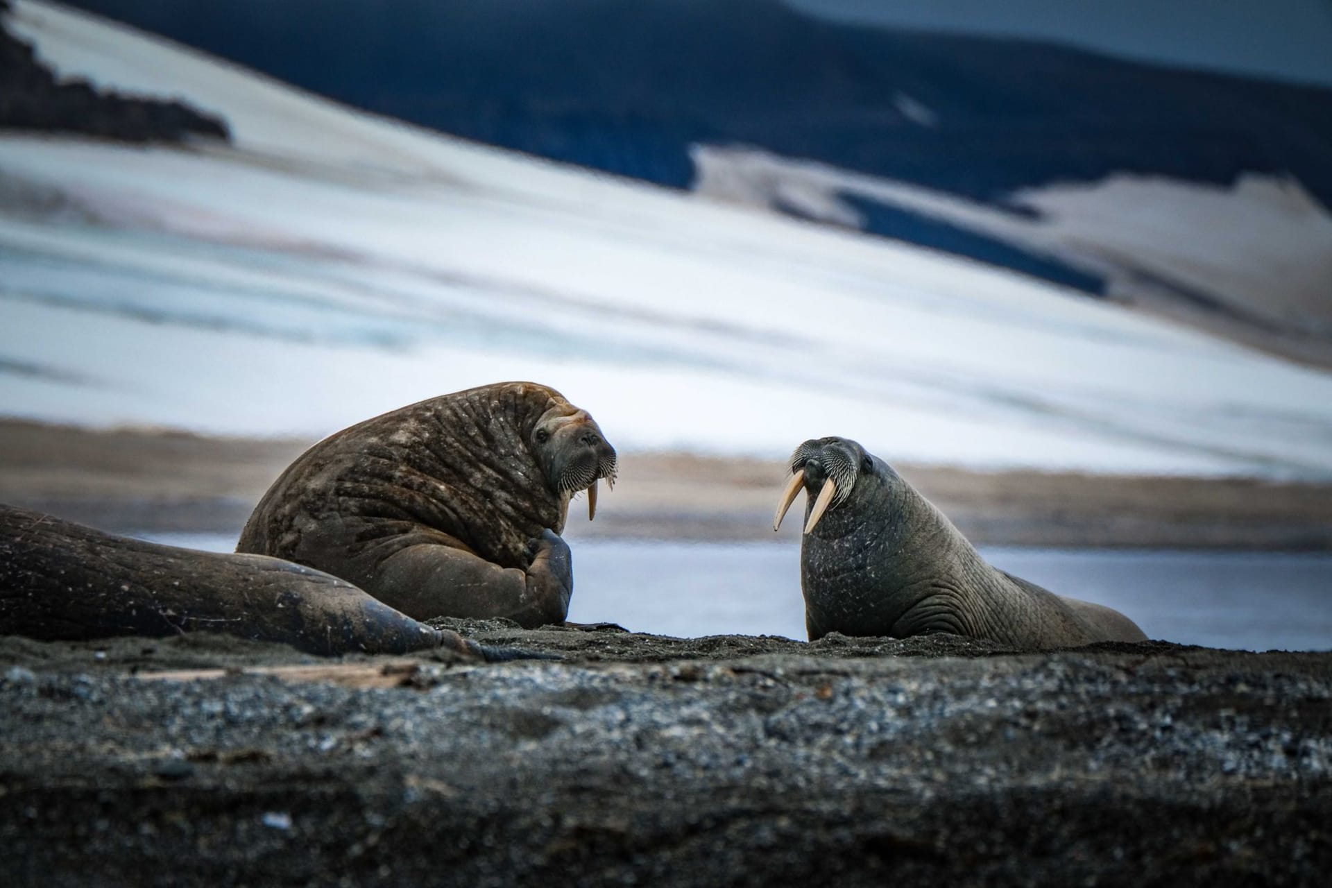
The Beach and the Birds
Magdalenefjorden’s beaches are important nesting sites for common eiders and purple sandpipers. The eiders nest close to the gravel berm and the females are almost preternaturally calm — you can walk within a few meters without disturbing them. The males form rafts just offshore, their dark green heads iridescent in the flat Arctic light. Arctic terns nest on the far side of the bay and patrol the beach with theatrical hostility.
When to go: June through August, when expedition cruises make Magdalenefjorden a regular stop on northwest Svalbard itineraries. The fjord rarely has pack ice issues in summer, making it more reliably accessible than the eastern or southern coasts. Calmer weather and sea ice conditions tend to occur in late July and August.