Đerdap Gorge
"The Danube here stops being a river and becomes something older — a boundary between worlds that keeps insisting on itself."
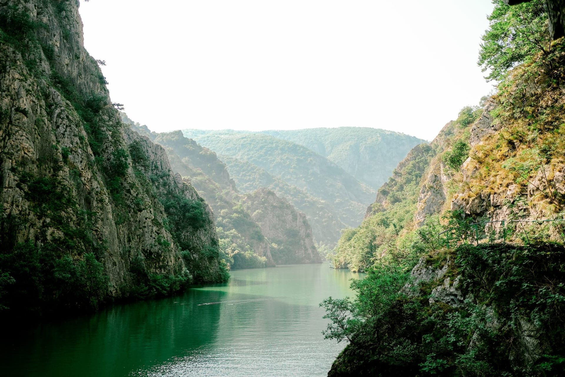
Eastern Serbia is a different country from Belgrade. The land corrugates into the southern Carpathians and the Danube — normally broad, flat-banked, utilitarian — becomes something else entirely: a gorge a hundred kilometers long, the cliffs rising 300 meters on both sides, the water compressed and green and fast in places where it’s usually slow. This is Đerdap. I came expecting scenery and left with archaeology, Roman engineering, and a persistent feeling that I’d been somewhere the 21st century hadn’t fully claimed.
Golubac and the Gorge Road
At the western entrance to the gorge, Golubac Fortress rises from a rocky promontory above the Danube in nine towers — medieval, partially restored, aggressively photogenic. I arrived late afternoon when the tour buses had gone. The light on the stone was the particular amber the Danube produces at that hour, the fortress turning gold, the far bank of the river still in shadow. You could spend an hour there without trying.
The road through Đerdap National Park follows the Danube’s southern bank, carved into the cliff in places, barely above water in others. The drive from Golubac east toward Kladovo takes most of a day if you stop properly. You should stop properly.
Lepenski Vir
About halfway through the gorge, the road leads to Lepenski Vir — one of the oldest planned settlements in Europe, inhabited from around 7000 BCE. The site was excavated in the 1960s and then partially submerged by the Đerdap hydroelectric dam in 1972; what survived was relocated uphill. The museum is small, slightly austere, climatically controlled. It houses the fish-faced sandstone sculptures found at the site: bulging eyes, wide mouths, expressions that feel taxonomically separate from anything made later. They stare from their glass cases with a quality that’s hard to name — not menace exactly, but not neutrality either. I stood in front of one for longer than I usually stand in front of anything.
The Roman Cliffs
Trajan built a road through this gorge around 100 CE to supply his campaigns across the Danube into Dacia. A small memorial inscription — the Tabula Traiana — is carved into the cliff face and sits now at water level, mostly submerged, visible from the road above depending on the season. On the Romanian shore across the river, a 40-meter carved face of the Dacian king Decebalus stares back from the rock, commissioned in the 1990s by a Romanian businessman with ambitions to match his budget. It shouldn’t work as a cultural object. It does anyway.
Why the Drive Is Worth It
The Đerdap gorge road is not fast or easy. There are stretches where the pavement deteriorates and the cliff drops straight to the water on your left and the rock face rises straight up on your right. The villages are small and spaced far apart and the fuel stations are worth noting before you need them. What you get in exchange is a corridor of landscape and history that hasn’t been infrastructure-ized into submission — the Roman inscription, the Neolithic site, the medieval fortress, the carved king, all in one day’s drive along a river that built civilizations on both banks and remembers all of them.
When to go: May–June or September are ideal. Spring brings wildflowers on the gorge walls and high enough water for boat tours through the narrowest sections. August weekends fill the park road with Serbian holidaymakers. Winter is passable but some services close.