Pic Paradis
"Standing on top of a two-country island and seeing both shorelines at once — it shouldn't be as moving as it is."
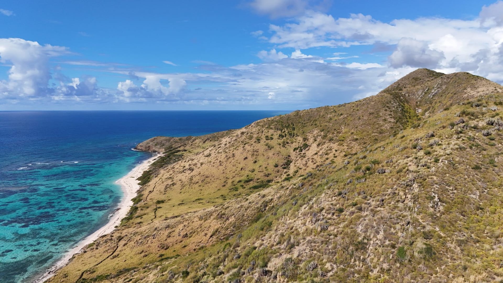
The highest point on Saint-Martin is 424 metres, which does not sound like much until you are standing on it with both the Caribbean Sea and the Atlantic Ocean visible at the same time. The trail starts from near Colombier on the French side and climbs through vegetation that becomes progressively damper and greener as you ascend — from dry scrub and cactus at road level to a proper montane forest near the summit, where the shade drops the temperature by what feels like ten degrees and the birds are different from the birds below.
I went up on a morning when a thin layer of cloud was sitting on the summit and lifting. The trail is not technical — it is steep in places, and the humidity makes it feel harder than the elevation might suggest — but it is manageable in about an hour of moderate effort. What I remember most about the ascent is the sound shifting. At the base, you can hear traffic on the road to Marigot. A third of the way up, the traffic disappears and there is only the wind in the scrub and two or three bird species I did not recognise. Near the top, there was a period of silence so complete it felt like something you could lean against — the kind of silence that is not simply the absence of noise but an active presence, dense and cool and slightly pressurised, the way silence sounds when it has been undisturbed for a very long time.

The summit view, when the cloud lifted, was one of those moments that makes me understand why people climb things. To the south: the Dutch side, Philipsburg’s Great Bay, the Simpson Bay Lagoon, the runway at the airport, and beyond all of it the sea. To the north: the French side, Grand Case’s gentle bay, Marigot’s harbour, and the Atlantic swells running in from the east in long dark lines. The whole island — twelve miles end to end — was visible at once. I could see both coastlines, both road systems, both flags in the settlements below. The political border that divides the island was invisible from up here, which seemed like the correct perspective on borders generally.
The forest at the top held small birds I later identified as Lesser Antillean bullfinches — the males a deep red-black, moving through the upper canopy with a directness that suggested they were not particularly interested in being observed. A hummingbird investigated my water bottle and found it disappointing. A lizard sat in the one patch of sunlight on the summit and appeared to be thinking very seriously about something.

The descent is faster than the ascent — perhaps forty minutes — and the heat hits you the moment you step out of the forest cover into the scrubland below, a wall of warmth that is almost physical. I sat at the bottom and drank most of my second water bottle and watched two lizards negotiate a patch of sunlit rock with the intensity of a territorial dispute that has been ongoing for years.
When to go: Start no later than 7 AM to avoid the worst of the summit heat and the afternoon cloud that tends to settle in and obscure the view. Wear proper shoes — the trail is well-marked but the surface is uneven and becomes slick after rain. The dry season, December through April, gives the clearest summit views, though the forest is more vivid and birdsong more active during and just after the wet season months. Bring twice as much water as you think you need.