Phang Nga Bay
"The karsts came out of the mist at six in the morning and I understood, finally, why people keep coming back."
I left the pier at Ao Por at five-thirty in the morning, the sky still dark, the longtail’s engine making the kind of noise that discourages conversation. By the time we cleared the bay and entered the open water of Phang Nga, the first light was spreading across the horizon and the limestone towers were emerging from the mist as shapes before they became details — vertical, improbable, covered in hanging vegetation that dripped in the still air. The guide was quiet. I was quiet. There is a category of landscape so extreme that commentary feels like vandalism.
Phang Nga Bay covers four hundred square kilometres of tidal water between the mainland and the northern edge of Phuket island, studded with around forty limestone islands of the kind that geologists call karst towers and everyone else just stares at. The rock is around two hundred and seventy million years old, pushed above the sea surface by tectonic movement, then carved by millennia of water and wind into the shapes it holds now: sheer walls, sea caves, arches, and the half-submerged grottoes called hongs that you enter by kayak through low tunnels at the right point in the tide. Inside the hongs, the world goes entirely quiet. Birdsong and water-drip and the sound of your paddle. Nothing else.

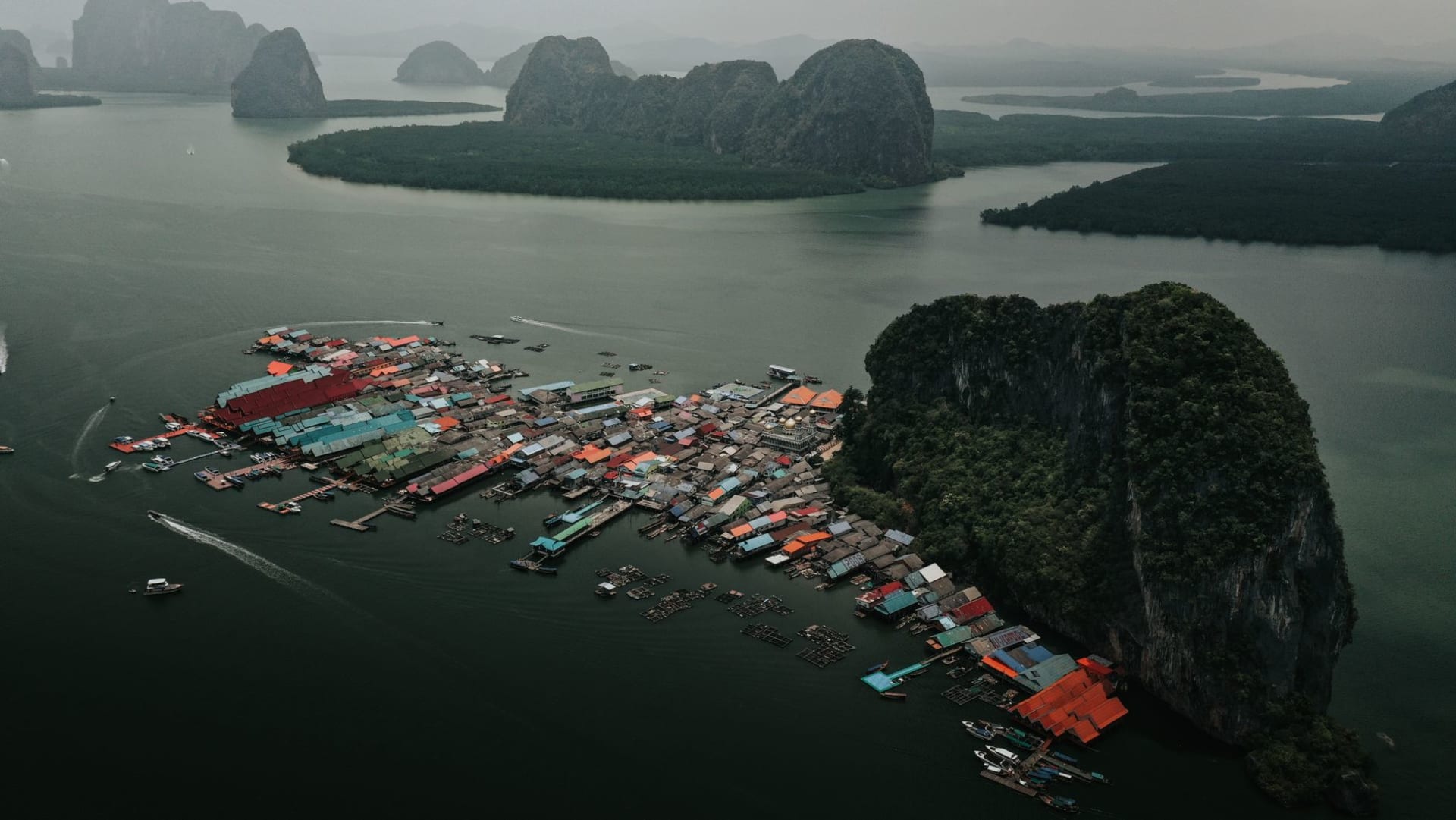
Koh Panyee — the Muslim fishing village built on stilts over the water, with a mosque whose golden dome appears improbably above the stilts and the fishing nets — is the stop that earns the most photographs and deserves them. The village has been here since the eighteenth century, home to a community of sea-farers who decided the water was a better foundation than the land, and it has not entirely surrendered to the tourist economy. Yes, there are overpriced restaurants with floating decks at the front. But walk behind them, past the mosque and the school and the boat-repair shed, and you are in a working village where kids ride bicycles on the wooden walkways and the smell is of diesel and salt and fish paste fermenting in the afternoon heat.
Koh Tapu — James Bond Island, as it has been called since a boat chase was filmed here in 1974 — is the one with the extraordinary vertical rock that rises thirty metres from the water on an impossibly narrow base. It is very crowded by nine in the morning. Go before eight, get your photograph, accept the cliché, and move on. The rock is genuinely strange and worth the effort of seeing.

The bay is different at different tides, which is something the tour operators don’t always tell you. At low tide the mangrove flats are exposed and the kayaking routes through the hongs open up. At high tide the water level inside the caves rises and the hidden lagoons change shape. I went twice, on separate days with different tide windows, and they were different experiences in ways that mattered.
When to go: November through April for flat water and clear skies. The bay is at its most dramatic just after the monsoon ends in November, when the vegetation on the karsts is intensely green and the water has a clarity that the dry season gradually reduces. Avoid the James Bond Island crowds by leaving before sunrise; the tour boats from Phuket and Krabi arrive en masse between nine and noon.