Mani Peninsula
"The Mani looks like Greece forgot to finish it, and then decided it was perfect that way."
The landscape changed south of Sparta without announcement. The olive groves thinned, the roadside vegetation became scrubby and grey-green, and the mountains — the Taygetos — closed in from the west until the road was running along a narrow coastal shelf with the sea visible through the cypress trees. By the time I reached the Mani proper, the peninsula had shed any resemblance to the agricultural Peloponnese I’d been driving through for two days. The rock was bare and grey-white, pitted with caves, cut through with dry river beds. The sky was very large. The houses — where they existed — were towers, four and five storeys of rough-cut stone, clustered on hilltops like defensive formations that had forgotten they no longer needed defending.
The tower houses are the thing people know about the Mani, and the reality exceeds the photographs. These were not decorative structures. Between the seventeenth and nineteenth centuries, the clans of the Deep Mani — the Exo Mani had already been partially Venetianized — conducted feuds of extraordinary duration and ferocity, and the towers were the physical expression of those feuds: the higher your tower, the more stones you could drop on your neighbors. The last major clan feud didn’t fully resolve until the twentieth century. Walking through the village of Vathia, where perhaps thirty towers cluster on a hilltop above a coastline of startling blue, you feel the weight of all that defensive architecture — the narrowness of the windows, the thickness of the walls, the way the towers turn their backs on each other even now.

The coastline itself is the other revelation. Cape Matapan — Tenaron, the ancient Greeks called it — is the southernmost point of mainland Greece, and one of the mythological entrances to the underworld. I drove to the end of the cape, left the car at the lighthouse, and walked out along a path through scrub to the very tip of land, where the Ionian and the Aegean technically meet. There was nothing beyond me but open water all the way to North Africa. The wind was strong and the sea was the colour of lapis lazuli and the only sound was the water on the rocks below. I understood completely why the ancient Greeks put the entrance to Hades here. This is exactly the kind of place where you feel the world running out.
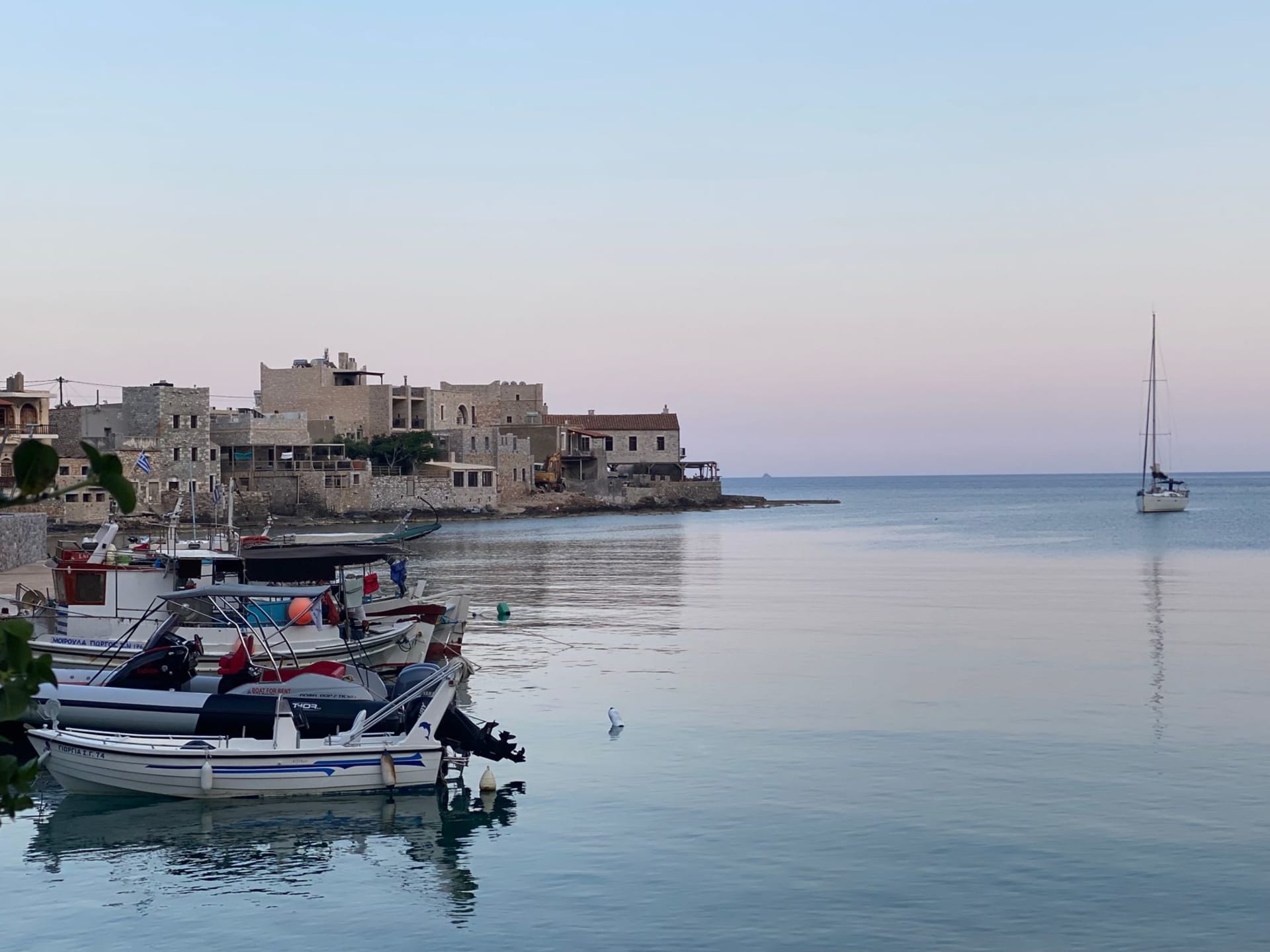
The small port village of Limeni sits in a cove a few kilometres north, its houses built directly over the water, their foundations in the sea. I had lunch there at a table that overhung the water by about a metre, eating grilled octopus and watching the light on the rocks beneath me shift from green to turquoise as the sun moved. The octopus had been hung on a line to dry in the morning sun — I’d seen it when I arrived — and the texture was firm and slightly smoky. The water below was clear enough to count the sea urchins on the bottom.

In the evenings in the Mani, especially the outer Mani villages around Kardamyli, there is a pleasant quality of having arrived somewhere that doesn’t urgently want your money. The tavernas open late, the wine is local and rough, and the conversations at nearby tables tend to be between people who have been coming here for twenty years and are arguing about the best swimming rocks. Patrick Leigh Fermor lived near Kardamyli for decades and wrote about this corner of Greece with the intensity of someone who had understood it first as a secret and spent the rest of his life protecting that secret by writing about it beautifully. He was onto something.
When to go: May and June before the summer heat, or September and October. The Mani in August is genuinely hot — the stone landscape absorbs and radiates heat — and the roads to the cape become busy with Greek summer tourists. April is extraordinary: wildflowers cover the otherwise austere scrubland and the light has a clarity that photographers would sell their equipment for.