Khunjerab Pass
"At 4,693 meters, the sky turns a shade of blue that doesn't exist at sea level. That blue alone is worth the drive."
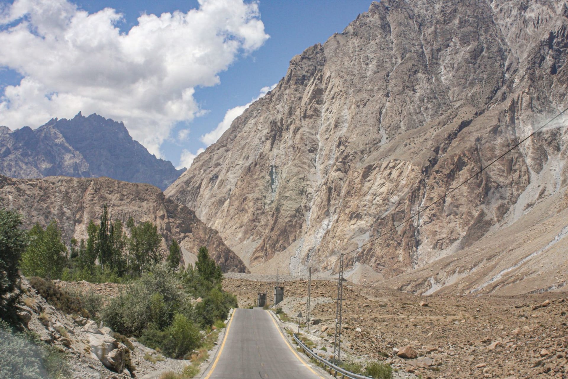
The drive up to Khunjerab from Sost takes about two hours through a landscape that gradually sheds everything that isn’t rock. The vegetation retreats first — the scattered shrubs of the lower valley give way to bare scree slopes, then to the ochre and rust-colored high plateau that the pass sits on. Snow patches appear at the roadside even in July. The air starts to make its thinness known at around 3,500 meters, a subtle but insistent demand that you breathe more deliberately. By the time you reach the pass at 4,693 meters, getting out of the car requires a moment of acclimatization simply to stand without your vision narrowing at the edges.
I drove up in a hired vehicle from Sost in late June. There were perhaps six other tourists at the actual border gate when I arrived — two Pakistani families who had come for the photograph, a couple of Chinese tourists in the matching windbreakers that suggest a tour group, and a German motorcyclist who had just crossed from China and was sitting on his panniers eating something from a bag with the focused efficiency of a man who has burned a tremendous number of calories. I asked him what it was like on the other side. “Flatter,” he said. “And the road is better.”

The Khunjerab National Park surrounds the pass and extends down both sides of the border — the name means “valley of blood” in Wakhi, a reference to the red-brown iron minerals in the soil rather than anything more alarming. The park is one of the last habitats of the Marco Polo sheep, with their improbable spiral horns, and the snow leopard, which is present in the region but which I did not see, because no one ever sees snow leopards when they expect to. What I did see, on the drive up, was a Himalayan ibex on a cliff above the road, standing with the specific unconcern of an animal that lives at an altitude most predators can’t reach.
The border monument is a simple concrete marker painted in both Pakistani and Chinese colors, flanked by a gate on each side. On Pakistan’s side, the rangers are unfailingly friendly. On China’s side, the crossing protocol requires a permit arrangement made in advance from Kashgar or Islamabad — you can’t simply cross spontaneously. Most visitors who come from Pakistan do so to experience the pass itself rather than actually crossing into China. Standing at the gate on a clear day, the Pamir Plateau visible on the horizon beyond the Chinese checkpoint, the concept of a Silk Road that has connected these two regions for over two thousand years becomes geographically comprehensible in a way that no map quite achieves.

The altitude makes everything more present. Colors are sharper at 4,693 meters — the deep blue of the sky, which has fewer air molecules to scatter its light, is a blue that doesn’t exist at sea level, a color that feels almost aggressive in its intensity. The silence, when the wind drops, is total. The cold, even in summer, is immediate. I stayed at the pass for perhaps forty-five minutes and came back down with a mild altitude headache and a strong coffee craving and the kind of satisfaction that comes from reaching somewhere that required actual effort to reach.
When to go: May through October, and even then the pass can close temporarily for weather. The Khunjerab Pass officially opens each year around May 1st and closes around November 30th. July and August offer the best chance of clear weather and snow-free road. Always check current conditions at Sost before driving up — the pass is at 4,693 meters and weather changes quickly.