
Karakoram Highway
"The KKH doesn't take you through a landscape — it takes you through a geological argument about what land can become."
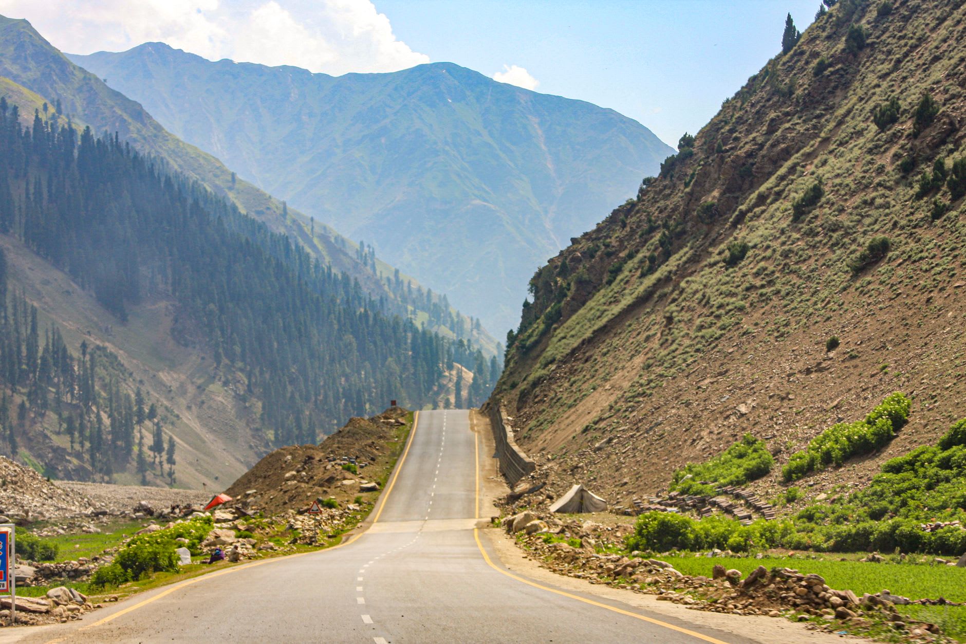
I first understood the Karakoram Highway not as a road but as an argument with physics. From Islamabad, it runs north through the Salt Range hills and into Hazara, crossing the Indus at Besham and following the river gorge north — the walls rising on either side from a few hundred meters to eventually several thousand, the river below changing color with the sediment load, sometimes brown and silty, sometimes that unlikely turquoise that means glacial meltwater has joined the flow. By the time you’re past Chilas and approaching the Kohistan region, the scale has stopped being comprehensible in normal terms. You’re in a canyon system so deep and so narrow in places that direct sunlight reaches the road for only a few hours a day.
The highway was built between 1958 and 1978, a joint Pakistan-China project that required blasting through the Karakoram range — the youngest and most actively tectonically rising mountains on earth — with 810 Pakistani and 82 Chinese workers dying in the construction. There are memorials to those workers along the route; the Pakistani memorial at Dasu is a simple plaque in a lay-by that most drivers stop at briefly and most travelers never notice. I stopped and read every name. It takes about four minutes.
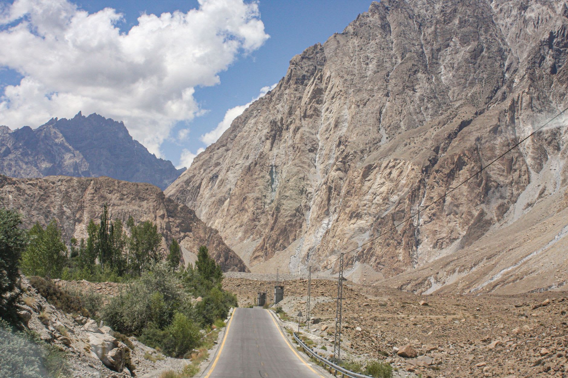
The section between Gilgit and Karimabad is the road’s greatest theater. The Hunza River gorge narrows until the car feels like a bead on a thread, then opens onto the wide braided channels near Hunza where the valley finally breathes. Rakaposhi announces itself to the east — 7,788 meters visible from the roadside in one of the longest continuous mountain faces on earth, rising from valley to summit in a single unbroken ascent. I stopped the car on a lay-by and stood in the wind looking at it for a long time, not because I expected to understand it but because standing in its presence seemed to require at least that acknowledgment.
Attabad Lake, created when a 2010 landslide blocked the Hunza River and drowned several villages, now sits astride the highway itself — an involuntary reservoir that turned a section of road into a ferry crossing before the bypass tunnels were carved. The water is the blue-green of a swimming pool advertisement, the submerged village towers visible in low water through its clarity. The bypass tunnels, blasted through the rock wall above the lake, have a raw, improvised quality to them: you drive through rough-cut rock with overhead lights strung on wires and emerge blinking on the far side.
North of Hunza, into Gojal and toward the Chinese border, the highway climbs through increasingly austere terrain — the vegetation retreating, the rock taking on the russet and ochre tones of high altitude, the air thinning into something that requires more effort from the lungs. Passing Sost and the Pakistani border checkpoint, the road continues to the Khunjerab Pass at 4,693 meters — the highest paved border crossing in the world. The descent into China, on the Chinese side, is surreal: the road quality improves so suddenly that the transition feels ideological.
When to go: May through October for the full highway experience. The Khunjerab Pass closes in winter and some sections become treacherous in heavy snow. Landslides are a genuine risk throughout, particularly in July and August when monsoon moisture reaches the region; check road conditions before committing. The most favorable weather for the most spectacular sections is typically May, June, and September.