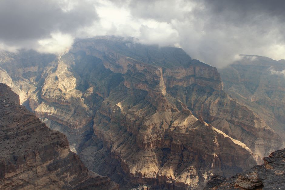
Oman's highest peak and the rim of Wadi Ghul, the 'Grand Canyon of Arabia' — a mile-deep gash in the Al Hajar range.
The turnoff for Jebel Shams is easy to miss and impossible to forget once you’ve taken it. The track climbs out of the Nizwa plain in a series of switchbacks that a rental sedan has no business attempting, past a checkpoint where a soldier waves you through with the particular boredom of someone who has seen a thousand tourists misjudge this road, and up into air that thins noticeably by the time you reach the rim. At just over three thousand meters, Jebel Shams is Oman’s highest point. Almost nobody comes for the summit. They come for what falls away beneath it.
Standing on the Edge of Wadi Ghul
Wadi Ghul — the canyon carved into the mountain’s western flank — is nicknamed the Grand Canyon of Arabia, and for once the marketing undersells it. I walked to the unmarked viewpoint near the old army post and simply stopped, because there was nowhere further to go without falling a kilometer. The canyon doesn’t announce itself gradually the way the American original does, with a slow buildup of overlooks. Here the ground is flat scrubland one step and then it is gone, straight down, striated limestone the color of rust and bone stacked in bands that took millions of years to lay down and about four seconds to comprehend.
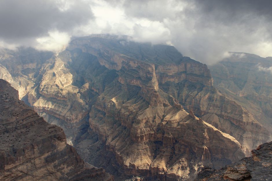
Lia sat a careful two meters back from the edge, camera out, refusing my suggestion that she get closer for a better angle. She was right to refuse. I got closer. I do not entirely recommend it, though I don’t regret it either — the wind coming up out of that void has a temperature and a smell all its own, mineral and cold, nothing like the desert air a few kilometers below.
The Balcony Walk
The trail everyone means when they say “hike Jebel Shams” is the Balcony Walk — a former donkey path, W4 by trail marker, that traces the canyon’s mid-height contour for about three hours round trip to the abandoned village of As Sab. It is not technically difficult. It is, however, a single-file ledge with a drop on one side that makes technical difficulty somewhat beside the point. I found a rhythm in it: watch your feet, glance at the canyon, watch your feet again. As Sab itself, when you reach it, is a cluster of roofless stone houses wedged into the cliff face, abandoned decades ago when the families who lived there — descendants, some say, of people who fled here to escape earlier conflicts in the lowlands — finally relocated to easier ground. Standing inside one of the empty rooms, canyon wind moving through where a roof used to be, I understood the appeal of impossible terrain as a form of security.
Camping at the Rim
We stayed the night at one of the basic rim campsites — a patch of gravel, a distant generator hum from a nearby camp, and after the generators cut out around ten, a silence total enough to hear my own pulse. The stars over Jebel Shams are the reason half the people up there haven’t bothered with a torch. No light pollution for fifty kilometers in any direction, the Milky Way laid across the sky like a spill, and somewhere below us in the dark, a canyon a mile deep doing absolutely nothing, waiting for daylight to be terrifying again.
When to go: October through April, when daytime temperatures at altitude sit in the low twenties and nights are cold enough to need a proper sleeping bag. Avoid summer entirely — the drive up is fine, but the exposed rim offers zero shade and the heat reflecting off the rock is brutal even at three thousand meters.
Keep exploring
More from Oman
 oman
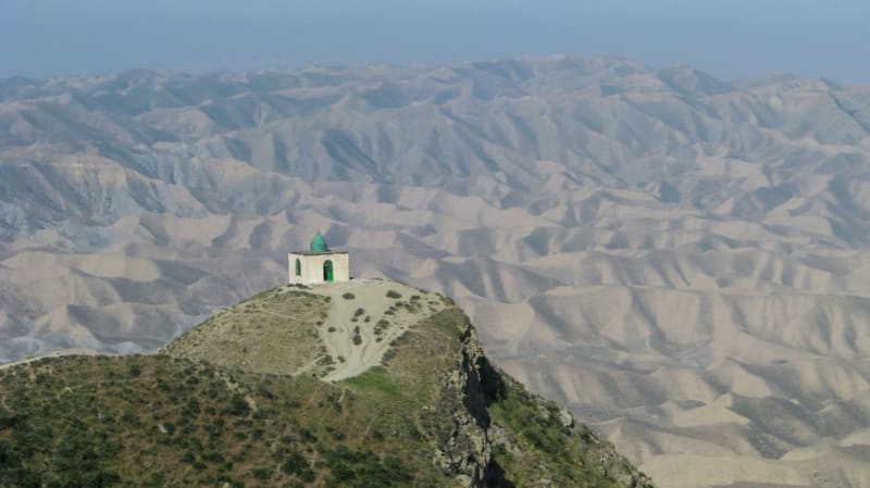
oman Job's Tomb (Nabi Ayoub)
A hilltop shrine to the biblical and Quranic prophet Job, wrapped in cloud and one of the best views in Dhofar.
Explore oman
oman Khasab Fjords
The 'Norway of Arabia' — dramatic sea inlets cutting through barren limestone mountains of the Musandam.
Explore oman
oman Khor Najd
A cliff-top viewpoint above the Musandam fjords, reached by a rough 4x4 track, where the khors look less like Norway and more like the moon.
Explore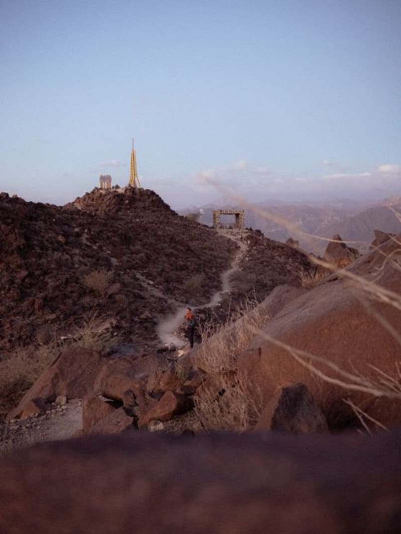 oman
oman Khor Rori (Ancient Sumhuram)
Ruins of a 2,000-year-old frankincense port overlooking a lagoon, where the trade routes to Rome and India actually began.
Explore oman
oman Kumzar
An isolated fishing village at the northern tip of Arabia, reachable only by boat, where people still speak a language found nowhere else.
Explore oman
oman Lima
A quiet coastal village at the mouth of its own private khor, and one of the best off-road detours in the entire Musandam.
Explore