
Asia
Northeast Vietnam
"The mountains here don't impress you — they absorb you entirely."
Terraced rice fields carved into cloud-wrapped peaks, hill tribe markets that open at dawn, and a landscape so vertical it barely feels like the same country.

I arrived in Sapa on a night bus from Hanoi, stumbled out at five in the morning into a cold I hadn’t packed for, and stood on the main street watching a Hmong woman in full embroidered indigo walk past me with a basket strapped to her back, completely unbothered, already halfway through her day. That was Northeast Vietnam introducing itself — not through a viewpoint or a brochure, but through a person who had somewhere to be.
The landscape around Sapa and Bắc Hà is vertiginous in a way that photographs still can’t quite capture. The rice terraces aren’t pretty fields spread across gentle hills — they’re engineering feats stacked up cliff faces, hand-cut into near-vertical slopes over centuries by the Hmong, Dao, Tày, and a dozen other groups who figured out how to grow food where flat ground simply doesn’t exist. In September and October the fields turn gold before harvest, and the whole valley looks like it was arranged by someone with too much patience and a very good eye. But March is when the water flooding the new terraces turns everything into a broken mirror of sky — and you have the paths almost to yourself.
Past Sapa, the roads unspool toward Đồng Văn on the Đồng Văn Karst Plateau — one of UNESCO’s global geoparks, though you’d never know it from the signage. The Ha Giang loop has become a rite of passage for motorcyclists, and for good reason: four days on a semi-automatic through limestone peaks, over the Ma Pi Leng Pass above a river the color of jade, stopping in Mèo Vạc for a bowl of thắng cố at the Sunday market. It’s not comfortable and not fast, and both of those things are precisely the point.
When to go: September to November for golden rice harvest and clear skies. March to April for flooded terraces and cooler temperatures before the summer crowds. Avoid July and August — rain, mud, and every guesthouse in Sapa fully booked.
What most guides get wrong: They treat Sapa as the destination and everything else as optional day trips. The real Northeast Vietnam starts two hours past Sapa on roads that aren’t well-paved. Ha Giang, Bắc Hà on a Sunday market morning, the drive north to Đồng Văn — this is where the region stops being a tourism product and starts being an actual place. Rent the bike. Take the extra day. You came this far.
Explore
Places in Northeast Vietnam
 northeast-vietnam
 Ba Be Lake
Vietnam's largest natural lake, cupped in limestone karst, where Tay stilt-house villages still meet the water by wooden boat.
Explore northeast-vietnam
 Bắc Hà
A Sunday market so vivid and unhurried that the Flower Hmong women who run it seem to dress not for commerce but for the sheer pleasure of colour.
Explore northeast-vietnam
 Bản Giốc Waterfall
A waterfall so wide it straddles two countries, thundering into a turquoise pool while bamboo rafts drift below and the border passes invisibly through the mist.
Explore northeast-vietnam
 Cao Bằng
A provincial capital with a revolutionary past and a surrounding landscape of karst peaks, cave networks, and the border with China just over the ridge.
Explore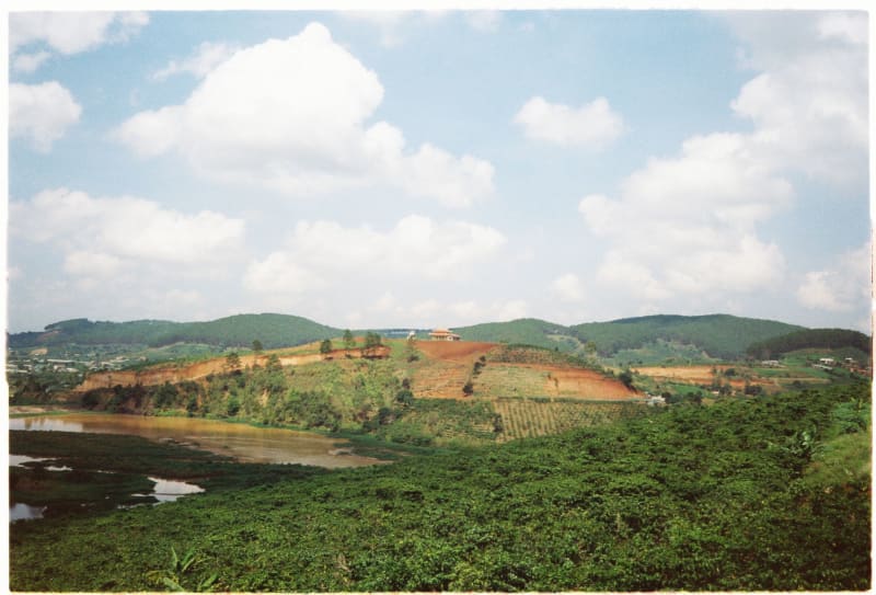 northeast-vietnam
 Đồng Văn
A stone-and-slate old quarter perched on the edge of a UNESCO karst plateau where the houses have grown from the same rock as the cliffs behind them.
Explore northeast-vietnam
 Ha Giang
The last proper city before the karst wilderness begins — where you rent the motorbike, eat the last bowl of pho at a proper table, and point north.
Explore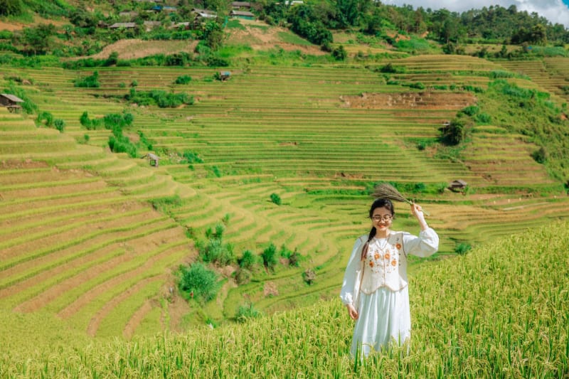 northeast-vietnam
 Hoàng Su Phì
Rice terraces that rival Sapa's but without the crowds — a valley of layered fields and La Pán Tẩn village where the harvest is still done entirely by hand.
Explore northeast-vietnam
 Lũng Cú
The northernmost point of Vietnam, marked by a flag tower on a bare summit — a place where the map ends and the feeling is unexpectedly enormous.
Explore northeast-vietnam
 Ma Pi Leng Pass
A 20-kilometre road carved into cliff faces above a jade river — Vietnam's most dramatic mountain pass, ridden rather than visited.
Explore northeast-vietnam
 Mau Son
A misty mountain massif above Lang Son where ruined French villas, tea terraces and rare winter frost meet.
Explore northeast-vietnam
 Mèo Vạc
A canyon market town at the bottom of the world's edge, where the Nho Quế River runs jade green and Sunday is the only day that counts.
Explore northeast-vietnam
 Quản Bạ
The first dramatic stop on the Hà Giang loop, where a mountain pass called Heaven's Gate opens onto a valley and a pair of perfectly rounded hills the locals call the Fairy's Bosom.
Explore northeast-vietnam
 Sapa
A hill town swathed in mist where rice terraces cascade down cliff faces and Hmong women outpace every tourist on the mountain paths.
Explore