White Mountains, New Hampshire
"Mount Washington wanted to kill me and I still think about it fondly."
The sign at the base of the Mount Washington Auto Road reads, in plain text: “This road may not be suitable for your vehicle. Weather changes rapidly. Many visitors have died above treeline.” This is not a warning designed to deter anyone, but it does function as a useful recalibration. The White Mountains are not the scale of the Rockies or the Alps, and their highest peak is not tall by any global measure, but they are serious in the way of mountains where the weather is genuinely dangerous and the terrain above treeline is exposed in ways that the size of the peaks doesn’t suggest. I drove the Auto Road on a clear September morning in a rented sedan that the man at the booth observed with a mild skepticism that I chose to interpret as encouragement.
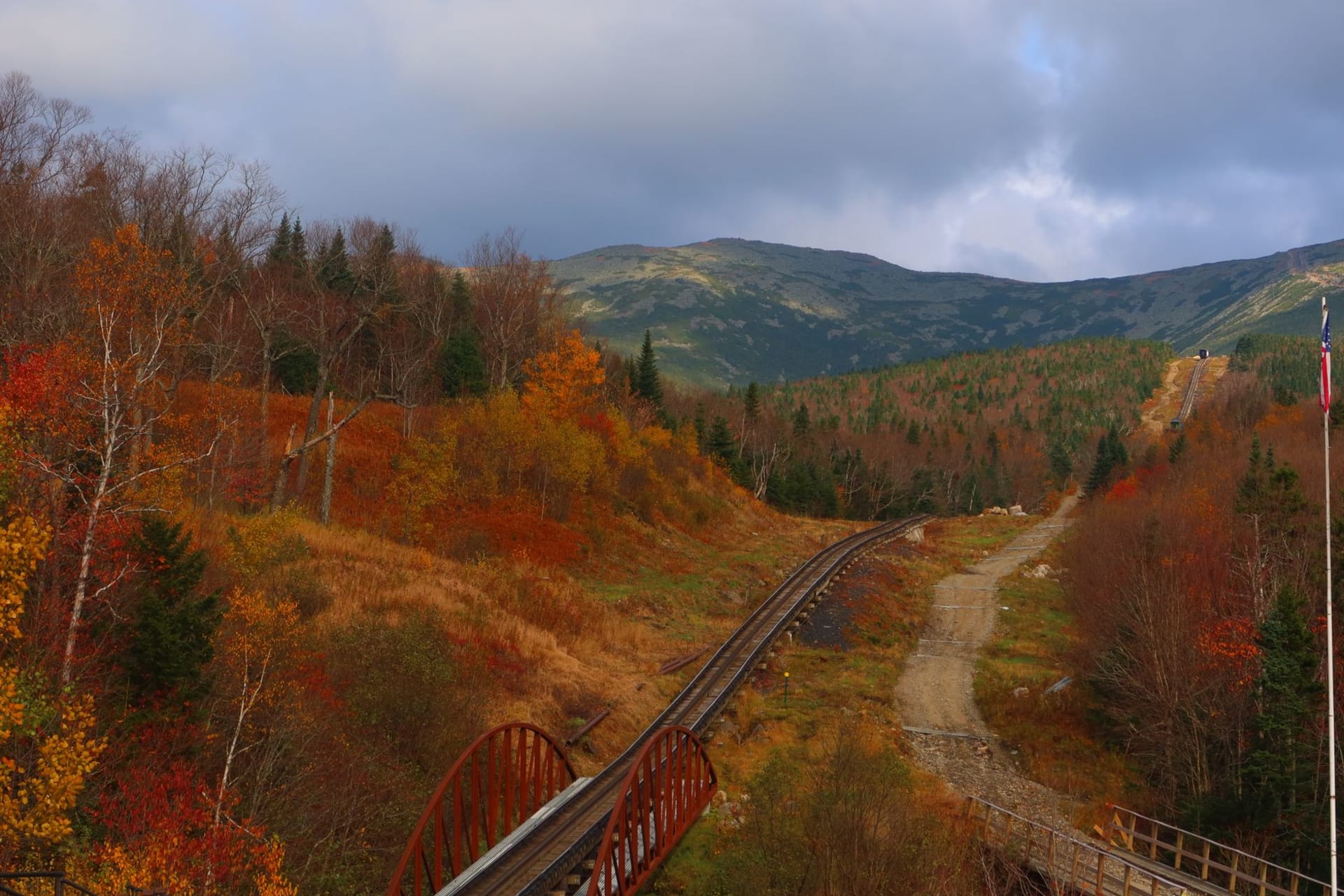
The summit of Mount Washington at 6,288 feet sits in a bowl of cloud more than three hundred days per year. On the day I went it was clear but the wind was running hard — forty miles an hour at the summit, the staff at the weather observatory told me, which they noted was a relatively calm day. The observatory itself is one of the stranger institutions in New England: a permanently staffed research station that has been recording the summit’s conditions since 1870, including the highest wind speed ever reliably recorded on Earth’s surface (231 miles per hour, 1934). The summit cafeteria sells chili and hot chocolate and has the specific warmth of a room where the contrast with the outside is doing all the work.

Franconia Notch, an hour south of the Washington massif, is where the White Mountains show their more accessible side without becoming any less beautiful. The notch is a glacially carved valley between the Kinsman and Franconia ranges, with Echo Lake at its floor and the cliffs of Cannon Mountain above. The Flume Gorge at the southern end is a narrow slot canyon carved by a mountain stream, its walls running with moisture and covered in ferns, the light inside it soft and diffuse even on bright days. I walked through it with a group of Quebec families, the children running ahead and screaming into the canyon walls to hear the echo, and it was exactly as good as children in a gorge always is.

North Conway in the valley to the east is the traditional base for the White Mountains, and it is cheerful and slightly overbuilt in the way of ski towns that have been ski towns for long enough to accumulate infrastructure. The outlet stores on Route 16 are not what I came for, but the breakfast spots open at six for the hikers and the gear shop on Main Street has the specific feel of a place where the people working there actually go out in what they’re selling. I found a bunkhouse in Lincoln on the western side that cost me forty-five dollars and smelled of damp boots and was absolutely correct for what I was doing.
When to go: September and October for foliage combined with the best trail conditions. Foliage peaks in the White Mountains around the first week of October, but the upper alpine zone turns first — by mid-September the Presidential Range above treeline is already showing color. Summer is reliable for hiking. Mud season (April through May) makes many trails nearly impassable. Winter is for experienced winter hikers only — exposure above treeline can be genuinely fatal.