Makoshika State Park
"Everyone goes west in Montana for the mountains; I drove east into the badlands and found the state's strangest country almost entirely to myself."
Montana sells itself on mountains. The brochures are all snow peaks and clear rivers and the kind of pine forest that smells like a candle. So when I told a man in Bozeman that I was driving east to Glendive, he looked at me the way you might look at someone who has announced plans to vacation in a parking lot. There is nothing out there, he said. He was wrong, but I understood the mistake. What is out there is so different from the rest of the state that it barely registers as the same place.
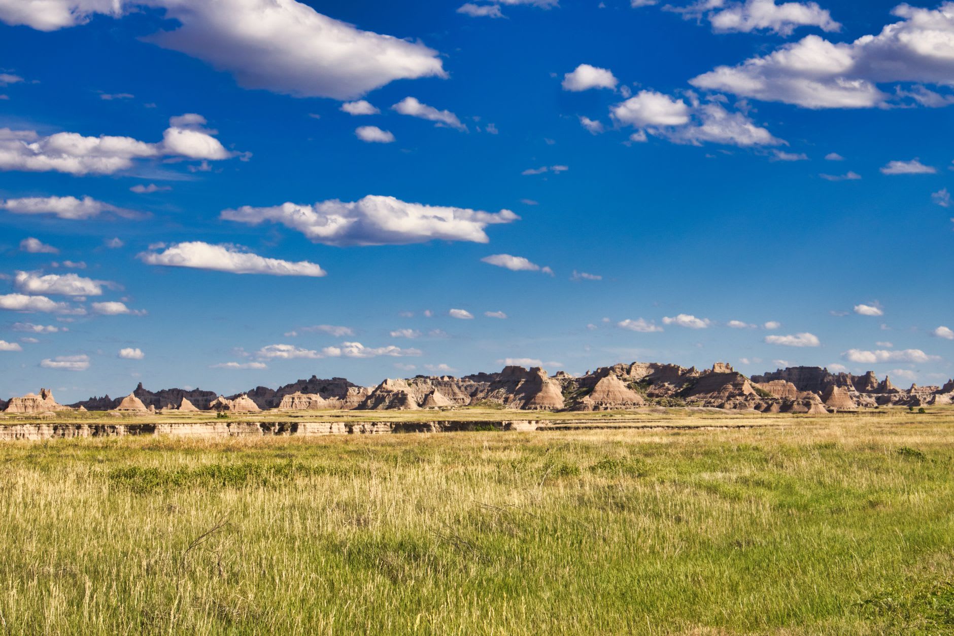
Makoshika is Montana’s largest state park, tucked into the southeastern corner near the North Dakota line, and it is badlands — eroded ridges and hoodoos and dry gullies carved out of soft sedimentary rock laid down sixty-some million years ago. The name comes from a Lakota phrase meaning bad land or bad earth, and standing on the rim you understand both the literal and the affectionate sense of it. It is bad land for farming and worse for walking carelessly. It is very good land for sitting still and watching shadows move across stone.
The country at the edge of the state
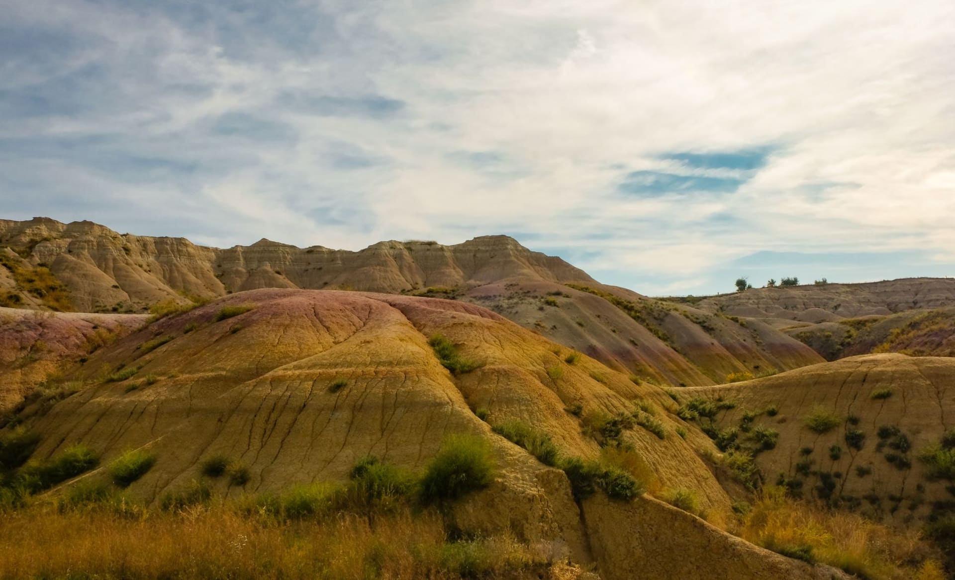
I drove the loop road through the park in the early evening, when the low sun does what it always does to badlands, which is turn the muted gray and tan layers into bands of gold and rose. The road climbs from the visitor center up onto the ridges, and at the high points you look out over a tangle of eroded formations dropping away in every direction, the Yellowstone River valley somewhere beyond, the sky doing the enormous thing that skies do out here. I had it to myself. One other car passed in two hours.
This is dinosaur country in the most literal sense. The rock here is the Hell Creek Formation, the same layer that has produced some of the most famous fossils in North America, including a Tyrannosaurus and the triceratops skull on display in the visitor center. I am not, by nature, a person who gets excited about rocks. But there is something genuinely sobering about walking a trail and realizing that the eroding hillside beside you is, statistically, full of bones, and that every rain reveals a little more of a world that ended long before anything resembling us showed up.
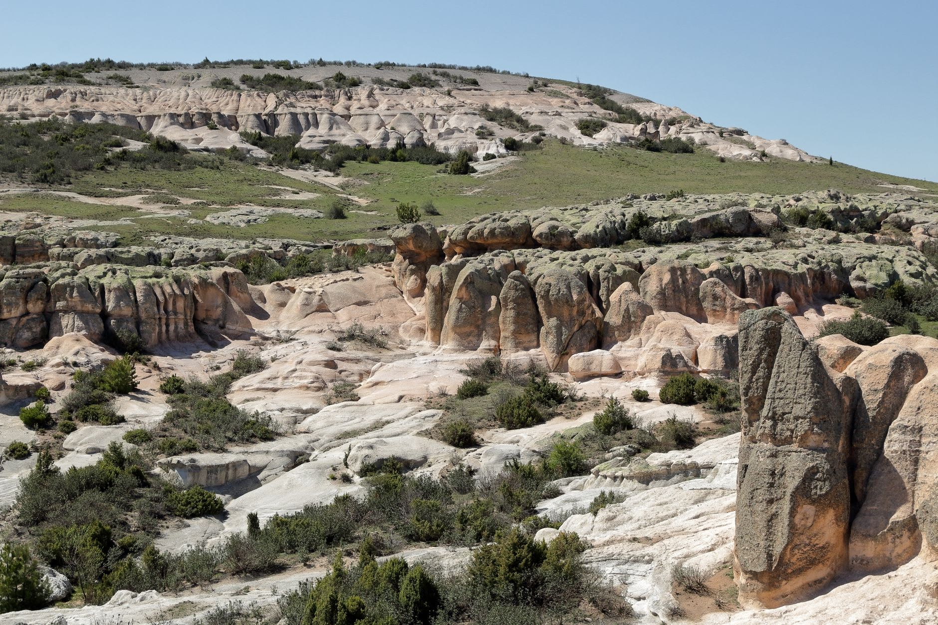
Walking the badlands
The trails are short but the terrain is unforgiving — loose, steep, and entirely without shade. I hiked the Cap Rock Trail, a modest loop that crosses a natural bridge and threads between pinnacles, and even in the cool of evening I went through more water than I expected. The clay underfoot turns to a slick, sticky paste when wet, locally and accurately called gumbo, and the rangers will tell you with feeling not to drive the dirt roads after rain unless you enjoy walking back.
There is a small campground inside the park, quiet and basic, and I spent the night there listening to nothing at all, which after a week of mountain-town traffic was its own kind of luxury. In the morning the light came up gold again, the formations threw long shadows, and a single mule deer picked its way along a ridgeline as if it owned the place. I suppose it does.
When to go
Late spring and early autumn are the sweet spots — the badlands bake in midsummer, with little shade and serious heat, and winter brings cold and the risk of impassable gumbo roads. May and September give comfortable hiking temperatures and the best light. Go early or late in the day for both the heat and the color, carry far more water than you think you need, and check the road conditions before driving the unpaved sections after any rain.