El Fuerte
"El Fuerte was the capital of the old province that included Sonora, Chihuahua, and Sinaloa. The province was called the Provincias Internas del Occidente. El Fuerte was where the silver came before it went to the coast."
El Fuerte is the colonial city on the Río Fuerte in northern Sinaloa that most travelers know only as the western terminus of the El Chepe train — the Ferrocarril Chihuahua al Pacífico that runs through the Copper Canyon from Chihuahua city to the Sinaloa coast. Los Mochis (45 minutes west) is the more common departure point for El Chepe, but El Fuerte was the historically significant city; Los Mochis is a 20th-century agricultural town.
Founded in 1564 as a Spanish military garrison and trading post, El Fuerte became the capital of the Provincias Internas del Occidente — the colonial administrative region that included what is now Sinaloa, Sonora, Chihuahua, and parts of Arizona and California. The silver from the Chihuahua mines passed through El Fuerte on its way to the Pacific coast. The Jesuit missions of the Sinaloa sierra were administered from here. Álvar Núñez Cabeza de Vaca passed through the Fuerte river valley on his famous 8-year walk from Florida to New Spain in 1536.
The Colonial Center
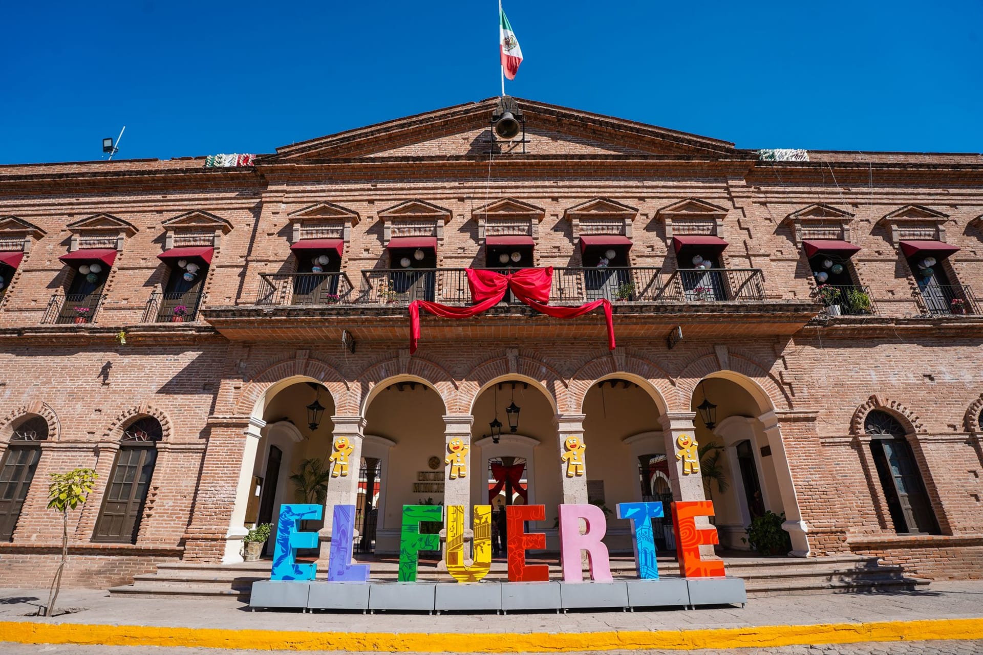
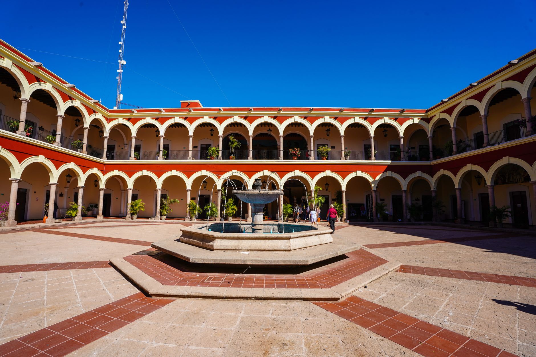
The Plaza de Armas of El Fuerte is bordered by the 17th-century fortress (after which the town is named), the 18th-century Iglesia del Sagrado Corazón, the colonial Palacio Municipal, and the Hotel Posada del Hidalgo — a converted 18th-century mansion that is the classic accommodation for visitors on the El Chepe journey.
The colonial mansions of El Fuerte’s historic center are in better condition than most provincial colonial cities of comparable size in Mexico — the buildings are maintained, the plaster painted, the ironwork balconies still in use. The economy of El Fuerte has never been fully depressed; agriculture (the Fuerte valley is one of the most productive farming regions in Sinaloa), fishing (the Río Fuerte empties into an estuarine system rich in shrimp), and the El Chepe tourist connection provide the stability that keeps the buildings from crumbling.
The Río Fuerte and the Estuary
The Río Fuerte runs through the town’s eastern edge and opens into a broad estuary system before reaching the Gulf of California. The estuary is a mangrove system that supports the shrimp fleet that makes El Fuerte’s restaurants more interesting than its inland location would suggest — fresh Gulf shrimp, cooked at noon by the women who sell their catch from coolers at the market.
Boat tours of the estuary: available from the river landing, the tours run through the mangrove channels where crocodiles and seasonal bird populations (herons, egrets, roseate spoonbills, the winter migrants from the north) inhabit the brackish margins. The crocodile population in the Fuerte estuary is large and visible; the tours approach within photographic range routinely.
The El Chepe Connection
El Fuerte is strategically located for the Copper Canyon train journey in a way that Los Mochis is not: it has colonial accommodation, a colonial dinner, and a colonial morning before boarding the train rather than the agricultural city experience of Los Mochis. The El Fuerte train station is on the eastern edge of town; the train east departs in the morning and the first significant canyon views appear within two hours.
The journey east from El Fuerte on El Chepe begins in the flat Sinaloa agricultural zone and then climbs — through the Sinaloan foothills, into the pine forest of the Sierra Madre, and then to the canyon rim sections where the train crosses the gorges on stone bridges — over 4-5 hours before reaching the canyon country around Creel.

Getting there: Bus from Los Mochis (45min). Los Mochis has an airport with flights from Mexico City and Guadalajara. El Fuerte is then the preferred overnight before the El Chepe departure eastbound. The El Chepe train departs El Fuerte in the morning (confirm current schedule — times shift seasonally).
When to go: October through May for the clearest weather and most comfortable temperatures. The agricultural valley climate is hot and humid in summer; the colonial town is more comfortable than the coastal cities but still warm. The El Chepe runs year-round.