Los Azufres
"Sulfur and pine and green water at 3,000 meters. I walked the lake twice and nobody came to make me leave. That was the best part."
The road up to Los Azufres climbs from Ciudad Hidalgo through pine forest that thickens as the elevation increases, and somewhere around 2,500 meters you begin to smell it: the specific sulfur smell of geothermal activity, hydrogen sulfide, the scent of the earth working. I have read that people find this smell nauseating. I find it interesting in a way that’s difficult to explain — something about the proximity of a genuine geological process, the planet doing something that predates every other thing in the landscape including the trees, makes the smell seem right rather than wrong.
I arrived in October, which turned out to be the correct month. The aspens — álamos in the Mexican highlands — had gone yellow along the trail edges, their small leaves trembling in the thin air, and against the dark green of the pine and the grey-green of the oyamel fir they produced a color combination I associate with the Alps in September, but at 3,000 meters above sea level with geothermal steam rising from vents in the middle of the forest. The combination is not what you expect from Michoacán.
The Lakes and the Landscape
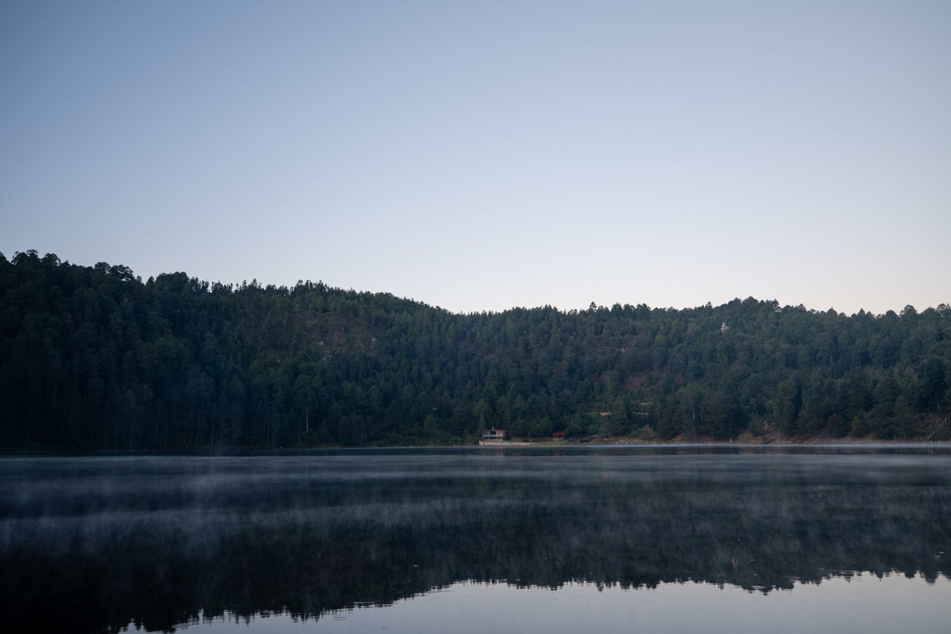
Lago de Tejamaniles is the larger of the two main lakes and the one with the best trail access. The water is green — not the clear green of a mountain lake fed by snowmelt, but the opaque green of mineral saturation, the color of old copper, warm to the touch at the edges where geothermal activity is closest to the surface. The trail around it takes about forty-five minutes at a reasonable pace and passes through several distinct microenvironments: open lake edge with views across to the fumaroles on the far shore, dense pine forest where the trail narrows and the light comes in green-gold through the canopy, sections of exposed volcanic rock where the ground is warm underfoot.
Lago de Lázaro, a short walk away, is smaller and more enclosed, and the geothermal activity around it is more visible — fumaroles venting steam, patches of ground stained yellow and orange with sulfur deposits, the specific sound of boiling mud in a pool a few meters off the trail. I stood by the mud pool for ten minutes watching it breathe. The bubbling is rhythmic in a way that is almost biological, and the colors in the clay — grey, yellow, rust — are the colors of something alive rather than inert.
The COMERMEX geothermal power plant operates in the forest above the lakes, its infrastructure visible from sections of the trail: pipes running through the trees, collection valves, the practical machinery of extracting energy from volcanic heat. The plant has been operating since the 1980s and provides a significant percentage of Michoacán’s electricity. I found its presence neither intrusive nor aesthetically comfortable — it simply exists in the forest as an additional fact about what the place is.

Alone at 3,000 Meters
I had arrived on a weekday in mid-October and found approximately no one. A couple of vehicles at the main parking area, a woman selling elotes at a small stand near the entrance who seemed genuinely surprised to see a visitor. The trail around Lago de Tejamaniles was empty for both circuits. No rangers, no other walkers, no designated closing time that anyone mentioned or enforced.
This is the quality of Los Azufres that is difficult to explain to people who are used to Mexican tourist sites operating at their peak capacity: the total absence of infrastructure for visitors. Not in a way that suggests neglect — the trails are maintained, the paths are clear — but in the way of a place that hasn’t decided yet whether it wants visitors or is simply indifferent to the question. There is no admission fee at most entry points. There are no interpretive signs in English. There is no Instagram installation in the shape of a heart frame placed to catch the lake view.
In the Auvergne region of France, which has similar geothermal landscapes — volcanic plateau, crater lakes, the puy chain — the infrastructure is extensive. The Puy de Dôme has a tramway and a visitor center and managed queues in summer. The volcanic landscapes of Michoacán are equally extraordinary and almost entirely unmediated. I do not say this to be precious about undiscovered places. I say it because the experience of standing at the edge of a geothermal lake in pine forest at altitude with no one else present is different from the experience of standing there with a thousand other people, and both things are true of their respective landscapes.

Getting There
Los Azufres is accessed from Ciudad Hidalgo, a mid-sized city in eastern Michoacán about 130km east of Morelia. The road up from Ciudad Hidalgo is paved and navigable in a standard vehicle, though it climbs sharply and the surface has sections that require slow driving. A car is essentially necessary — there is no regular public transport to the geothermal zone itself, and even with a car the approach takes 30-40 minutes from town.
From Morelia, the drive is around two hours via Ciudad Hidalgo. From Mexico City, Los Azufres is approximately three and a half hours — an overnight in Ciudad Hidalgo or Zitácuaro makes this a reasonable two-day excursion.
Bring warm layers. At 3,000 meters in October the afternoon temperature drops quickly, and the sulfur smell on cold wet clothing has a particular persistence that requires advance acceptance. The lakes are warm enough to enter — people do swim in the thermal areas — though the mineral content makes them inadvisable to drink from, which the signs at the edge of Lago de Tejamaniles note in Spanish without apparent urgency.