Pico Ruivo
"The cloud was sitting three hundred meters below me and the island was invisible. I felt like I'd stepped off it entirely."
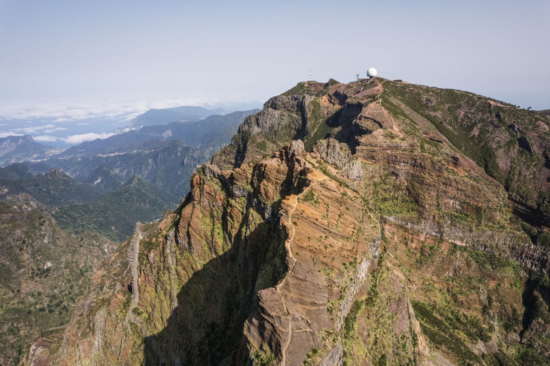
I drove to Pico do Arieiro in the dark — intentionally, the way you sometimes do a thing that is harder than it needs to be because the difficulty is part of the point. At 1800 meters, the car park is already cold in a way that doesn’t match anything about the island you’ve experienced at sea level. I watched the sun come up from the paved viewpoint at Arieiro and the cloud sat below the ridgeline in a flat white sheet, and the volcanic peaks of the central massif pushed through it like islands in a second ocean. Pico Ruivo, the actual summit, was visible three kilometres east along a ridge trail that goes up, then down, then dramatically up again, and the morning light was doing something to the rock faces that made the whole scene look like a painting of itself.
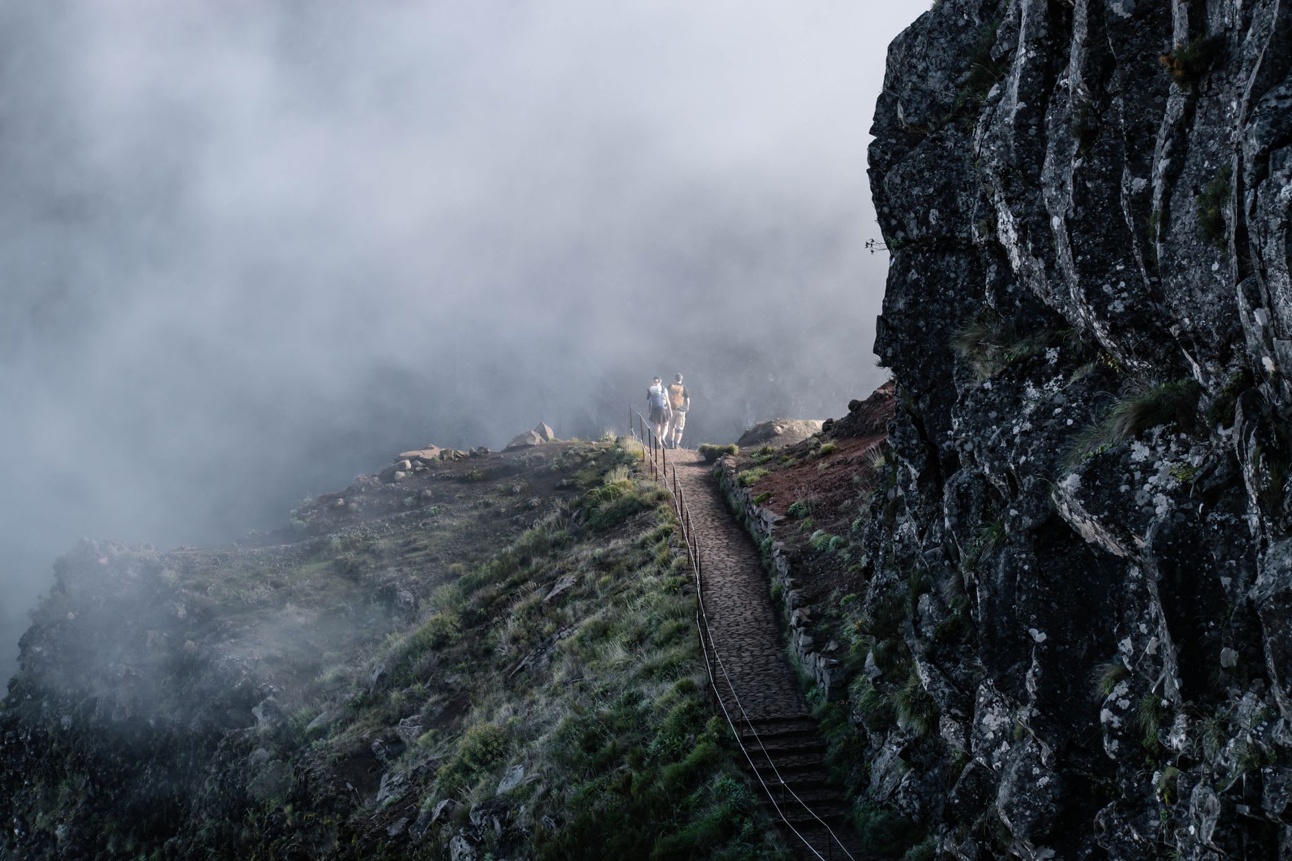
The trail between Arieiro and Ruivo is Madeira’s most famous hike and earns its reputation not through distance — about eight kilometres one way — but through the intensity of the experience. The path crosses ridge after ridge, passes through tunnels hand-cut into the rock that require ducking, and at several points offers vertigo-inducing views on both sides simultaneously. The vegetation at this altitude is heathland and rock, occasionally flowering in small purple clusters, the silence broken only by wind and the occasional distant goat. I met a German couple near the second tunnel who had hiked up at three in the morning with headlamps and looked contentedly destroyed. I understood them completely.
The summit at 1862 meters has a small refuge — Casa de Abrigo — where you can get coffee and soup and sit on a terrace looking at one of the more extraordinary views in the Atlantic. On a clear day the outline of Porto Santo, Madeira’s smaller sister island, is visible to the northeast. The land below vanishes into levada-threaded valleys and then into coastline, the sea surrounding everything, and you become aware in a sudden and visceral way that you are standing on a mountain on an island that rises from very deep water. That awareness sits differently from any other mountain experience I’ve had.
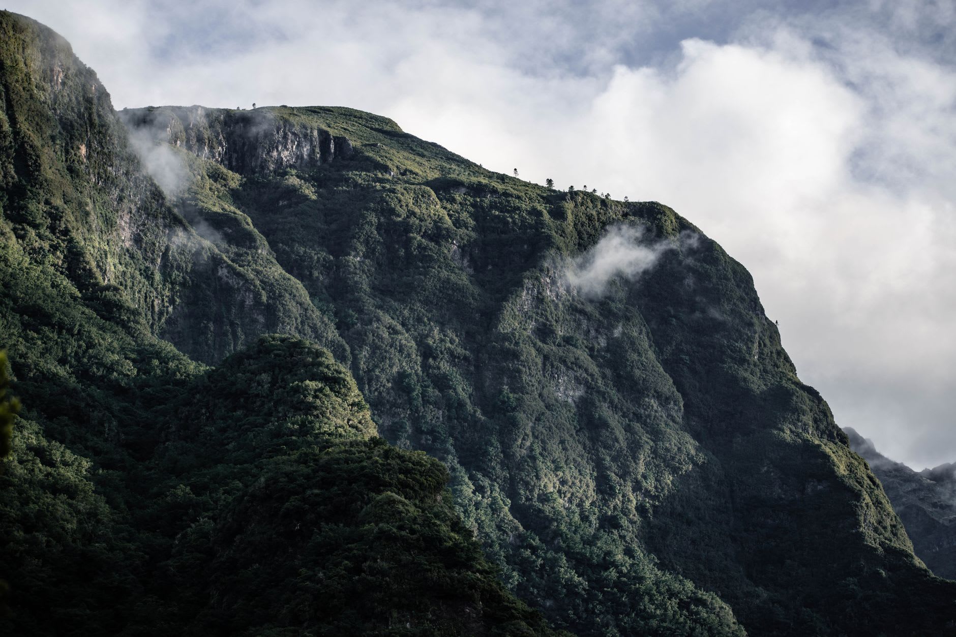
The descent on the north side — if you continue through to Achada do Teixeira rather than returning to Arieiro — is gentler and wetter, the vegetation transitioning back through heather and then into laurel, the air picking up moisture as altitude drops. A taxi from Achada can return you to wherever you’re based, which is a reasonable thing to arrange in advance because at that point in the afternoon most people have spent whatever reserves they had on the ascent and the return drive to Funchal is an hour of winding mountain road.
When to go: May through September offers the best visibility, though even then the cloud can roll in without warning. April and October are reasonable bets. Winter brings genuinely cold and icy conditions that can close the trail — check with local hiking operators before committing. Start early regardless of season; the ridge collects cloud by midday most of the year and what is clear at seven is often white by eleven.