Paul da Serra
"Every road off this plateau drops through the cloud and it takes a moment each time to remember there is an island below."
Nobody who reads about Madeira expects this. The island’s brochure version is levadas, laurel forest, flower gardens, blue sea. The Paul da Serra — the high plateau that occupies the island’s western interior — is none of those things. It is sixteen square kilometres of moorland at 1400 metres, treeless, windswept, grazed by cattle that appear out of the mist at the side of the road with an indifference to their surroundings that suggests they find the landscape as obvious as anyone born to it would. In winter the plateau can see snow. In summer the cloud sits on it like something with nowhere else to be. The wind turbines rotate steadily regardless of season.

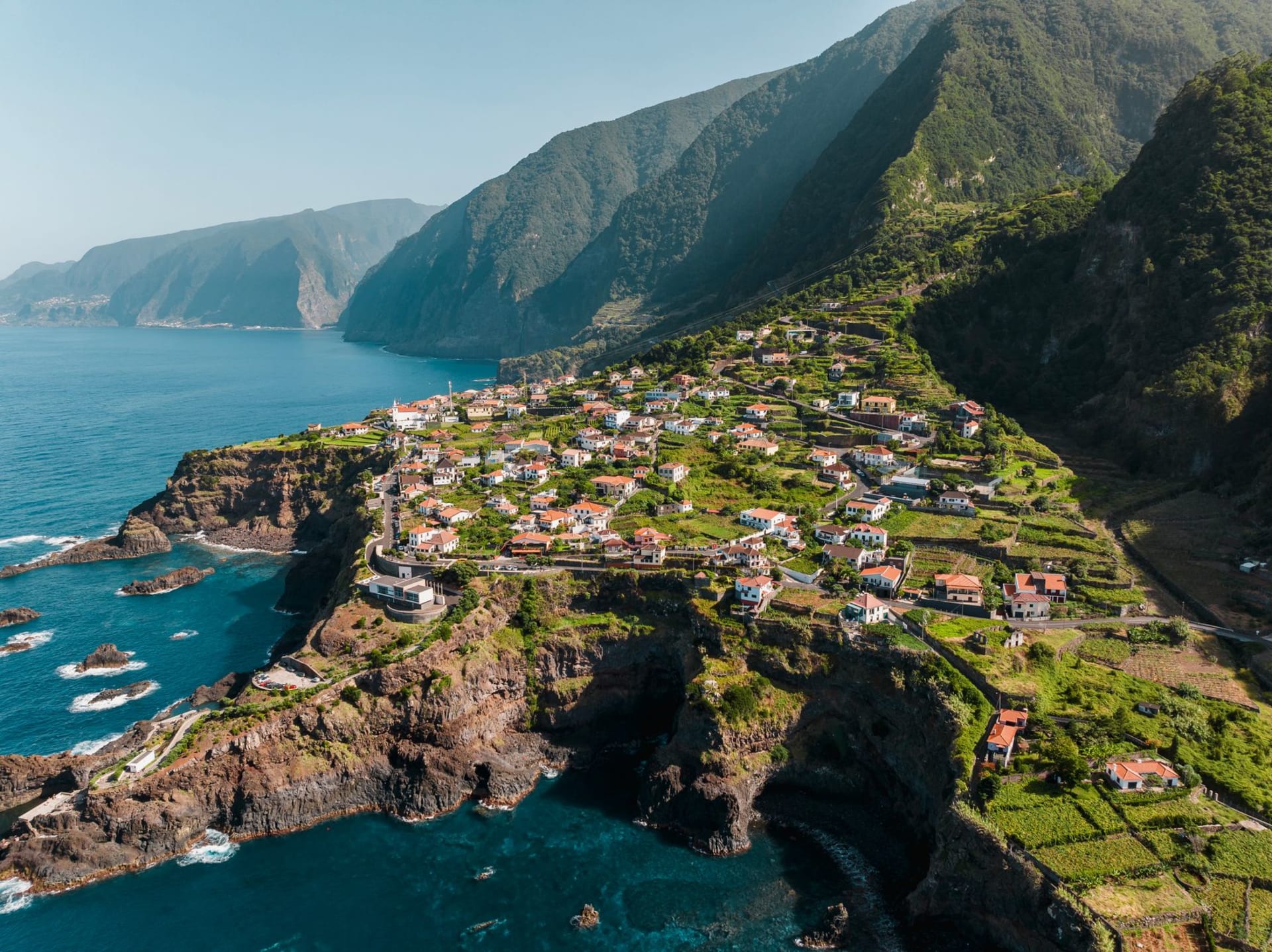
I drove across it on a November afternoon when the cloud was total and visibility dropped to about thirty metres and the road — the ER110, the east-west spine of the plateau — was completely empty. The sensation was of driving through a space that had become purely abstract: no horizon, no depth, no reference points beyond the white lines of the road and the occasional silhouette of a turbine looming and then passing. I pulled over at a point where a break in the cloud revealed a few hundred metres of the western edge, and below me the land fell away into a valley that plunged toward São Vicente and the north coast. That valley was in full afternoon sun. I could see sun, green hillsides, a strip of blue sea — all of it separated from where I stood by several hundred metres of cloud that I was standing directly on top of.
The levadas that carry water to the south of the island draw from this plateau. The Paul da Serra catches rain and cloud moisture and channels it down through mountain tunnels to irrigate the banana and sugarcane plantations of the warmer coast. The hydrological infrastructure of Madeira is genuinely impressive engineering, and this plateau is where much of it originates: the water collection and distribution system was begun in the fifteenth century and has been continuously maintained and expanded since. Walking the Levada do Paul, which crosses the plateau and then descends steeply to Calheta on the south coast, takes you through both the high moorland and the beginning of the forest zone in a single long route that covers most of what the island is made of.

There is almost nothing here in terms of infrastructure — a café at the plateau’s main crossroads, a petrol station, a few unmarked parking areas at the heads of levada trails. This is the point. The Paul da Serra is the island with its tourist logic removed, and what remains is surprisingly affecting: the sound of wind and cattle, the occasional distant car horn on a mountain road, the smell of wet grass and something mineral underneath it that might be the volcanic rock itself. After three days at sea level in Funchal I drove up deliberately, to remind myself that the island had another mode entirely. It does. The two modes barely share a vocabulary.
When to go: The plateau is most itself in winter, November through February, when the mist is consistent and the light is low and flat. In summer it can clear entirely to give long views west toward Porto Moniz. It is worth crossing regardless of season — the transition from coast to plateau is one of the more jarring and pleasurable geographic shifts on the island. Drive slowly: the cattle cross the road without signalling, and they are not small.