Cochamó Valley
"Nobody mentioned the mud would be up to my knees, and somehow that made the valley better."
A granite-walled valley of waterfalls and old-growth forest that climbers call Chile's Yosemite, reached on foot or on horseback through mud that never fully dries.
The trail into Cochamó starts easily enough, following the Río Cochamó through farmland out of the small fishing village of the same name, and then, somewhere around the second hour, it turns into a different kind of hike entirely — a churned, root-laced, genuinely difficult mud trail that gaucho families have used for generations to move cattle up into summer pasture. I arrived at the end of it caked to the knee and grinning, because the reward is one of the more startling landscapes I’ve stood in: a glacial valley walled in by granite domes that would not look out of place in California, draped in temperate rainforest instead of pine, waterfalls dropping hundreds of metres down bare rock faces on both sides.
Climbers have quietly been calling this place the Yosemite of South America for years, and the comparison holds up better than most tourism-brochure claims — La Junta, the valley floor where trails converge, sits ringed by walls like Trinidad and Cerro Arco Iris, big enough that international climbing teams now come specifically for multi-pitch routes on clean granite that barely anyone has touched. I’m not a climber, but I sat at the base of one of those walls for the better part of an afternoon, watching the light move across rock the color of old bone, and understood the obsession without needing to share it.
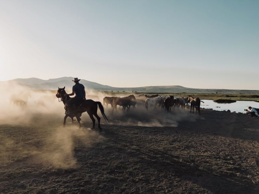
The refugios at La Junta are simple, wood-fired, and run by families who’ve worked this land for generations, which gives the whole valley a lived-in quality that pure wilderness areas often lack. I ate dinner at a long communal table with climbers, hikers, and a rancher moving cattle through, all of us equally muddy, and fell asleep to the sound of the river below the refugio’s deck. In the morning, mist sat in the valley below the granite domes until around ten, then burned off all at once, like a curtain being pulled.
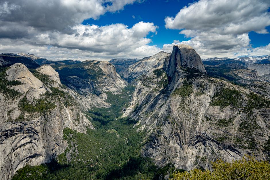
When to go: December through March, when the trail is at its driest — which is relative; bring gaiters regardless. Avoid the valley entirely during heavy winter rains, when the trail becomes genuinely hazardous and several river crossings can be impassable.
Keep exploring
More from Chilean Lake District
 lake-district-chile
 Curarrehue
A Mapuche-Pehuenche town on the road to Argentina where the food, the crafts, and the mountains all carry more weight than in flashier Pucón nearby.
Explore lake-district-chile
 Frutillar
A pristine lakeside village on Llanquihue where German colonial houses and a world-class concert hall face Osorno across still water.
Explore lake-district-chile
 Hornopirén
The small fjord town where the paved road quietly gives up and the ferry-hopping adventure of the Carretera Austral genuinely begins.
Explore lake-district-chile
 Isla Huapi
A Mapuche-Williche island in the middle of Lago Ranco reachable only by barge, where rural life continues largely untouched by the mainland's tourism.
Explore lake-district-chile
 Isla Tenglo
A five-minute boat ride from Puerto Montt to an island that still runs on fishing, curanto, and a view of the city that makes you forget it's the city.
Explore lake-district-chile
 Lago Calafquén
Volcanic black sand beaches and thermal springs fringe this lesser-known lake south of Villarrica, where Chilean families holiday and foreign travelers rarely follow.
Explore