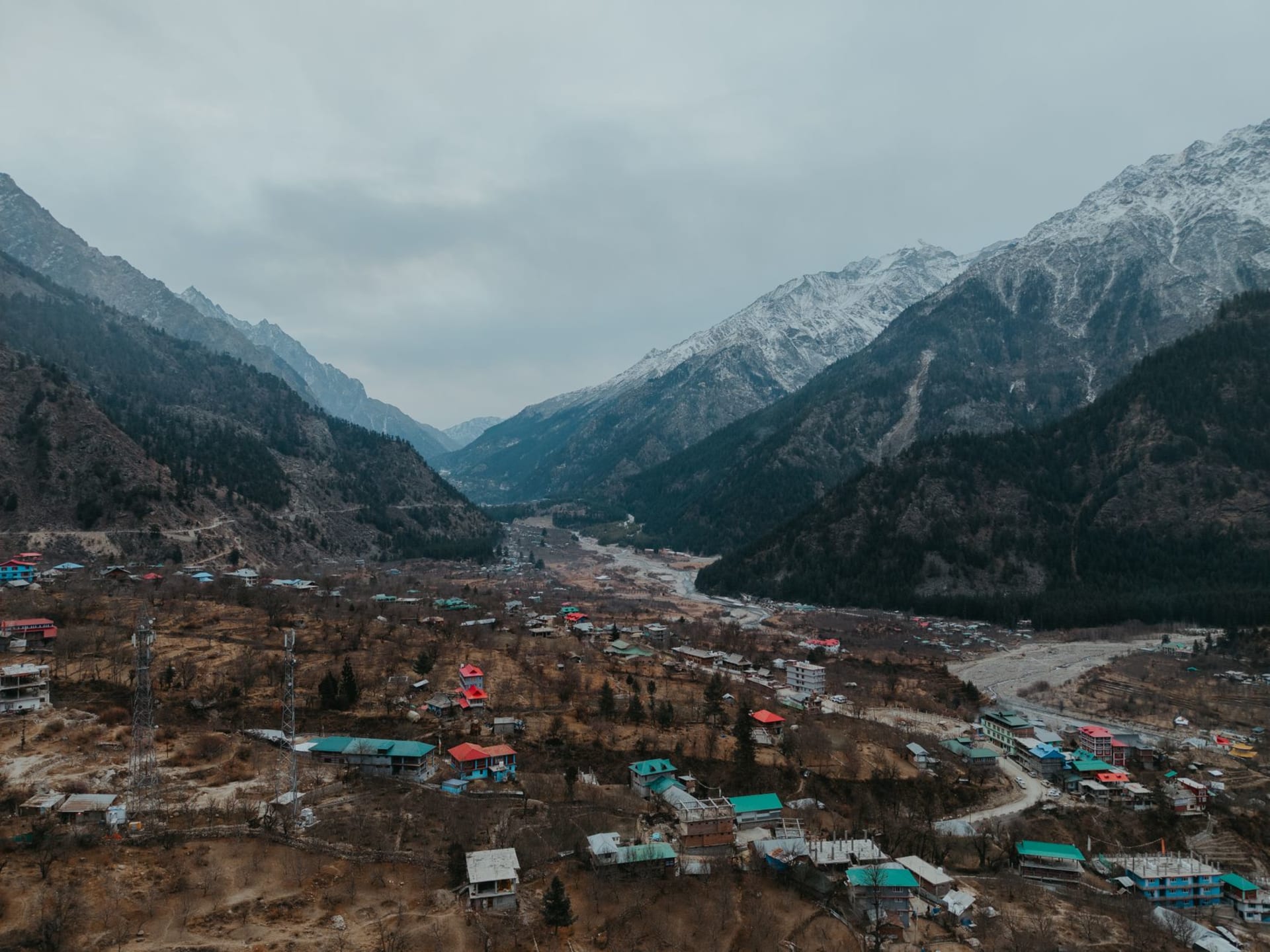
Sangla Valley
"After the gorge road, Sangla opens like a secret that someone finally trusted you with."
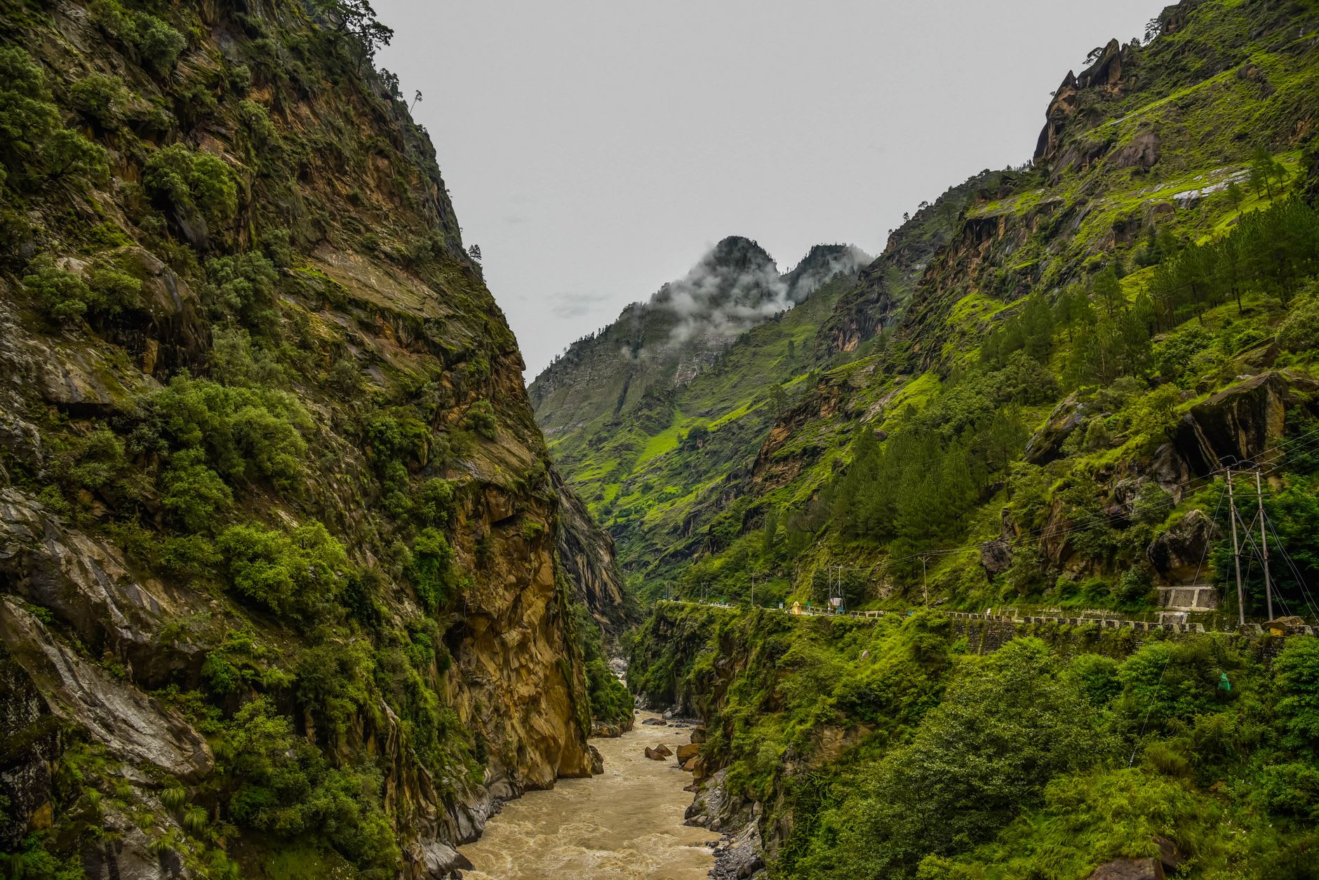
You reach Sangla Valley by turning off the main Kinnaur highway and following the Baspa River up a side canyon. The main road is already dramatic enough — pressed against the Sutlej gorge walls with the river hundreds of metres below — but the Baspa side valley is a different register entirely. Within five minutes of the turn-off, the walls widen and the valley floor broadens and the vegetation changes from the scrubby pine-and-rock of the gorge to something lush and almost extravagantly green. Deodar cedars rise to heights that seem wrong for the altitude. The river, fed by glaciers to the east, runs cold and opaque and the blue-grey of raw silk. This is Sangla Valley, and it is one of the more startling arrivals I have experienced in the Himalaya.
The valley runs for about 25 kilometres from the mouth to the last habitable village of Chitkul, which sits at 3450 metres on the Tibet border and has the formal distinction of being the last Indian village before the Chinese frontier. Between the entrance and Chitkul, a sequence of villages — Sangla, Kamru, Batseri, Rakcham — occupies a valley that has clearly been inhabited for a very long time. The Kamru Fort, above the main Sangla village, is a seven-storey wooden tower of the kind found throughout Kinnaur and Lahaul, its lower floors used as a granary and its upper floors housing a temple to the local deity Badrinath. Getting there requires a short climb through a village of carved wooden houses and vegetable gardens where the kale and root vegetables are the size that only cold-climate, high-altitude growing produces. The views from the fort’s upper floors take in the whole breadth of the valley, the Baspa River a bright thread through meadows of impossible green.
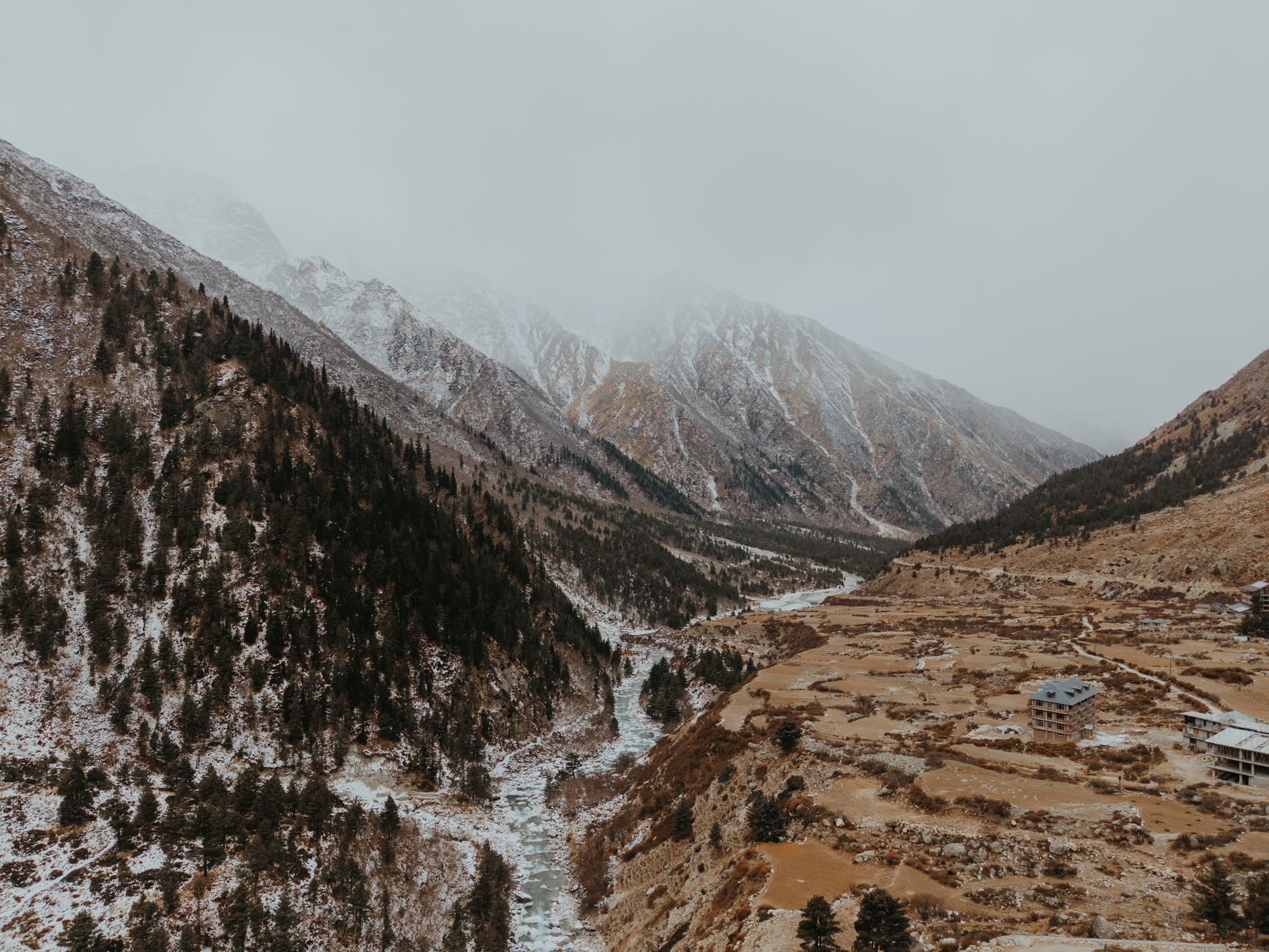
Chitkul deserves the full day it takes to reach it from Sangla. The road is narrow and erratic and the last stretch after Rakcham climbs through pine forest and then breaks out into alpine meadows where yak graze in summer and the Himalayan marmots — fat, sun-seeking, absurdly tame after years of tourists — sit upright on rocks like small oracles. Chitkul itself is a collection of maybe 400 people, wooden houses with slate roofs, a small temple, a single guesthouse where the owner’s daughter speaks excellent Hindi and has opinions about Bollywood that she will share with you at length over dinner. The Baspa here is narrower and faster and comes from glaciers you can see directly up the valley. Standing at the last checkpoint — beyond which no Indian civilian may travel — and looking east into Tibet is one of those experiences that exists simultaneously as geography and as imagination.
The fruit in Sangla is worth a separate paragraph. The valley produces cherries, apricots, apples and pears of a quality that Kinnaur as a whole is famous for, but Sangla’s relative inaccessibility means the fruit here is locally consumed rather than commercially distributed. In June and July, the cherry trees are heavy and red and the roadside stalls — mostly just a woman with a bucket and a price chalked on a board — charge essentially nothing. I ate cherries continuously for two days in Sangla and had the clearest conscience about it.
The valley receives a surprising number of independent travelers — it has become reasonably well known on the Himachali circuit — but the tourist infrastructure remains genuinely basic. This is still a place where the guesthouse owner will ask what time you want breakfast and then wake up that early to make it. The trails into the side valleys and up toward the glacier are unmarked on most maps. Bring printed or downloaded offline maps.
When to go: May to June for cherry season and clear weather before the monsoon. September to October for apple harvest and the best trekking conditions, with cooler temperatures and the dramatic light that comes to the Himalaya in autumn. July and August see some rain but the valley is less affected than lower Himachal. The valley closes completely in winter, usually by November.