Pointe des Châteaux
"At the very tip of Guadeloupe, where two seas fight each other, you remember the island has edges."
The drive east from Saint-François changes. What starts as a beach-town road with rental bike shops and ice cream places gradually loses its tourism infrastructure until there is only the road, the vegetation shrinking on either side, the sky getting bigger. The last few kilometers before the point, the landscape has become something almost Mediterranean — low scrub, sun-bleached rock, wild succulents growing from crevices in the limestone — which is a strange thing to encounter at the end of a Caribbean island, and exactly the right preparation for what’s at the tip.

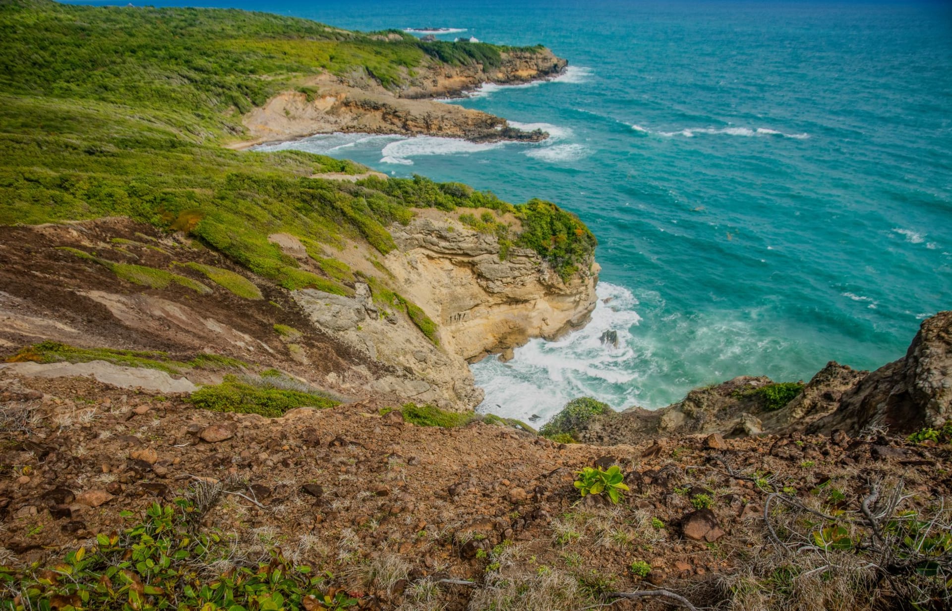
I parked where the road ends and walked the last kilometer out to the point. The wind at the headland is serious — not dangerous, but the kind of constant pressure that requires you to lean into it and reconsider your hat. The path climbs through the limestone formations that give the headland its name: the rock has been worked into shapes by centuries of Atlantic swells, and the results are cathedral-like — arches, columns, pinnacles of pale stone with the sea visible through gaps, the whole arrangement generating a feeling that the rock is in the process of becoming something else and you are watching it happen slowly.
At the cross on the summit, the view opens in all directions: the flat green length of Grande-Terre stretching back west, the offshore island of La Désirade — a long, low, dry shelf of rock with a permanent population and almost no tourism — sitting five kilometers to the northeast. On the south side, the Caribbean was its usual self, that particular organized blue. On the north side, the Atlantic was considerably less organized — larger swells, white water breaking over the limestone at the base of the cliffs, a sound that was more thud than crash. Two seas, one headland, a cross on the summit, and whatever comes from standing at the edge of something.

There are small beach pockets on the south side of the headland, sheltered from the Atlantic swell, where the water is that perfect warm Caribbean temperature and the limestone formations provide natural shade. I swam in one of them for a while, completely alone — the day-trippers who arrive around mid-morning were still an hour away. The limestone above the waterline was hot to the touch; below it the rock was covered in sea fans and small coral growths and the kind of life that accumulates on rock given enough time and the right water temperature. A pelican made several unsuccessful passes at something in the shallows, then gave up and floated.
When to go: Pointe des Châteaux is best in the morning before 10am, when the parking area is manageable and the light on the limestone formations is at its most interesting. The point is exposed to wind year-round — the trade winds blow consistently from December through June, making this period ideal for the dramatic sea conditions on the Atlantic face. The walk to the cross and back takes about ninety minutes at a relaxed pace; allow longer if you’re exploring the coves on the southern side.