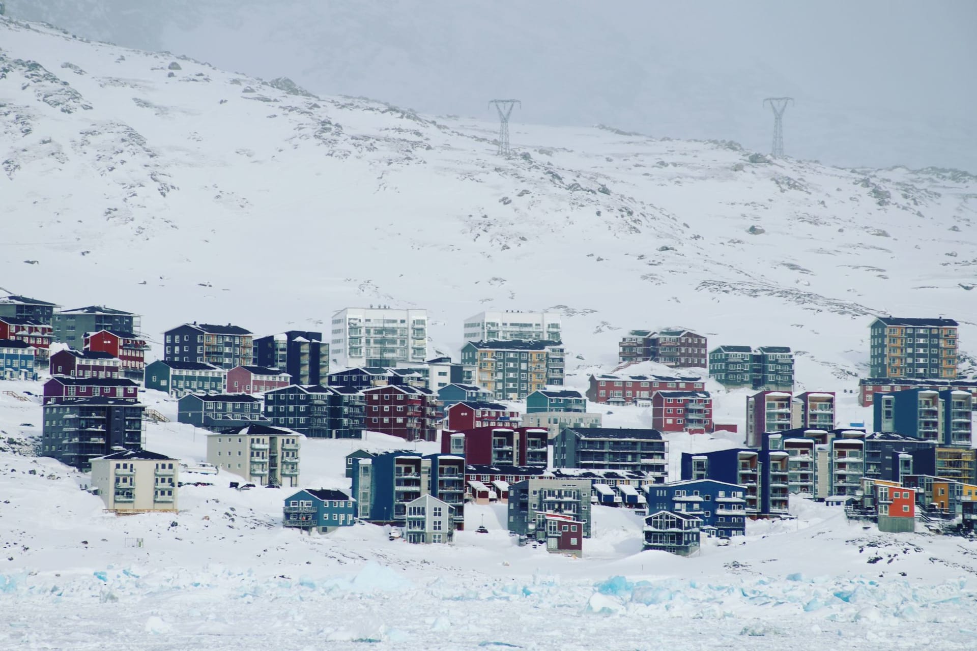
Kangerlussuaq
"The ice sheet starts just behind the airport — geography here skips the formalities."
Kangerlussuaq exists because of an airstrip. The Americans built it in 1941 as Bluie West Eight, a WWII air base on a gravel delta at the head of a 170-kilometre fjord, and when the military left in 1992 they handed over the infrastructure to a settlement that had no reason to be there except the runway. It is now the main international entry point into Greenland — most transatlantic flights pass through here — and its character reflects that origin: utilitarian, oddly compelling, the kind of place that makes more sense the longer you stay in it.
The fjord, Kangerlussuaq, is the longest in Greenland and one of the longest in the world. The access road runs along its southern shore for a stretch before the settlement, and driving it on the bus from the airport, I kept expecting the fjord to widen or curve or do something to break the illusion of infinite length. It did not. The water runs brown with glacial melt, the hills on either side are bare tundra in summer, and the light falls flat and even, without the drama of the iceberg coasts to the south. It is a subtler landscape than Ilulissat or Tasiilaq — drier, continental, warmer in summer — and I found I preferred it for hiking precisely because it was not trying to overwhelm me.
The musk oxen are the first thing most people mention. There are around 10,000 of them in the Kangerlussuaq area, and they have become so accustomed to the settlement that they occasionally wander onto the airfield, requiring handlers to move them before flights can land. I saw my first group on the hillside above the road from the airport, five of them in a loose formation, moving with that deliberate unhurried pace that large herbivores in places without many predators tend to develop. Up close — and you can get close, though guides will tell you not to provoke them — they are genuinely prehistoric-looking: the thick dark coat, the curved horns, the low forehead. They have been on this continent for 700,000 years. They notice you the way rocks notice you.

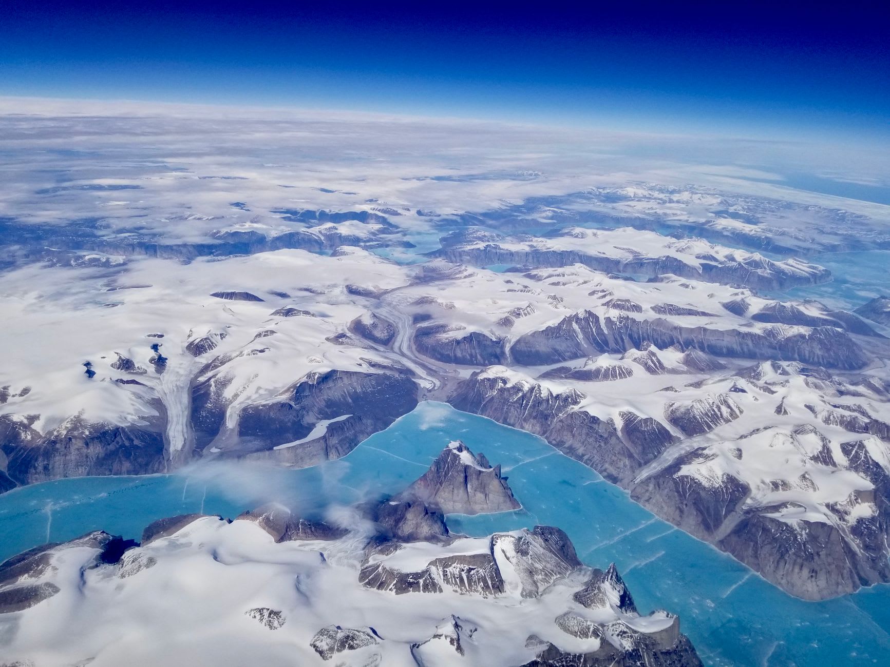
An hour’s drive on gravel roads above the town — or three hours on foot — and you reach the edge of the Greenland ice sheet. This is not an icefjord or a glacier tongue descending to water. It is the ice sheet itself: a surface that extends 2,400 kilometres and carries 80 percent of Greenland’s ice. Standing at the margin where the tundra ends and the ice begins, looking out at a white expanse that has no far edge, I felt a specific kind of vertigo that has nothing to do with height. The scale is not dramatic in the way a cliff face is dramatic. It is simply beyond the kind of scale that human perception handles easily. I walked onto it a short distance and then came back, because there was nothing to walk toward, and the tundra behind me suddenly seemed very particular and dear.
When to go: June to August for hiking, musk ox viewing, and access to the ice sheet. July is warmest — genuinely continental warm, sometimes 20°C or above, which surprises people who come expecting Arctic cold. Northern lights viewing in September and October is outstanding, with very low light pollution. Avoid deep winter unless joining an organised expedition; the settlement offers limited services off-season.