Enniberg
"Standing at Enniberg, the wind doesn't push you — it makes a case for why you shouldn't be here at all."
I drove north on Viðoy on a road that ran out of maintenance confidence somewhere around the second-to-last farm and became a track with grass growing down the centre line, the wheels finding the hardpack on either side by feel. The map indicated a viewpoint at Enniberg. What it did not say was what viewpoint means when applied to a place where the land terminates in a cliff that drops approximately seven hundred and fifty metres to the North Atlantic. I parked where the track ended — there was nowhere else to go — and walked the last stretch to the edge.
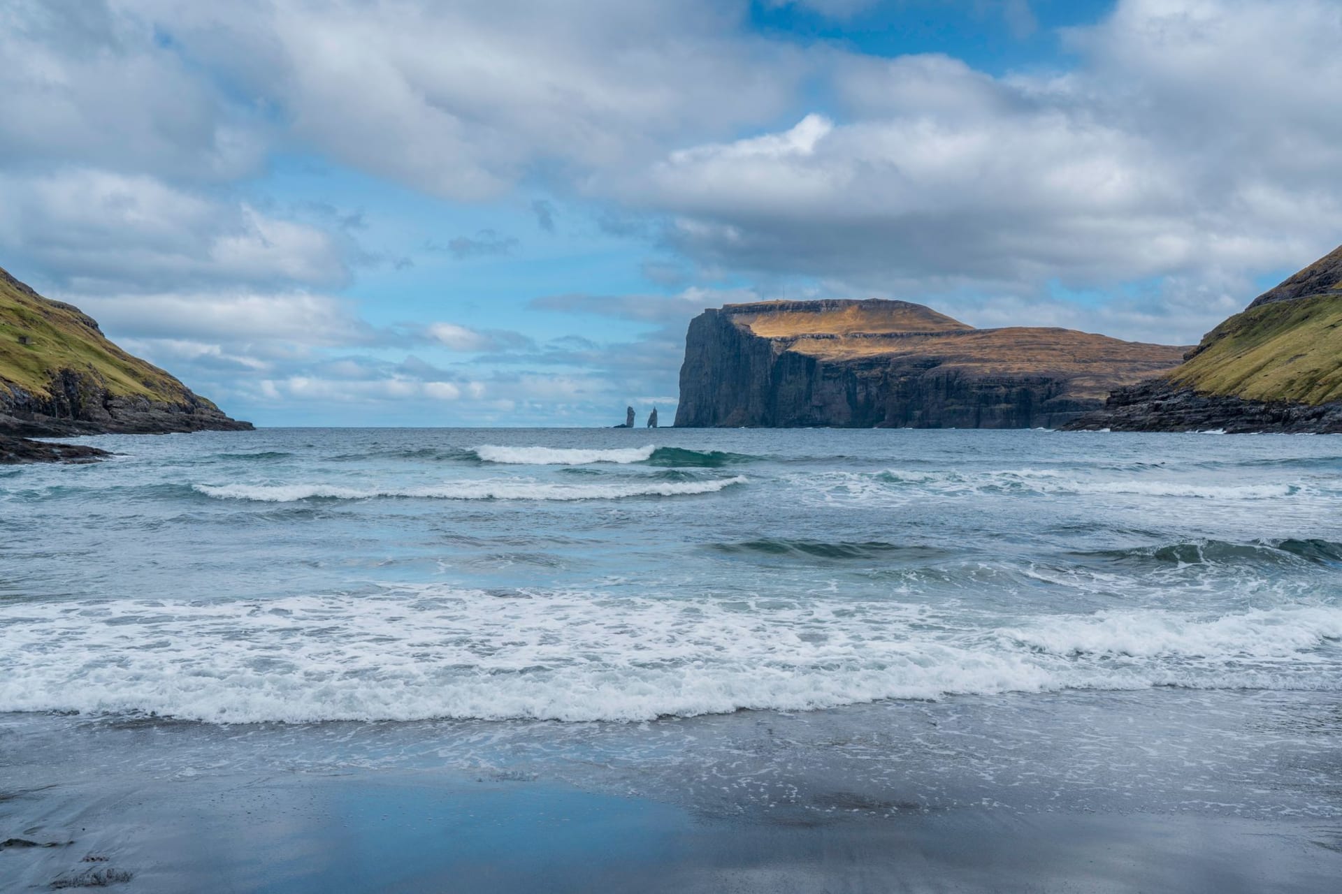
The cliff at Enniberg is often cited as the highest sea cliff in the world, or among the highest, depending on how you define the starting point and whether you measure the sheer vertical face or include the talus and boulder field at the base. What is not open to debate is the effect of standing at its edge in a wind that has been building across open ocean from Norway. I lay on my stomach on the rim and looked down, and the sea below was so far away it appeared slow — the waves arriving at the base in a movement that seemed geological rather than daily, each one taking long seconds to complete its collapse. Guillemots flew past at eye level, which meant they were also approximately seven hundred metres above the water, and they seemed entirely unbothered by this fact.

The island of Viðoy is thin — only a few kilometres wide in most places — and the ridge path north to Enniberg crosses between the eastern and western coasts at various points, so that you can look down to the fjord on one side and to the open ocean on the other almost simultaneously. This gives the walk a quality of exposure unlike anything else I encountered in the Faroes: the land feels provisional underfoot, a narrow argument against the sea. The wind on the eastern side was strong; on the western approach to the cliff it was something else, something I would call structural rather than meteorological — a sustained pressure requiring conscious forward lean to make progress. I found a hollow in the turf below the final rise where the wind dropped to almost nothing, and sat there for a while eating chocolate and watching a skua patrol the ridge above me in long, purposeful arcs.

Getting to Enniberg requires driving to Viðareiði first — the northernmost village in the Faroe Islands — and then continuing on the track beyond it. I stopped in Viðareiði for water and found a small church, a cluster of houses, and two men fixing a boat outside a shed, and the kind of quiet that isn’t emptiness but simply the ordinary morning of a place that isn’t performing anything for anyone. It felt like the right prelude to what came after: the cliff edge, the wind, the sea seven hundred metres below moving at its own unhurried pace.
When to go: Late May through September for the walk north from Viðareiði. The track beyond the village becomes unreliable in wet conditions — proper footwear is essential. Go on a day with clear visibility, because the point of Enniberg is the view, and in thick fog you will stand at the world’s highest sea cliff and see nothing but white. Morning light falls best on the cliff face.