Mount William
"Standing on Mount William's ridge, the entire Falklands War compressed itself into a single cold afternoon in 1982 that I can almost feel."
I left Stanley in the early morning before the wind had fully built, walking south out of town past the last of the coloured rooftops and into the brown upland that rises immediately behind the capital. The track fades within the first half-hour, giving way to tussock grass and wet ground that requires attention underfoot — the tussock pedestals that look solid will turn under your weight, and the boggy sections between them are exactly as deep as they look until they are not. I had good boots and waterproof trousers and a conviction that this was exactly the kind of walk I needed to understand the Falklands from the inside rather than through a car window.
Mount William rises to 206 metres, which sounds modest until you are climbing it in a forty-kilometre westerly wind along a quartzite ridgeline that offers nothing to hold onto except the rock itself. The quartzite is extraordinary — pale grey, sharp-edged, arranged in the stone runs that characterise the Falklands uplands, rivers of boulders that lie in the valleys and on the slopes in formations that look designed but are the product of periglacial freeze-thaw cycles over thousands of years. Walking through a stone run requires a kind of negotiated movement, stepping from one boulder to the next, the whole surface shifting slightly underfoot, the gaps between rocks deep enough to swallow a leg to the knee.

The military history arrives suddenly, in the form of a concrete sangar — a low defensive wall built from rocks that are themselves part of the mountain — and a rusted ammunition tin half-buried in the peat. Mount William was held by Argentine Marines in June 1982 and taken by British troops in a night assault on June 13th and 14th, in the final hours before the Argentine surrender. The fighting was short and brutal; men died on this specific ridge, in this specific cold. The commemorative cross on the summit is not elaborate — a simple metal marker, its inscription weathered — and the lack of ceremony seems appropriate. The mountain does the commemorating itself, in its scale and its difficulty and the way the wind moves across it.
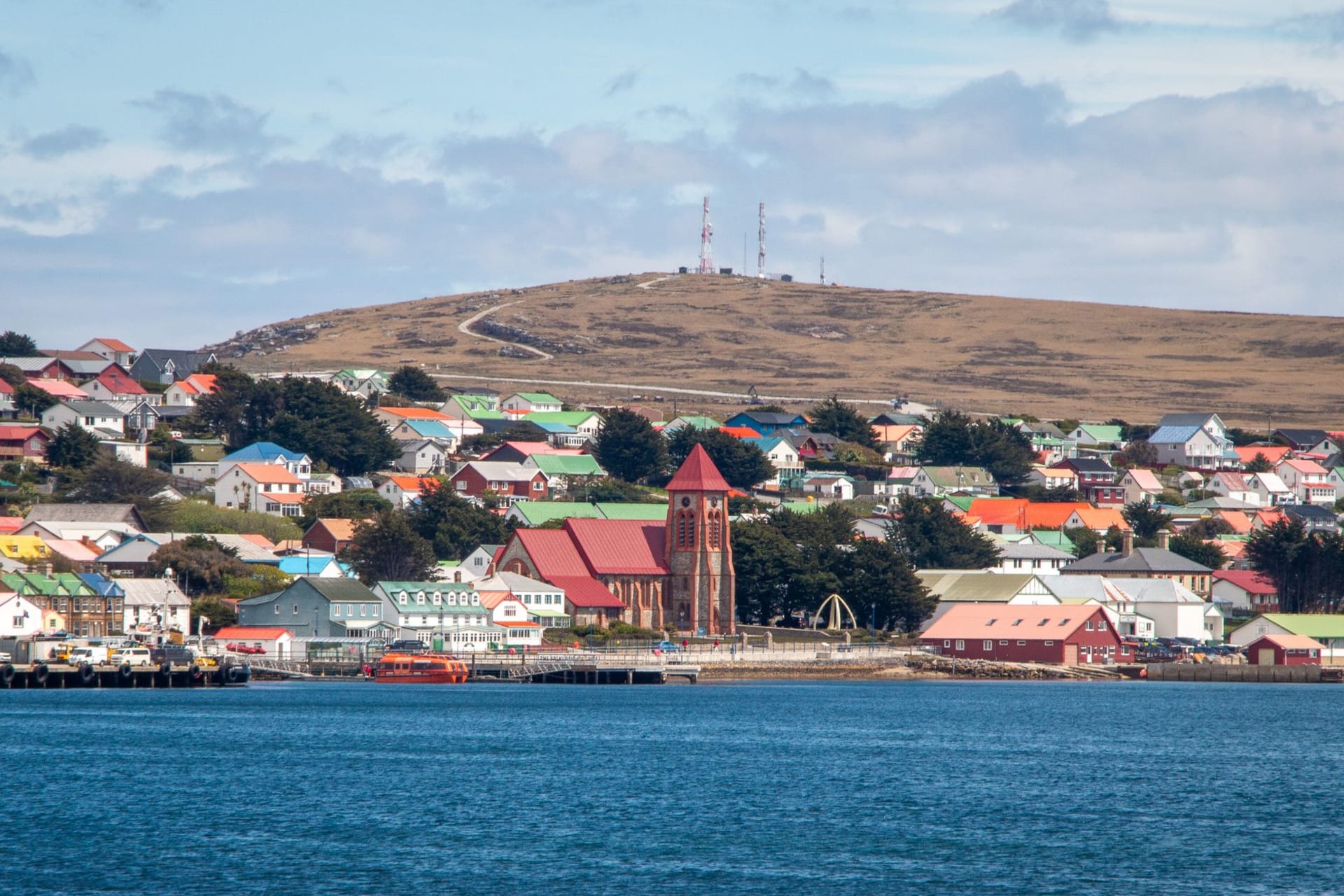
From the summit, the view is the Falklands in miniature: Stanley Harbour laid out below, its coloured rooftops and the Whalebone Arch visible on a clear day, the Sound beyond it running west into the open ocean. The ridgeline of Mount Tumbledown and Two Sisters extends to the west, both of them also 1982 battle sites, and in the middle distance the empty brown interior of East Falkland stretches to the horizon with no visible boundary. Sheep move across the lower slopes with the complete indifference to history that I find both irritating and correct.
I ate my lunch on the summit sitting out of the worst of the wind behind a rock and looking south, where the ocean took over in a way that made clear this was not a temporary interruption but the actual edge. The tea from my flask was the best thing I had tasted in three days, which is what wind does to your relationship with hot liquid.

The descent via the eastern face brings you down through more stone runs and eventually back to the road and the outskirts of Stanley, where the wind hits differently now that you have spent a day above it. I arrived back at my accommodation in the late afternoon, boots heavy with mud, and felt something I associate specifically with days walked rather than driven: the particular satisfaction of having covered ground on your own terms.
When to go: The walk is possible year-round but the summit is exposed and conditions change fast. October through March offers the longest days and most stable weather, though wind is constant regardless. Allow four to five hours round trip from Stanley’s edge.