
Cross-Island Track
"The ridge at the top looks both ways at once. Everything you can see is water."
The entrance to the cross-island track is a gap in a fence at the end of a residential road in Avarua, marked by a hand-painted sign that looked like it had been there since at least the nineties. I set out just after seven with a local guide named Tino, who had worn the same bush boots for what appeared to be a decade of this same route and who greeted every section of the jungle with the comfortable familiarity of someone returning to their own garden. Within five minutes of leaving the road, Rarotonga’s population of hotels and rental scooters and slightly sunburnt tourists ceased to exist. The jungle absorbed everything except the sound of water moving somewhere downhill, and the calls of birds I could not identify, and the steady, rhythmic squelch of mud under boots.
The track climbs without apology. The roots that cross the path serve as stairs for the first section; higher up, where the angle steepens and the roots run out, you use your hands on rock and pull yourself up through gaps in the fern. The humidity sits somewhere between the air and the soil — you stop distinguishing between sweat and moisture absorbed from the leaves you brush against. Tino told me, at one point, about the native birds that still nest in this interior, species found nowhere else on Earth, protected partly by the simple fact that the terrain is uncomfortable enough to discourage most people from coming in. That seems like a reasonable conservation strategy. The wild orange trees that colonised parts of the mid-slope smell extraordinary when you push through them; I picked one and ate it standing in the path, juice running down my chin, and it tasted like something citrus distilled to its essence.
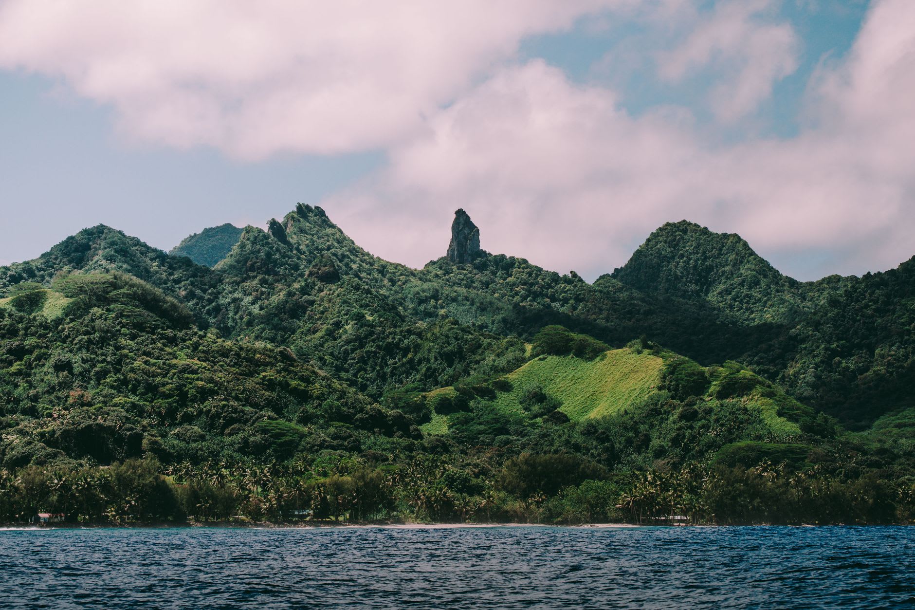
The summit ridge arrives without announcement — you push through a last section of low scrub and suddenly the whole island is below you on both sides. To the north, Avarua and its harbour, and beyond the reef the Pacific goes dark blue to the horizon. To the south, the lagoon on the opposite coast, mint and turquoise in the morning light, and the white thread of the perimeter road. The needle spire of Te Rua Manga rises from the ridge nearby, a sheer basalt column that Polynesian legends attach to a story I have heard several versions of and which Tino told me straight, without embellishment, as we ate our sandwiches. I sat up there for an hour. No signal, no other hikers, no sound except wind and the distant reef. I have no idea what I was thinking about. That is probably the correct outcome.
When to go: The dry season, April through October, gives the firmest ground underfoot, though the track is muddy in sections regardless of season — go with boots that have already been sacrificed to a similar cause. The hike takes two to three hours return, depending on pace. Starting early avoids both the midday heat in the exposed upper section and the afternoon rain showers that come in most days.