Chapman's Peak
"Chapman's Peak is the kind of road that makes you forget you were going somewhere."
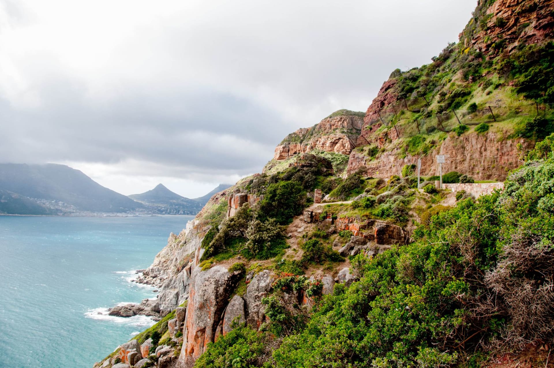
I’ve driven Chapman’s Peak Drive in both directions three times now, and it is one of the very few roads I would drive again purely as an experience rather than a means of getting anywhere. It winds along the western face of Chapman’s Peak — a vertical wall of Peninsula Granite and Graafwater Formation sandstone, visible as banded layers of cream and brown in the cliff face — for nine kilometers above Hout Bay, with the Atlantic several hundred meters below. The road was blasted into the cliff face by convict labor between 1915 and 1922. That took seven years. Looking at what they made, seven years seems reasonable.
I stopped at every viewpoint. There are several built into the road — wide bays carved into the cliff where you can pull over and look north to the Twelve Apostles range or south to the open ocean. At one of them, a Cape sugarbird was working through a protea bush at eye level with the road, and I stood watching it for ten minutes while the traffic trickled past and the shadow of the mountain moved across the water below. Chapman’s Peak keeps doing this — it keeps handing you things you weren’t ready for.

The road was closed for years after rockfall damage and only reopened as a toll road with extensive rock netting and engineering. The toll is modest. The concrete shielding cut directly into the mountain — visible in the tunnels and overhangs — is impressive in a functional way, all purpose and no decoration. The road hugs the contour tightly enough that in places the cliff overhangs the lane, and you drive briefly in shadow before the view opens again and the full curve of Hout Bay spreads out below with the harbor trawlers small as toys.

From the summit area — the highest point, where there’s a viewpoint looking south to Noordhoek — the view in both directions is disorienting in the best possible way. North is Hout Bay harbor, the mountain closing in behind. South is Noordhoek Beach, a five-kilometer sweep of white sand that looks uninhabited from up here, barely a mark on it. Between the two views, you stand on a ledge of billion-year-old granite and feel very temporarily placed.
The hike up Chapman’s Peak itself — away from the road, up the actual summit on foot — is not heavily trafficked and not particularly difficult, a few hours return, with views that extend on clear days to Robben Island and the Cape Flats. I’ve done it once, at sunrise, the Peninsula spread beneath me in the early light. That image has stayed.
When to go: The drive is spectacular in all weather, but still, clear summer days give the sharpest colors — the blue of the sea, the cream of the granite, the green of the fynbos against the pale sky. Sunset from the westward-facing viewpoints is reliably extraordinary. The road sometimes closes in high winds or heavy rain; check conditions before planning a day around it. Cyclists use the road on weekend mornings — start before 7am to have the curves mostly to yourself.