
Columbia Icefield
"The marker showing where the glacier reached in 1992 is further from the ice than you would believe possible."
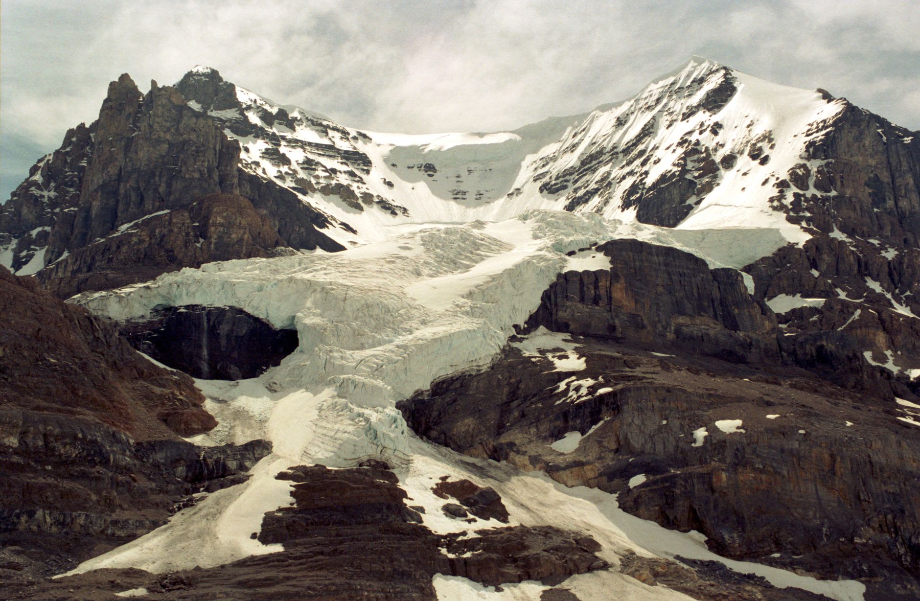
The Columbia Icefield sits at the boundary between Alberta and British Columbia, straddling the continental divide at an elevation where the accumulated snowfall of centuries has compressed into a mass of ice eight hundred meters deep in places. It is the largest icefield in the Rocky Mountains, and from a viewpoint on the Icefields Parkway it reveals itself gradually — first as a white cap on the horizon that you mistake for cloud, then as something too still to be cloud, and finally as the actual thing: an ancient plate of ice that feeds eight glaciers, whose meltwater drains into three different oceans.
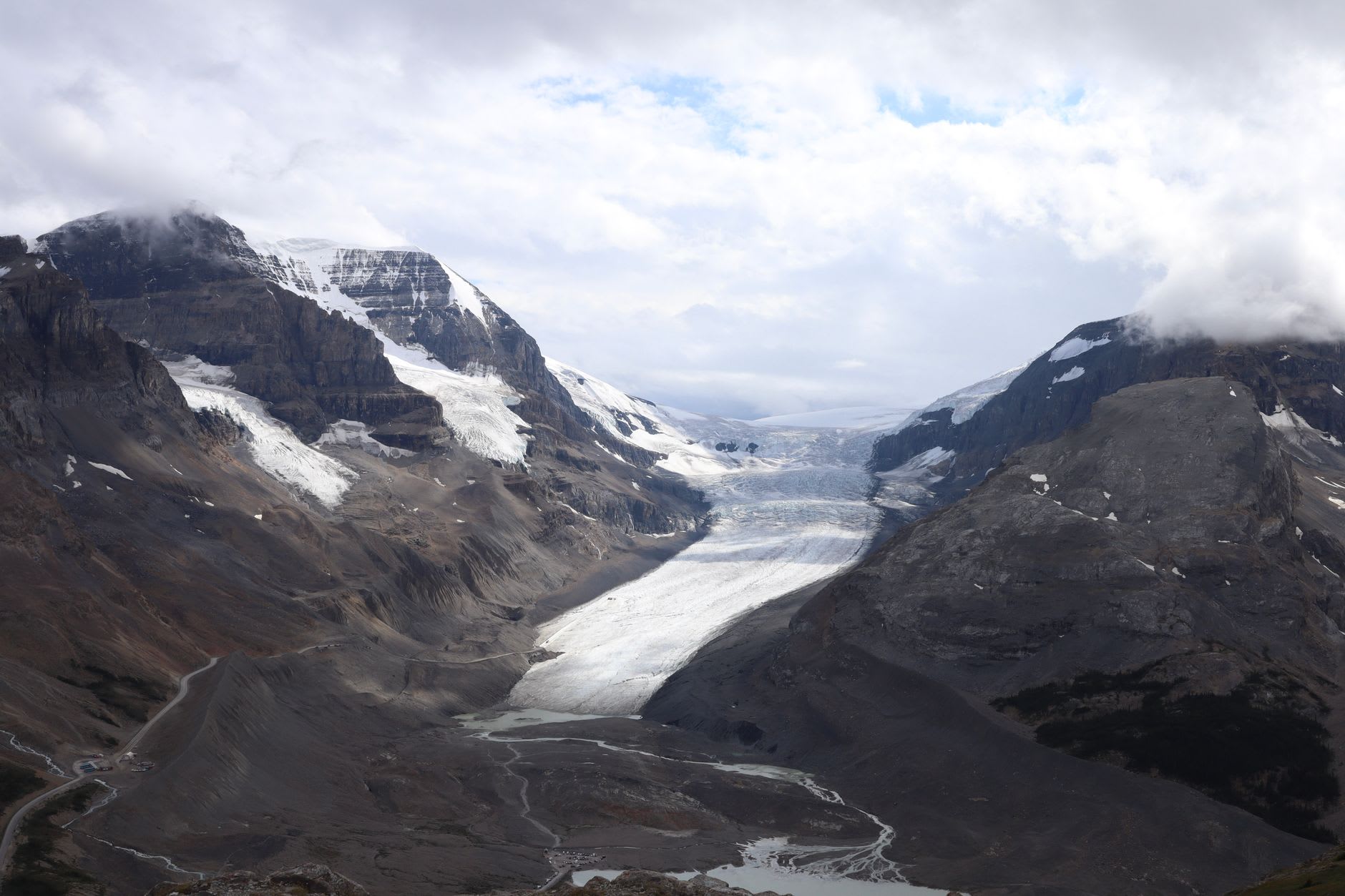
The Athabasca Glacier is the tongue of the icefield that comes closest to the road, and it is the one most people walk on. You can access it via the Glacier Adventure buses — enormous modified vehicles that drive directly onto the ice — or, for those who prefer to earn their chill, by hiking from the parking lot to the glacier’s terminus and signing the waiver that acknowledges you understand crevasses exist and have consequences. I walked the free approach trail on my own and reached the ice at the terminus where the glacier meets the meltwater lake it is currently creating as it retreats. The ice at the edge is a blue-grey so dense it looks carved from something other than frozen water. I put my hand on it. It was cold in a way that hand cream and hot drinks won’t fix.
What struck me more than the glacier itself were the stakes: metal markers at regular intervals along the approach trail, each one showing the position of the glacier’s edge in a given year. 1992. 1998. 2003. 2009. The gaps between them grow. Since formal measurements began, the Athabasca has retreated more than a kilometre and lost half its volume. The 2009 marker is far from the 2003 marker. The 2003 marker is far from the 1992 marker. I stood at the 2024 edge of the ice and looked back down the valley at the parade of stakes and felt something that wasn’t quite grief but was in the same neighbourhood.
The Skywalk, a glass-floored walkway cantilevered over a cliff edge above the valley, offers a perspective on the whole system from above. I have mixed feelings about it as a construction — it is genuinely audacious engineering — but the view is real: the valley floor below, the glacier above, the Icefields Parkway as a grey thread through it all. It costs extra and takes twenty minutes and is not the reason to come here. The reason to come here is the ice, the cold, the stakes, and the long uncomfortable understanding of how much has already gone.
When to go: June through September for full access to the glacier approach and Skywalk. July and August are the peak visitor months — the buses run constantly and the parking lot is chaotic by mid-morning. Go early or come in September for a more contemplative experience. The Glacier Adventure buses run on reservation; book in advance in summer.