The Lost Coast
"The highway stopped here because the mountains told it to. That refusal is the whole point."
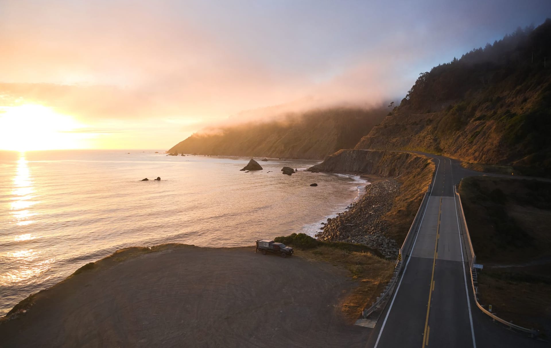
I read about the Lost Coast in the margin of a California road atlas — a small note that said the coastal highway diverted inland here because the King Range was too steep to build on. I drove up to Shelter Cove from Garberville on a Tuesday in late October, two hours on a two-lane road that climbed into the mountains and then dropped steeply toward the Pacific, and the last twenty minutes I was watching the ocean appear and disappear between the ridges and thinking: why does no one talk about this. Shelter Cove is a small community perched on a marine terrace above black sand, reached by that single road, with a sense of remove that genuine wilderness creates. I was the only person checking into the inn. The person who checked me in told me I was about three weeks late for the good weather and smiled in a way that suggested she said this every year.

The Lost Coast Trail runs twenty-five miles along the beach between Mattole in the north and Black Sands Beach south of Shelter Cove. Most people walk it north to south over three or four days, camping on the beach, carrying enough water for each waterless section, watching the tide tables carefully because some sections are only passable at low water. I walked the southern section as a day hike — ten miles along black sand that is more like gravel, scattered with agates and jasper you can pick up and put down again, the King Range to the east going up four thousand feet in less than two miles. The surf was heavy that day. The noise of it fills everything.
There are no towns on this coastline. No cafes, no services, no cell signal. The King Range National Conservation Area, which covers the headlands inland, has black bear and Roosevelt elk and mountain lion, and the trail register at the trailhead lists three bear encounters in the previous two weeks. I saw elk on the beach — a group of five bulls with their antlers still on, walking north along the surf line in the late afternoon, entirely unbothered by my presence. They moved with an unhurried dignity that made the beach feel like it was theirs first, which it was.

The black sand itself is the tactile signature of this coast. It is not sand in the usual sense but ground-up greywacke and shale and volcanic rock — heavy, dark, magnetic in places, cool even in the sun. It squeaks differently under your boots than coastal sand does. The agates in it come in jasper red and honey amber and milky white, tumbled smooth by the same surf you can hear crashing twenty metres to your left. I filled my jacket pocket with stones I had no intention of keeping, then put them back where I found them, then picked up three more at the trailhead parking lot and kept those instead.
When to go: May through October for the trail. June through August is peak season — the beaches are accessible, the weather reliable, the wildflowers on the slopes. September and October are ideal: fewer people, clear skies, the elk beginning to bugle in the uplands. Winter brings rough surf, heavy rain, and the occasional impassable section; beautiful but requiring experience and commitment. Always check the tide tables before the beach sections regardless of season.