Lake Qaraoun
"The lake looks ancient. It is not — the dam went in during the 1960s — but the water has already decided it belongs here."
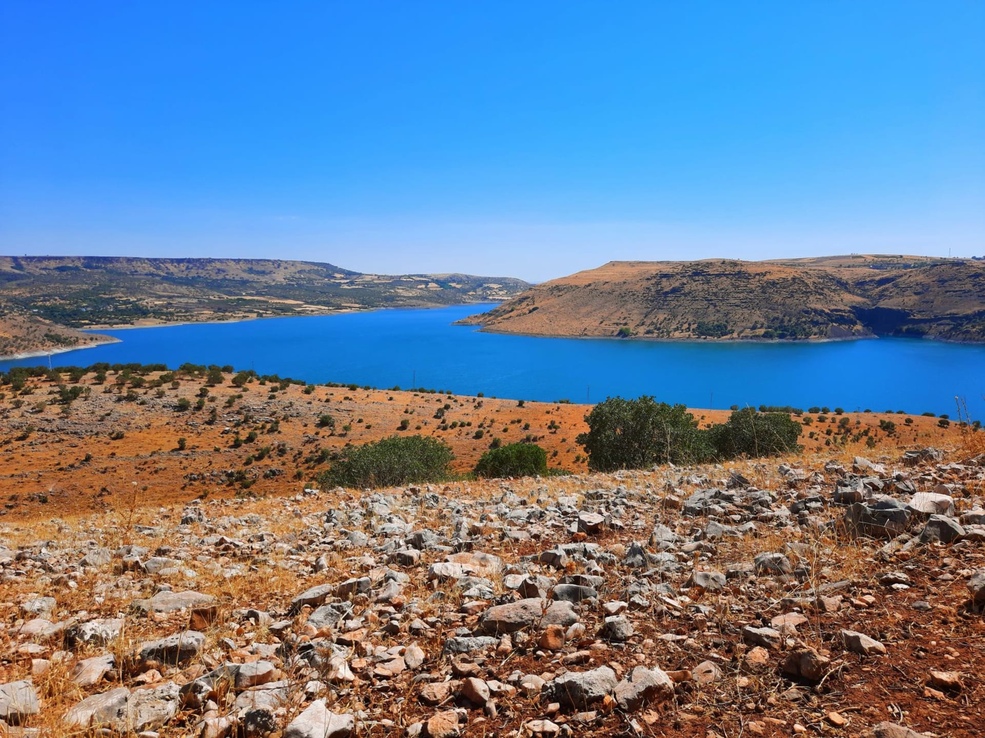
The road south from Zahle runs through the middle of the valley, past onion fields and apple orchards and the occasional roadside stand selling produce, and gradually the valley narrows, the mountains closing in on both sides, until the road crests a small rise and the lake appears below without warning — a wide blue mirror set into a fold of the land, its surface so still on the morning I arrived that every ridge reflected perfectly in it, doubled and inverted.
Lake Qaraoun is artificial, created in 1965 when the Qaraoun Dam was built across the Litani River. It is Lebanon’s largest lake by area — roughly twenty-seven square kilometers — sitting at nine hundred meters altitude in the southern Bekaa. The dam generates electricity and feeds the irrigation network that sustains much of the valley’s agriculture; it is, in its functional way, the infrastructure that makes the Bekaa what it is. The lake that formed above it has taken on its own logic since then, acquiring fishing communities, small boat operations, and a quality of silence that feels earned.

I spent a morning on the western shore, where a small village had set up plastic tables at the water’s edge and a man was grilling fresh fish from the lake over charcoal — mostly carp and trout, served whole with lemon and fresh herbs and bread. He did not ask if I was hungry. He put the plate in front of me and went back to tending the coals. The fish had the clean mineral taste of cold mountain water. I ate it slowly, watching a pair of coots cross the lake surface in a straight line that barely disturbed the reflection. The Anti-Lebanon range on the Syrian side of the border was still white with snow in April.
The drive around the lake rewards patience. Villages cling to the slopes above the waterline, places with names that appear on no tourist map and no Instagram feed — Yohmor, Saghbine, Lala — where the population is almost entirely Shia and the rhythms of daily life run on agriculture and fishing and a pace that has more to do with the seasons than with the news cycle. There is a castle above the lake, Aarjess Castle, which requires a rough road and some will to reach, but offers a panorama of the whole southern Bekaa from its broken battlements.
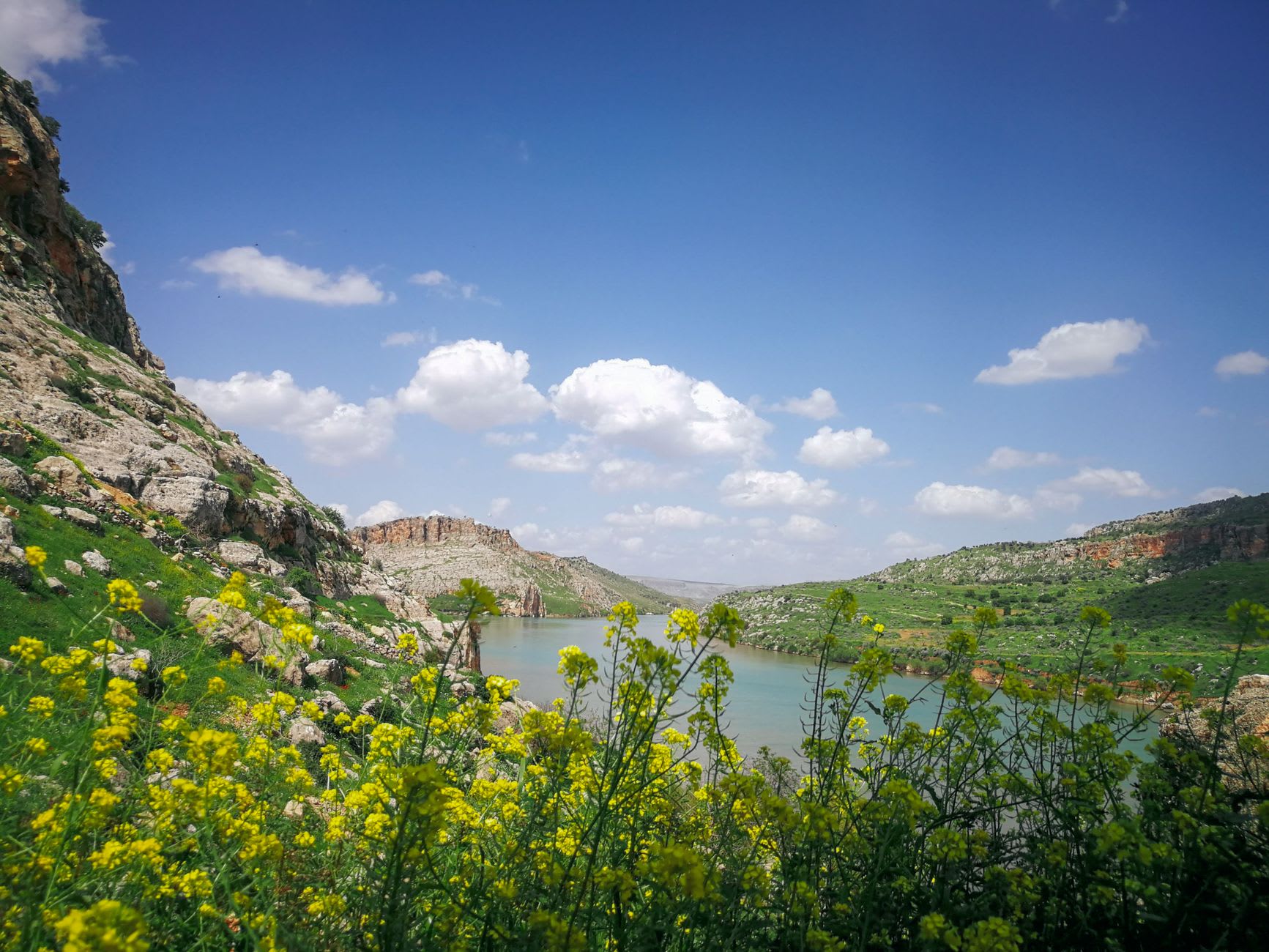
What the lake gives you is a Bekaa that has nothing to do with temple complexes or wine routes: a quieter, wilder version of the valley, where the horizon is water instead of columns and the only schedule is the morning fish market and the afternoon light on the mountains.
When to go: Spring and autumn are best for the lake — the water is calm, the light is horizontal in the evenings, and the surrounding hills are green or golden respectively. Summer brings some visitors from Beirut but the southern Bekaa remains far less crowded than the north. The lake is at its most dramatic in late winter/early spring when the surrounding mountains carry snow down to relatively low altitudes and the contrast with the blue water is striking.