
Mount Erciyes
"Skiing in Anatolia feels like something a dream invented and then forgot to explain."
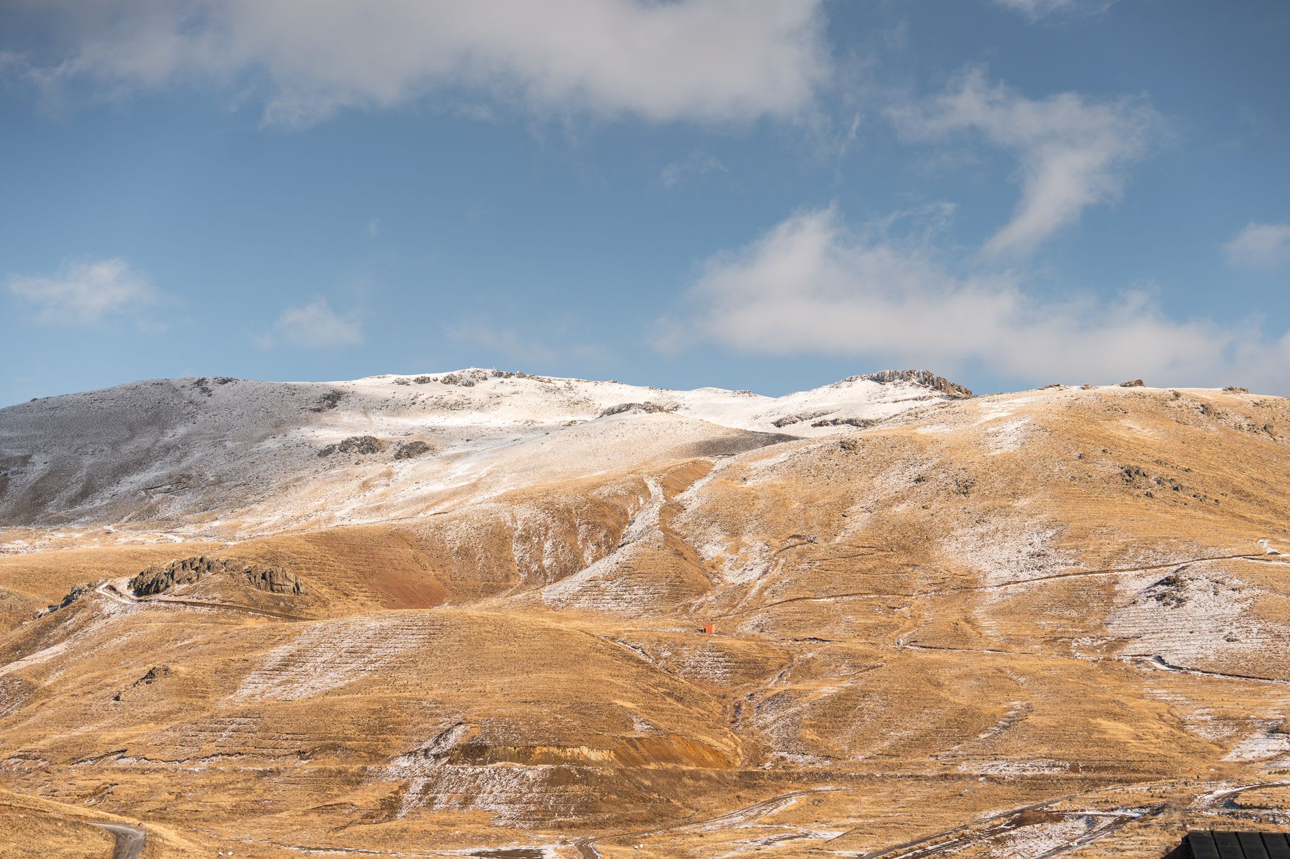
I took the gondola from the base station at 2,100 metres in early March, when Kayseri below was cold and grey and the mountain above was fully white. The gondola climbs steeply, and by the time it deposited me at the mid-station the city had become a low smudge on the plateau and the air had a different quality — thinner, crisper, carrying a faint smell of cold rock and old snow. Mount Erciyes rises to 3,916 metres, making it the highest peak in central Anatolia, and it is a stratovolcano — a proper one, with the symmetrical cone profile that tells you immediately it has erupted seriously in the past, though the last significant activity was around ten thousand years ago. The mountain sits alone on the plateau, which means the views in every direction are unobstructed: Kayseri to the north, flat steppe to south and west, the long grey line of the Taurus Mountains on the horizon.
The ski resort, which has been substantially upgraded since 2011, is Turkey’s largest in terms of vertical drop — around 1,200 metres from the top station to the base. On a powder day in February or March, the upper runs hold dry, light snow with a quality I hadn’t expected this far south. The slopes are not particularly crowded by European standards, even on weekends, and the clientele is overwhelmingly Turkish — families from Kayseri and Ankara mostly, teenagers on snowboards, groups of middle-aged men skiing in formation with the collective focus of people on a business trip. I felt the same pleasurable foreignness here as I feel skiing in Mexico: the recognition that a sport I associate with the Alps operates on its own logic when the language changes.
In summer, Erciyes transforms. The ski infrastructure switches off and the mountain opens for hiking, and this is when I think it becomes most itself. The trails above the treeline are technically easy but physically demanding — altitude catches you — and the volcanic geology reads clearly in the landscape: obsidian fragments on the ridgeline, pumice fields, the sudden appearance of crater lakes in hollows that the winter snow had concealed. I hiked to the summit on a July morning, starting at four to catch the sunrise, and the light coming across the plateau below — the flat steppe turning gold in sequence, Tuz Gölü glinting white in the middle distance — is one of those views that earns your four o’clock alarm without question.

The mountain has been sacred for a very long time. The Hittites associated it with their storm god, and the Byzantine name for the peak — Argaeus — appears in ancient texts as a place of prophecy, where the gods could be seen in the eternal snows. I’m not sure I saw any gods, but I did see a pair of golden eagles riding the thermals above the southern face in the late afternoon, circling in a slow, patient gyre that seemed to have nothing to do with anything below them. Erciyes does that — returns you to scale.
When to go: December through March for skiing; February and March offer the most reliable powder. Late June through September for hiking — the summit trail is clear of snow by July. Avoid the ski season in January if crowds matter; school holidays pack the mountain with day-trippers from Kayseri.