Chuya Highway
"I've driven mountain roads on four continents. The Chuya Highway made all of them feel like rehearsals."
The Chuya Highway begins modestly. Out of Gorno-Altaysk heading south, it follows the Katun River through populated valley country — small villages, dachas, roadside cafes selling pirozhki and honey from local hives. For the first hour it is scenic without being overwhelming, the mountains present but politely sized. Then the valley narrows, the river picks up speed, the road lifts away from the water on a series of switchbacks, and something shifts.
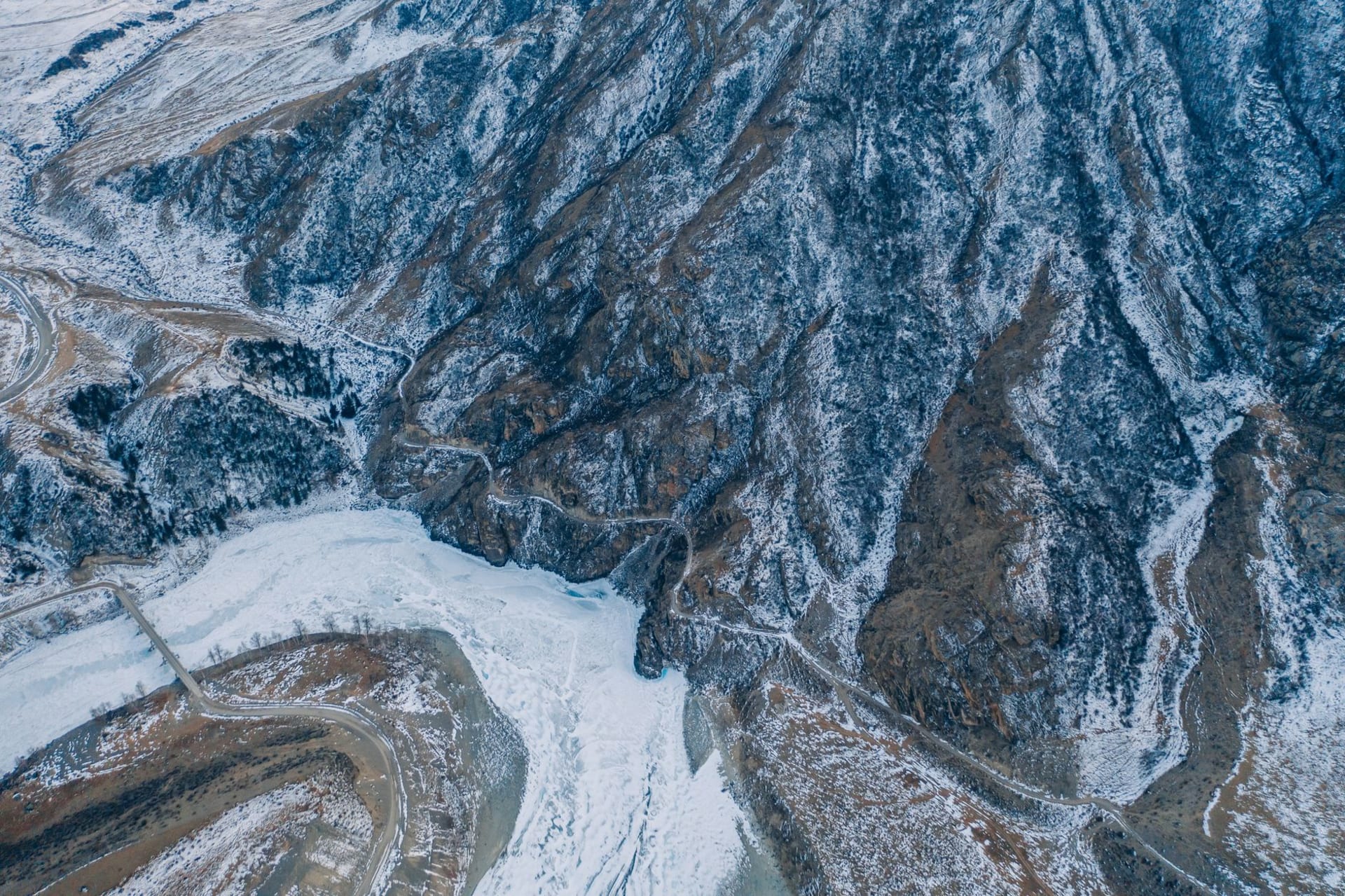
The shift is not gradual. It is sudden and categorical. Around the 300-kilometre mark, after passing through the Seminsky and Chike-Taman passes, the landscape transforms from alpine Siberia into something that has no single reference point — part Central Asian steppe, part Patagonian canyon country, part Mongolian plateau. The Chuya River replaces the Katun as your companion, and the Chuya is a different river: smaller, faster, an impossible turquoise where it runs shallow over pale limestone. The canyon walls close in to forty metres on either side in places. At others they open to a panorama of fifty kilometres that has nothing human in it.

I drove the highway in a rented Lada Niva that I was genuinely uncertain could handle the road. It handled it perfectly. The road itself is paved for its entire length, a fact that becomes remarkable when you see what it is paved through — not alongside mountains but between them, around them, occasionally through them. The Russian engineers who built this route in the Soviet era made decisions that feel, from the driver’s seat, less like engineering and more like argument. They argued with the terrain and somehow won, at least provisionally.
The Kuray steppe section, about 80 kilometres from Kosh-Agach, stopped me for two hours. I pulled onto a dirt track beside the road, cut the engine, and sat with the window down looking at a scene that I cannot fully describe and will not try to simplify. The North Chuysky Range rose in a wall to the east, still carrying its summer snowpack, white above the treeline and then orange-brown rock below, then the bronze-green of the steppe itself, and then the road, a single thin line across the middle of it all, and then more steppe on the other side. A lone horse stood in the middle distance doing nothing in particular. No cars passed for twenty minutes.

The petroglyphs at Bichiktu-Bom are a stop most drivers miss because they are not signposted in any language except Russian, and the sign is small. Pull over at the canyon walls about 40 kilometres south of Aktash, look at the dark rock face on the western side of the road, and you will find images of deer, ibex, hunters on horseback, and geometric shapes that scholars have dated to between 3,000 and 1,000 BCE. Someone stood in this exact canyon several thousand years ago and made marks on the rock. The marks are still there. The canyon is still there. The Lada is a newer development.
When to go: The highway is drivable from May through October. June to September is optimal. Winter driving requires serious experience and the right vehicle — sections above 2,000 metres ice unpredictably. For the Kuray steppe views, clear mornings in July and August are ideal.