Wrangell-St. Elias
"Thirteen million acres and two unpaved roads — Wrangell-St. Elias makes Denali feel approachable."
The road into Kennecott is sixty kilometres of washboard gravel that the rental car company specifically mentioned when I returned the vehicle, but I don’t regret a single pothole. It follows the Chitina River and then the Kennecott River into a valley surrounded by peaks that belong to four separate mountain ranges simultaneously — Wrangell, St. Elias, Alaska, and Chugach — and the four-hour drive is a gradual removal from the world as it normally operates, the pavement getting thinner and the mountains getting larger and the radio stations fading one by one until there is only the road and the rock and the occasional bear on a gravel bar below. I arrived in the late afternoon, when the light was hitting the Kennecott mine buildings — red and white and rusting, tall above the glacier — and I understood immediately why people make this drive.

Kennecott was one of the richest copper mines in the world, operating from 1903 to 1938 and extracting a quantity of copper that helped electrify America. When the ore ran out, the company closed overnight — literally overnight, workers told to leave their tools where they lay — and the buildings have been sitting in the mountain air ever since, slowly returning to the landscape. The National Park Service has stabilized some of them and offers guided tours of the mill building, a fourteen-story structure of timber and corrugated iron where you can see the processing equipment still in place, dusted with copper-green mineral residue. I went up through the levels in the company of a ranger who talked about mining history with the specificity of someone who’d thought about it for years, and I came out at the top with a view over the Root Glacier that was unreasonably beautiful.
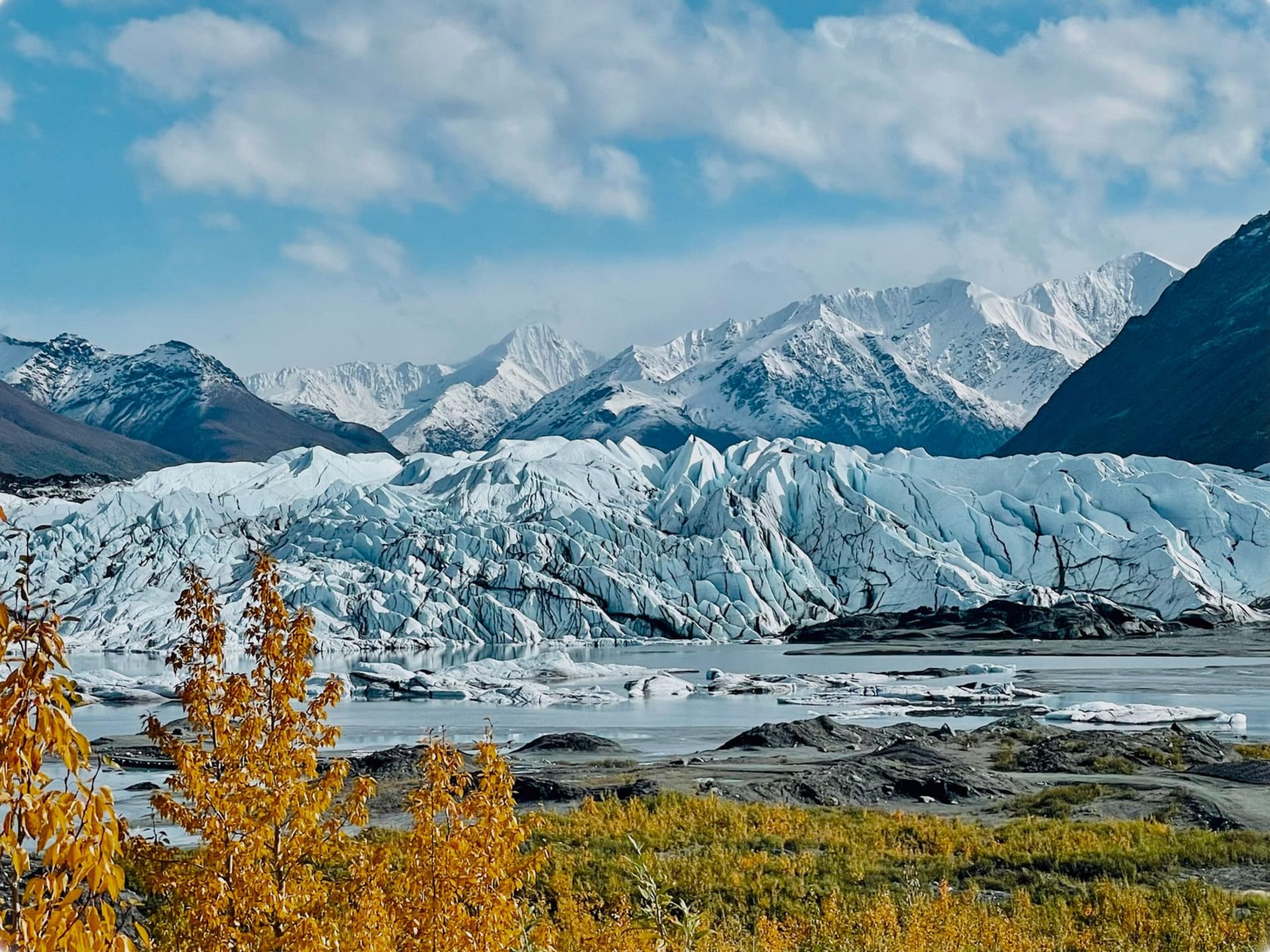
The glacier itself is right there, walkable from the town of McCarthy a few kilometres down the valley. I hiked onto it with crampons and an ice axe rented from one of the small outfitters in McCarthy — a town of maybe fifty year-round residents, one bar, one restaurant, and a particular frontier quality I found immediately comfortable — and spent four hours on the ice, crossing crevasses on plank bridges left by the guides, listening to the meltwater moving beneath. The scale of the Bagley Icefield above, feeding this glacier and dozens of others, is difficult to hold in mind.

McCarthy, the small town at the end of the road before the bridge to Kennecott, has a quality I associate with places that have been places long enough to stop pretending. There’s a bar that serves beer and sandwiches and has been there in various forms since the mining era. The people who run the small lodges and outfitters have chosen to be here deliberately, and that choosing is something you feel when you talk to them — a combination of capability and preference that’s hard to fake. I ate dinner there, some kind of stew that involved local game, at a table with a couple who’d hiked in from a remote backcountry camp, and we talked for two hours about routes and bears and the particular quality of silence in a place where the nearest road is sixty kilometres of gravel.
When to go: The Edgerton Highway and McCarthy Road are accessible from late May through mid-October, with June through August offering the most reliable conditions. Backcountry travel — the park has no trails and no infrastructure beyond McCarthy and Kennecott — requires experience, proper equipment, and careful planning. Fly-in remote camping is available for those willing to pay for the access it provides.