
Upper Zambezi & Barotseland
"The river here is not dramatic. It is wide and slow and immense, and that's something different."
The slow, wide stretch of the Zambezi above Victoria Falls, where Lozi kings still hold court and dugout canoes cross floodplains that turn to inland sea each year.

Most people who visit the Zambezi experience it at its most theatrical — the gorges at Victoria Falls, the rapids downstream, the dam at Kariba. The Upper Zambezi, above the falls, is the river in a different register: broad, braided, moving at the pace of thought. In the western province of Zambia, the Barotse floodplain spreads from its banks every year as the waters rise, transforming an already vast landscape into an inland sea hundreds of kilometers wide.
I came up here to understand what the river looked like before it fell.
The Kuomboka Ceremony
Each year, when the floods peak and the king’s capital on the floodplain becomes untenable, the Lozi paramount chief — the Litunga — makes the ceremonial journey from his lowland palace at Lealui to his highground palace at Limulunga. This is the Kuomboka, one of the oldest and most significant royal ceremonies in southern Africa: a procession of royal barges, paddled by hundreds of men in ceremonial dress, the Litunga seated under a black and white striped canopy on the royal barge Nalikwanda.
The date shifts with the floods and is announced by the palace; typically March or April. I attended on a year when the floods were substantial and the procession covered fifteen kilometers of open water, the singing from the paddlers carrying across the floodplain in a way that made the distance irrelevant. The crowds on the high-ground bank were large and dressed for ceremony, and the day had a gravity to it that I was glad to have witnessed from enough distance to observe rather than participate in.
Mokoro Canoes and the Flood Season
During the high-water months, local fishermen and guides will take you out on the floodplain by mokoro — the traditional dugout canoe, poled or paddled depending on water depth. The floodplain at high water is a temporary ecosystem: fish that spend the dry season in the river channel disperse into the grass, kingfishers work the shallow water at astonishing speeds, and the visual horizon is simply water in every direction with the tree canopy of submerged villages just visible above the surface.
Senanga and Mongu are the main towns of the western province and neither is set up for tourism in any significant way. This is part of the appeal. Accommodation is basic; the food is what’s available; the conversations with local fishermen and traders are unmediated by any hospitality industry. I ate nshima with dried bream most evenings at a roadside spot in Senanga and it was exactly right.
The Dry Season Floodplain
When the waters drop, the floodplain emerges as a perfectly flat grassland stretching to a horizon that seems geometrically impossible. The light here does things I haven’t seen elsewhere: the flatness means the sky is enormous and the sunsets come in layers, pink above green above grey, the whole sequence reflected in the remaining pools across the grass.
Lia found this landscape initially unsettling — no reference points, no hills, no tree line to anchor your sense of scale — and then found it the most calming place she’d been in years. Both responses seem valid.
When to go: February to April for high flood and the Kuomboka ceremony, if timing can be arranged with the palace’s announcement. May to June for receding waters and the transition landscape. July to October for dry season access and wildlife on the emerging grasslands. The Kuomboka date is unpredictable — follow the Lozi royal establishment’s announcements.
Keep exploring
More from Zambia
 zambia
Bangweulu Wetlands
A vast, half-flooded wilderness in northern Zambia where the shoebill stork exists like a prehistoric rumor made flesh, watching you from the papyrus.
Explore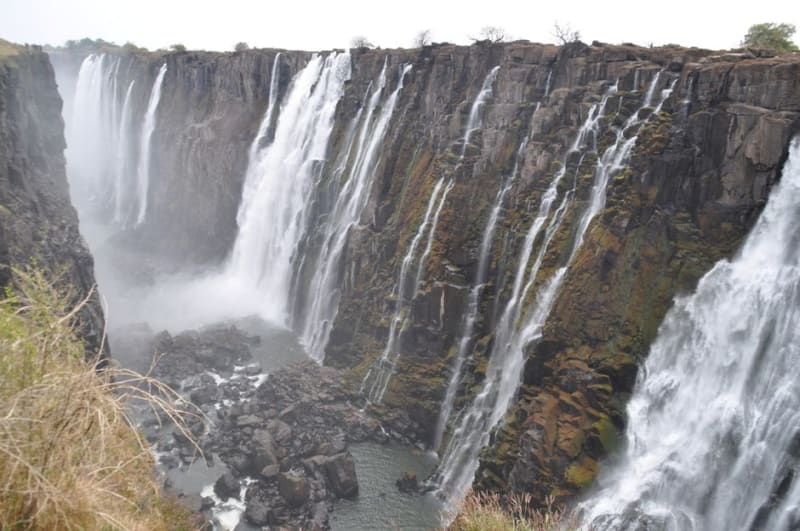 zambia
Chishimba Falls
A three-tiered waterfall dropping through Northern Province forest on the Luongo River, reached by a short walk and shared mostly with local picnickers.
Explore zambia
Kafue National Park
Zambia's largest and most remote park — a wilderness the size of Wales where you can drive for hours and see no other vehicle.
Explore zambia
Kalambo Falls
One of Africa's tallest single-drop waterfalls, plunging off the edge of the Rift Valley near Lake Tanganyika beside an archaeological site that rewrote how long humans have lived here.
Explore zambia
Kasanka National Park
A small, little-visited park with one of the most extraordinary natural spectacles on earth: ten million fruit bats arriving each November like a living storm.
Explore zambia
Lake Kariba
A vast man-made lake where dead trees still stand in the water sixty years after the valley flooded, and houseboats drift between elephant-covered shores.
Explore