Gran Sabana
"The rock here is older than life. You feel it in your feet when you walk across it."
The Gran Sabana is one of those landscapes that resists the vocabulary of travel writing. “Dramatic” is insufficient. “Ancient” is accurate but unhelpful — the Precambrian quartzite that forms the tepuis here is literally among the oldest exposed rock on Earth, somewhere north of 1.7 billion years. Standing on it, the number means nothing, but the texture does: pitted and dark and rough underfoot, stained red by iron, crossed by thin streams that have been running the same paths for longer than the concept of a path exists.
The region occupies the far southeastern corner of Venezuela, pushing against the borders of Brazil and Guyana. The highway south from Ciudad Bolívar runs through the Parque Nacional Canaima before entering the open savanna — the Gran Sabana proper — and what happens to the landscape over those hours of driving is one of the more gradual revelations I’ve experienced from a car window.
The Tepuis
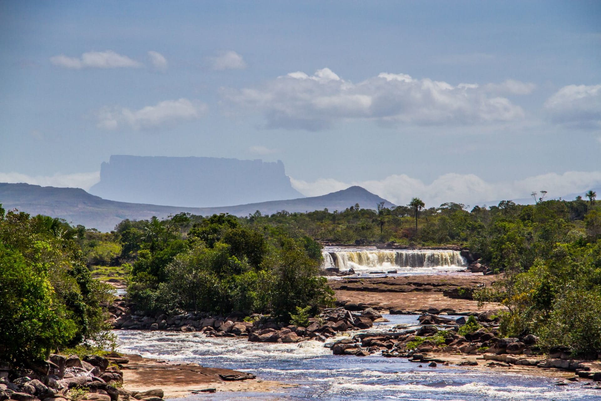
The tepuis are the defining feature: flat-topped sandstone mesas that rise abruptly from the savanna floor, their vertical walls streaked with moss and water, their summits hosting ecosystems that evolved in isolation for millions of years. Roraima is the most famous — the mountain that inspired Conan Doyle’s Lost World — a massif shared by Venezuela, Guyana, and Brazil, rising to 2810 meters. The trek to its summit takes about five days and is one of the better multi-day hikes in South America.
You don’t need to climb Roraima to understand the tepuis. From the road, their silhouettes are extraordinary — Kukenán rising alongside Roraima, its walls equally sheer. In the early morning, when low cloud wraps around their bases and the summits are clear, they appear to float. The Pemón people, who have lived in this region for centuries, regard certain tepuis as sacred, and standing at their base it’s easy to understand why.
Waterfalls of the Plateau
The Gran Sabana is waterfall country. Rivers run constantly across the laterite and quartzite surface and drop repeatedly over the plateau edges. Salto Kama, Salto Yuruaní, Salto Aponwao — these fall in stages into pools and gorges where the water is cold and clear and the color of amber from the tannins. Swimming at the base of Aponwao, with the water crashing into the pool twenty meters above and the mist settling on my arms, was one of those physical experiences that the body remembers longer than the brain does.
Pemón Communities
The indigenous Pemón maintain communities along the main highway — Santa Elena de Uairén is the main town and border crossing — and run many of the lodges and tours in the area. The quality of their knowledge of the land is not abstract: they know which plants do what, which streams are safe to drink from, which clouds signal rain in the next two hours. I spent two days with a Pemón guide named Carlos whose grandfather had walked the Roraima trail before there was a trail, and whose stories about the plateau’s seasons made the landscape more specific and stranger in equal measure.
When to go: The dry season (December to April) offers the clearest skies and best visibility for photography, but waterfalls run lower. The wet season (May to November) swells every waterfall dramatically and turns the savanna vivid green — the trade-off is muddier roads and some trail closures. The Roraima trek is possible year-round but is most comfortable in January through March. Nights at altitude are cold regardless of season; bring layers.