Taganay National Park
"The stone river doesn't flow. It just lies there reminding you how patient geology is."
Taganay sits twelve kilometers from the industrial city of Zlatoust, which makes it one of the stranger adjacencies in Russian geography. You walk out of a metallurgy town with its Soviet-era smokestacks and factory murals, and within two hours you’re standing in a landscape that looks like it hasn’t been touched since the Pleistocene. The transition is abrupt enough to feel like a door swinging open.
The Stone River
The Bolshaya Kamennaya Reka — the Great Stone River — is what most people come for, and it earns the attention. It’s a kurumnik, a geological feature formed when the surrounding rock gradually disintegrated and the debris filled a valley over thousands of years. The result is a river of boulders, some as large as small cars, that stretches six kilometers through the forest. You walk on top of it, hopping between rocks, listening to water running somewhere far below through the gaps.
The light in early morning, when mist pools between the stones and the spruce forest closes in on both sides, does something particular to the color of the granite — it goes from grey to almost violet. I sat on a boulder for twenty minutes trying to identify the sound coming up from under my feet. It was water, running in the dark through channels I’d never see.
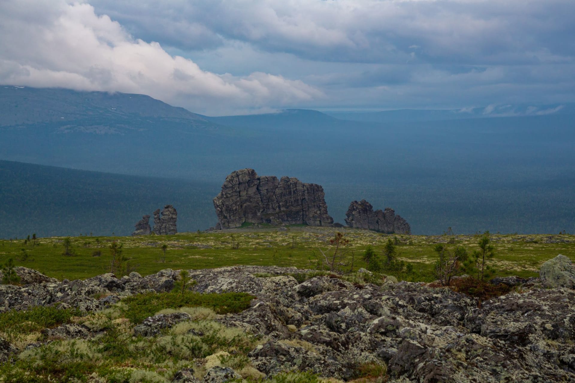
The Ridges
The main ridge of Taganay runs north-south and the highest point, Kruglitsa, tops out at just under 1180 meters. That’s not dramatic elevation by alpine standards, but the Urals are old mountains, ground down by time, and Kruglitsa’s summit is bare quartzite swept clean by wind that has nowhere to slow down. The views open completely: dark forest below, the Zlatoust smokestacks to the south, and to the north the ridge extending ridge after ridge into taiga that eventually reaches the Arctic.
The trail up Kruglitsa is well-marked and requires no technical skill, but the weather changes fast. I started in sunshine and arrived at the summit in horizontal sleet. I had the top to myself for about fifteen minutes before a group of school students from Chelyabinsk appeared out of the cloud, completely unfazed, eating sandwiches in the wind.
The Shelter Huts
Taganay has a network of mountain huts — simple wooden structures with bunks, wood stoves, and park rangers who sell instant noodles and tea. The Meteo hut near the summit ridge was built in the Soviet era as a weather station and is now the most atmospheric place to spend a night in the southern Urals. The walls are thick, the stove ticks through the night, and when the cloud lifts at 5 a.m. the ridge goes pink in a way that makes getting up worth it.
I was the only foreigner there on a Tuesday in September. The rangers were patient with my Russian, which is mostly composed of food words and directional phrases. We got by.
The Forest Below
The lower trails move through mixed taiga — pine, spruce, silver birch in autumn turning a yellow so sharp it looks lacquered. The park protects several rare plant species and the birdlife is what you’d expect from undisturbed boreal forest: nutcrackers, woodpeckers, the occasional owl sound at dusk. It’s quiet in the way that large forests are quiet — not silent, but layered with sounds that cancel out to something close to peace.
When to go: Late August through September for autumn color and manageable crowds. June and July are also excellent for long days and full green. Winter hiking is possible and the stone river under snow is extraordinary, but requires proper gear and experience with cold-weather conditions. Avoid May — snow lingers on the upper ridges and the trails below turn to mud.