Sarek National Park
"Sarek doesn't care if you're ready. That's the whole point of going."
No Trails, No Huts, No Help
Most wilderness areas make some concession to navigation: a waymarked path, a shelter, a staffed station at the entrance. Sarek makes none. There are no marked trails. There are no huts maintained for public use. There is no ranger office inside the park. There is barely a clear entry point. The Swedish government designated it a national park in 1909 and then left it alone, which is perhaps the most radical conservation position of all.
This means that everyone who enters Sarek is navigating by map, compass, and terrain reading. The rivers are unbridged and must be waded or crossed on improvised logs. The valleys are wide and the vegetation is dense in summer — dwarf birch and willow that comes up to your waist and tangles your feet. The weather changes without consultation. You either have the skills for this or you don’t go, and you should be honest with yourself about which category you’re in.
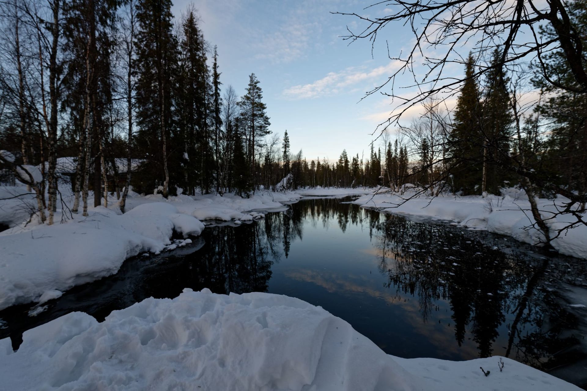
I’m a reasonably competent wilderness hiker, and I entered Sarek from Kvikkjokk to the south, walking the Rapadalen valley. I brought a 1:50,000 topographic map and a compass and I was still humbled by the river crossings.
The Rapadalen Valley
The Rapadalen — the Rapa River valley — is Sarek’s most accessible interior route and also one of the most beautiful river valleys I’ve walked. The Rapa braids across a wide gravel outwash plain, glacier-blue, splitting into channels and rejoining, depositing islands of gravel and scrub willow. The valley walls rise to glaciated peaks on both sides: Skierffe on the east, its cliff face dropping eight hundred meters directly into the river plain, is one of the most dramatic viewpoints in Scandinavia.
I climbed Skierffe in an afternoon. The top is a flat platform of exposed rock, and the view down into the delta below — the river splitting into dozens of channels across the plain — is one of those perspectives that makes you recalibrate scale. The whole valley looks like a satellite image from up there, and you can see it all at once: the braids of water, the grey gravel bars, the green of the willow scrub, the dark forest at the edges.
Wildlife and Solitude
Sarek is one of the last places in Sweden where brown bears exist in meaningful numbers. I saw evidence — tracks in soft ground near a river — but not bears themselves. I also saw wolverine tracks, and a golden eagle hunting above the valley for an hour, methodical and unhurried. Reindeer move through in herds during summer pasture season.
What I found harder to describe was the quality of the solitude. Over four days in the park, I met five other people. The absence of infrastructure means the place is self-selecting — everyone out there has committed to something demanding, and the conversations you have at river crossings or on ridge lines are different from conversations at a staffed hut. Brief, specific, respectful of the other person’s self-sufficiency.
Practical Considerations
Enter from Kvikkjokk (south) or Ritsem (north, via Padjelanta trail). The full Sarek traverse takes five to seven days with significant navigational skills. A lighter option is the two-day walk from Kvikkjokk to the Skierffe viewpoint and back.
When to go: July and August for the best conditions — snow is largely gone from the valleys, river levels are lower than June, and daylight is around-the-clock. Mid-August brings the first hints of autumn color. Avoid June when snowmelt makes rivers dangerous. Winter travel is possible for experienced ski tourers only.