
La Soufrière
"The summit smells like the earth is still deciding whether to stay put."
You start the La Soufrière hike before six in the morning because the cloud moves in by midday and closes off the summit view completely. I was in a minivan out of Kingstown at five-thirty, driving north along the leeward coast as the light turned from black to grey to the particular pink of Caribbean dawn, passing the ruins of villages evacuated in April 2021 when the volcano exploded and sent a column of ash fourteen kilometers into the sky. That eruption — the most significant in the Eastern Caribbean in years — was visible from Barbados, 160 kilometers away. The evidence of it is still everywhere in the north of the island: ash-grey fields, damaged rooftops, a layer of grey sediment that turned the rivers white.
The trailhead starts at the Rabacca Dry River in the northeast, a wide graveled riverbed that carries water only after heavy rain. The first section of trail climbs through remnant banana plantations and secondary growth — the forest here is still recovering from the eruption’s thermal damage — and the sound of the vegetation changes as you gain altitude, becoming denser and more overtly wet, the epiphytes thickening on the branches until the trunks are wearing coats of moss and bromeliad. At around 500 meters the cloud forest proper begins: tree ferns three meters high, heliconia with leaves the size of doors, silence except for the thrum of the wind in the canopy.
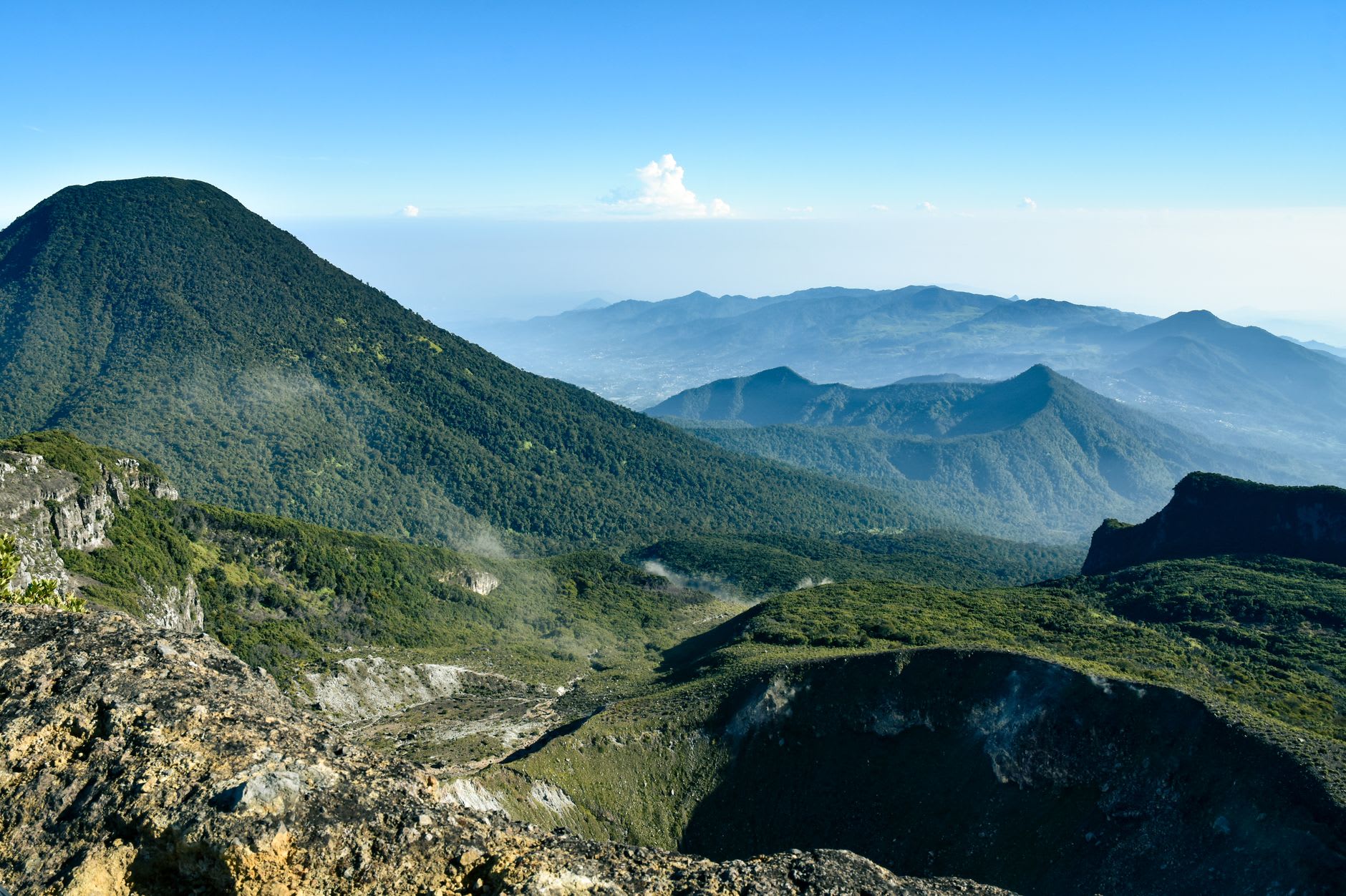
The last four hundred meters is the hard part. The trail steepens onto the volcanic cone itself — loose ash and rock underfoot, the wind arriving unimpeded from the Atlantic — and you’re working too hard to look up. Then you crest the rim and there it is: the crater, roughly a kilometer across, with a new lava dome rising from the floor and plumes of sulphur steam drifting sideways in the wind. The smell is like struck matches mixed with something older and more mineral, something deep in the earth. The guides call it “volcano breath” and that is exactly what it smells like.
The view out from the rim, when the clouds permit, is one of the Caribbean’s great panoramas. Saint Vincent’s entire northern coast drops away to the sea — black-sand beaches, fishing villages, the dark arc of the shoreline. On clear days you can see Bequia to the south and the Grenadines beyond. The wind is cold enough at the summit that you’ll want a layer despite the heat of the climb.
The descent back through the cloud forest has a different quality from the climb — quieter, more attentive to the detail of the vegetation now that you’re not focused entirely on where to place your feet. I came down slowly, stopping to look at tree ferns and to eat oranges I’d bought from a woman at the trailhead. By midday the cloud had closed in completely and the summit was invisible. The timing had been just right.
When to go: January through April, the dry season, gives the best chance of a clear summit view. Start before seven to beat the cloud. Hire a licensed guide — not for safety on the trail but for knowledge; the guides who know the geology and eruption history make the whole experience considerably richer. Check the Seismic Research Centre (UWI) for current volcanic activity status before planning a summit attempt.