
Cânion Fortaleza
"We stood at the edge of nothing for an hour, and then the cloud tore open and there was the whole world."
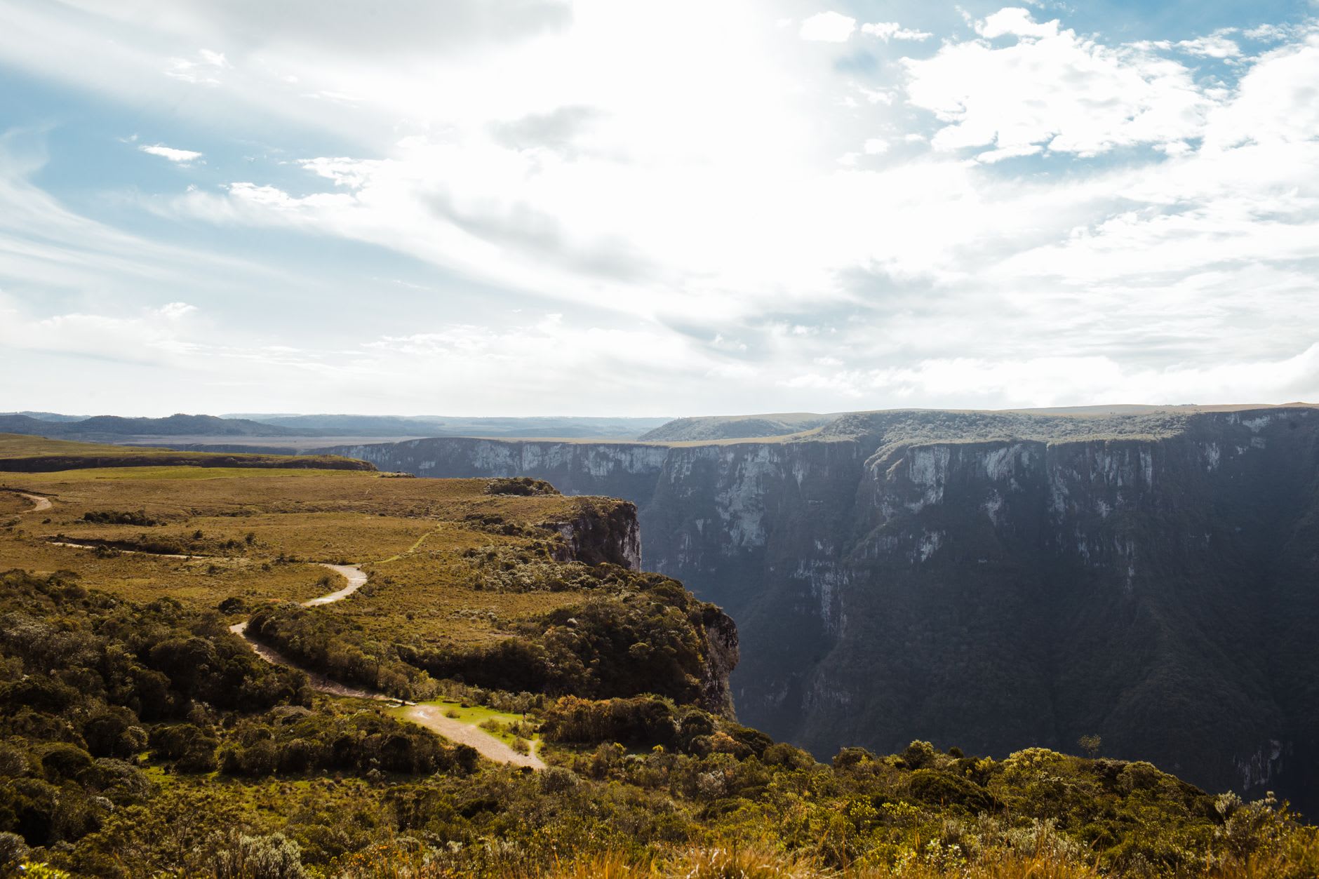
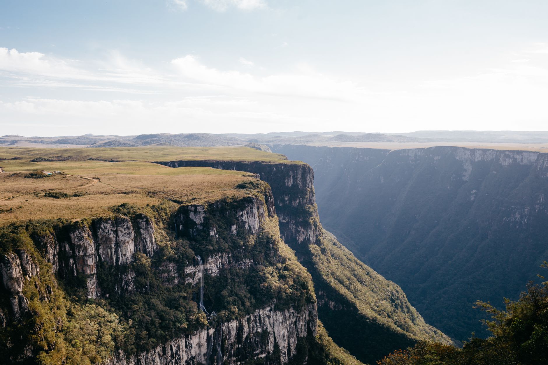
Everyone who comes to this corner of the Brazilian south goes to Itaimbezinho, the famous canyon, and far fewer make the longer drive to Fortaleza, which is a shame for them and a quiet gift for the rest of us. It sits inside Serra Geral National Park, up on the high plateau where the states of Rio Grande do Sul and Santa Catarina meet along a series of immense canyons gouged into the edge of the highlands. The approach is across rolling grassland that looks nothing like the tropical Brazil of the postcards — it could be the Scottish Highlands, all wind-flattened grass and grazing cattle — until the ground simply ends and drops away in a green wall that falls some nine hundred metres to a forested valley far below.
A negotiation with the clouds
We based ourselves in Cambará do Sul, the small ranching town that serves as the gateway, and drove out on a gravel road early enough to beat the day-trip vans. The park has you walk a few kilometres across the open plateau to the various miradouros, and the entire experience is governed by cloud. Moisture rolls up the canyon walls from the coast and pools at the rim, and on most mornings the view is simply white — a soft, total blankness where the canyon should be, with the disorienting sound of birds calling from somewhere below the cloud you cannot see into.
We stood at the edge of nothing for the better part of an hour, Lia increasingly convinced we had driven all this way to look at fog, and I was about to agree with her when the wind shifted and the whole cloud bank tore open like a curtain. The canyon was suddenly, vertiginously there — sheer cliffs streaked with waterfalls, the valley floor impossibly far down, and at the very edge of sight a thin silver line that the guide said was the Atlantic, forty kilometres away. It lasted maybe ten minutes before the cloud closed again, and it was worth every minute of the waiting.
The Pedra do Segredo and the edge
The signature viewpoint is the Pedra do Segredo — the Stone of the Secret — a slab of rock balanced at the very lip of the canyon, where you can stand with the void directly beneath your boots if your nerve holds. Mine mostly did not; I edged out far enough for one photograph and then retreated to a respectful distance while Lia, who has no such instincts, sat with her legs hanging over the drop and ate an orange. The wind up here is relentless and cold even in summer, and the grass at the rim is permanently combed flat in the direction the cloud travels.
Back in Cambará do Sul that evening we ate at a galpão-style churrasco place where the meat arrived in slow waves on long skewers and the regional pinhão — the seed of the araucaria pines that dot the plateau — was roasted and served by the bowlful. It is hearty, cold-country food, gaúcho food, and after a windswept day on the rim it tasted exactly right.
When to go
The canyons are open year-round, but the cloud is the deciding factor. The drier, clearer months run roughly from April through September, with the southern winter (June to August) offering the crispest air and the best odds of an open view, at the cost of genuinely cold, windy mornings — frost is common up top. Whenever you go, start as early as the park allows, because the cloud tends to build through the day. And bring far warmer layers than the word “Brazil” will lead you to pack.