Cape York Peninsula
"North of Laura the sealed road ends, and Australia becomes itself again."
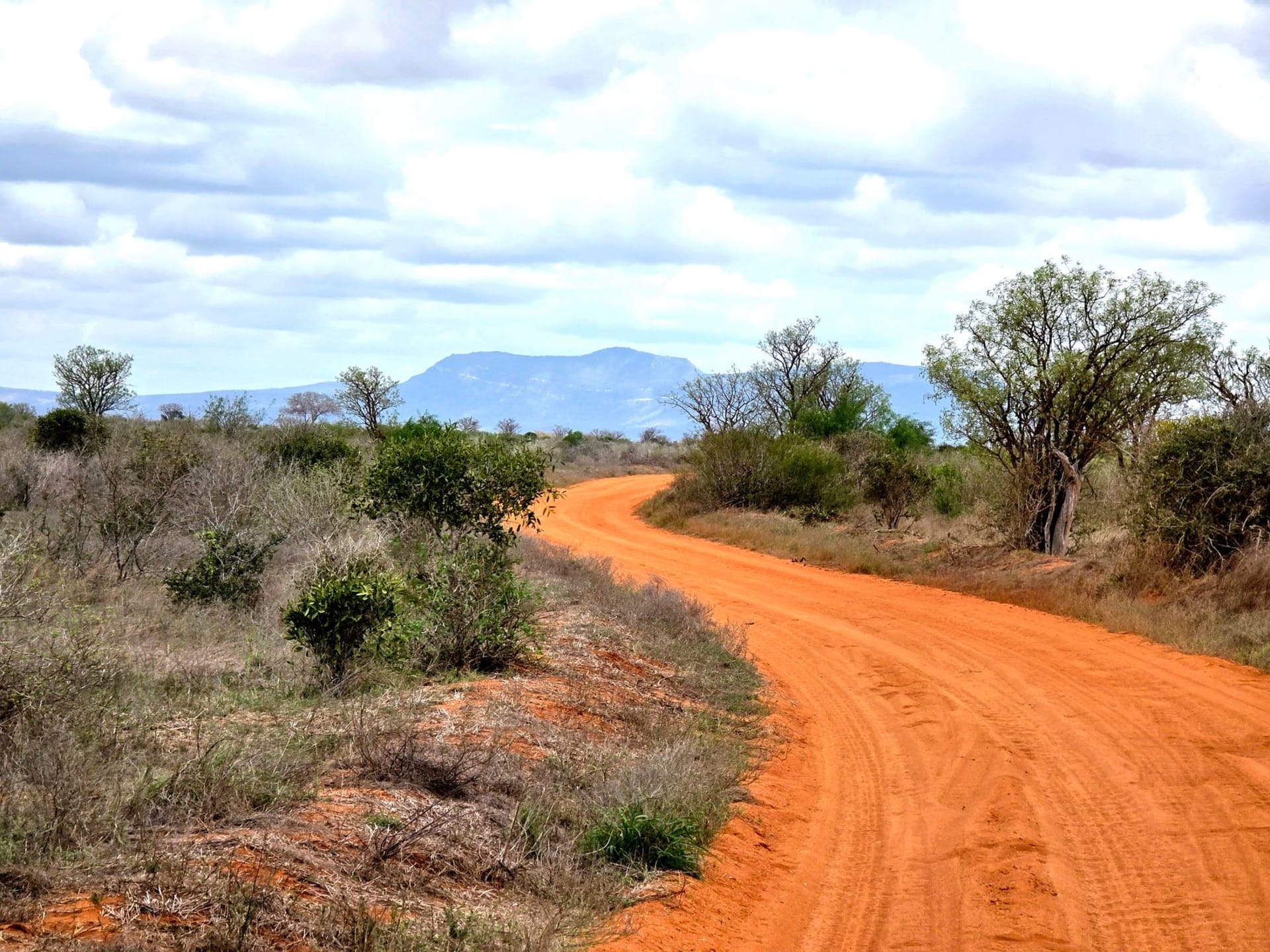
North of Laura, the sealed road ends and the Cape begins. A junction sign indicates distances to stations and communities in the manner of a city sign indicating intersections, and then you’re on red dirt and the whole tenor of the drive changes. The dust is extraordinary — a deep iron-red that coats everything within the first hour, settles in the folds of your map, stains the hire car to a colour the rental company will later discuss with you in careful detail. But the landscape opening around that red dirt is one of the genuinely unrepeatable things I’ve encountered in travel: vast open savanna running to horizons that have no feature to break them except the occasional paperbark forest lining a river and the dark silhouette of a wedge-tailed eagle riding a thermal above it all. The silence is not the absence of sound — it is the active presence of a landscape doing its work without reference to you.

The Quinkan rock art sites near Laura are among the most significant in Australia and are still not widely known outside the country. The sandstone galleries in the jump-up country south of the Palmer River hold figures painted in ochre that the Ang-Gnarra Aboriginal Corporation dates between 10,000 and 14,000 years old — a span of time that makes the word “history” seem like an imprecise tool and the word “ancient” seem like something only recently invented. I went with an Ang-Gnarra guide who engaged with the paintings as living cultural documents rather than tourist attractions, and his reading of one particular figure — a Timara, a spirit being associated with this specific Country — made the ochre marks on the rock wall suddenly immediate rather than archaeological. The detail in some of the larger galleries is extraordinary: animals rendered with such specific anatomical knowledge that zoologists have used them to track species distributions over millennia.
The river crossings are where Cape York communicates its terms most directly. The creek crossings in the south are often dry in the dry season — you drive through sandy creek beds without ceremony. But the Jardine River in the far north, the final major crossing before the tip, is different: deep, wide, moving, occupied by saltwater crocodiles who treat the 4WD fording as an inconvenience. A barge service operates during the dry season, and there is something clarifying about the combination of paying for a barge crossing and watching crocodile movement in the water below that confirms you are not in a recreational park but in country that is managing itself.

The small community of Bamaga, north of the Jardine, operates with the quiet self-possession of a place far enough from everything that the usual national narrative doesn’t quite reach. The vegetation shifts here — denser, lower, the savanna giving way to something that feels more Pacific than Australian. The tip itself — a narrow rocky promontory where the Coral Sea meets the Torres Strait — is anticlimactic in the way all extreme geography eventually is. A cairn, a sign, photographs of people with the satisfied expressions of those who’ve completed something. The satisfaction is real, though: getting here requires a proper 4WD, early departure from Cairns, several days of driving, the river crossings, and a willingness to be entirely out of range of mobile phone networks for extended stretches.
The return drive south, heading back through the dust and the savanna and the creek crossings, has a different quality from the outbound journey: not the anticipation of arrival but the particular pleasure of carrying a landscape inside you. Some places earn the effort of reaching them by changing how you see everything afterwards, and Cape York is one of those places.
When to go: June through September only. The roads north of Laura are accessible in the dry season and impassable in the wet. July is peak season and the best-known campsites book out — go in June or late August for more breathing room. A proper 4WD rated for river crossings, a recovery kit, two full spare tyres, and a satellite communicator are not optional recommendations. They are the equipment list for a place that does not care about your convenience.