Ladybower Reservoir
"There is a village somewhere below the surface. On dry years, its chimney stacks come back."
In the drought summer of 1976, the water level in Ladybower Reservoir dropped enough to expose the ruins of Derwent village — the community that was compulsorily purchased and submerged when the reservoir was completed in 1943. The church spire appeared above the surface first, then the mill, then walls and foundations. People came from Sheffield and Manchester to walk through the ruins, photographing a village that had not been accessible for thirty years. In dry years since — 1989, 1995, 2018 — it has happened again, briefly, the dead village returning to the surface like something refusing to stay buried. This is the story that Ladybower holds under its cold surface, and it is impossible to stand on the shore and not think about the two hundred people who were paid to leave and watched from surrounding hillsides as their homes disappeared.
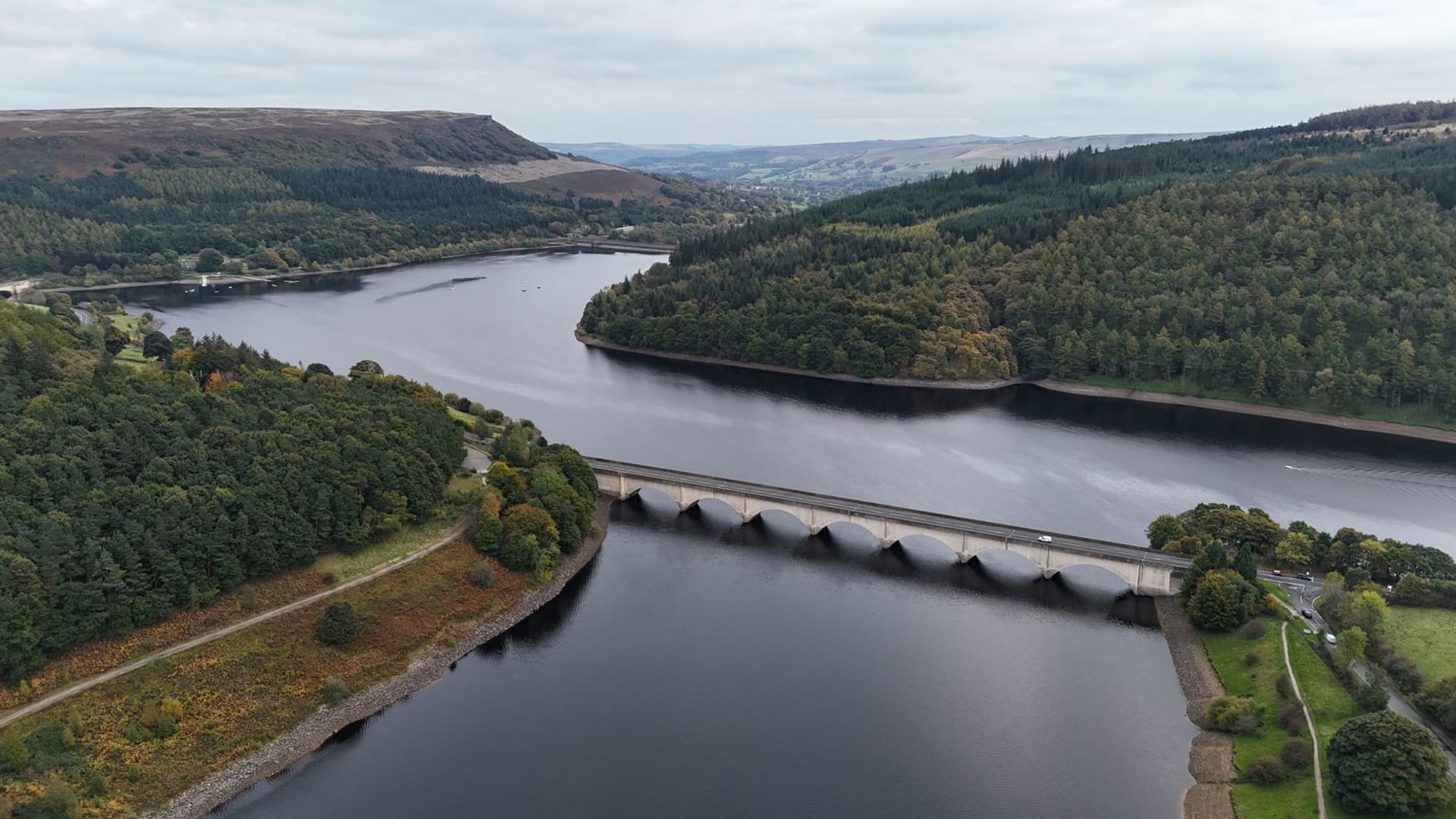
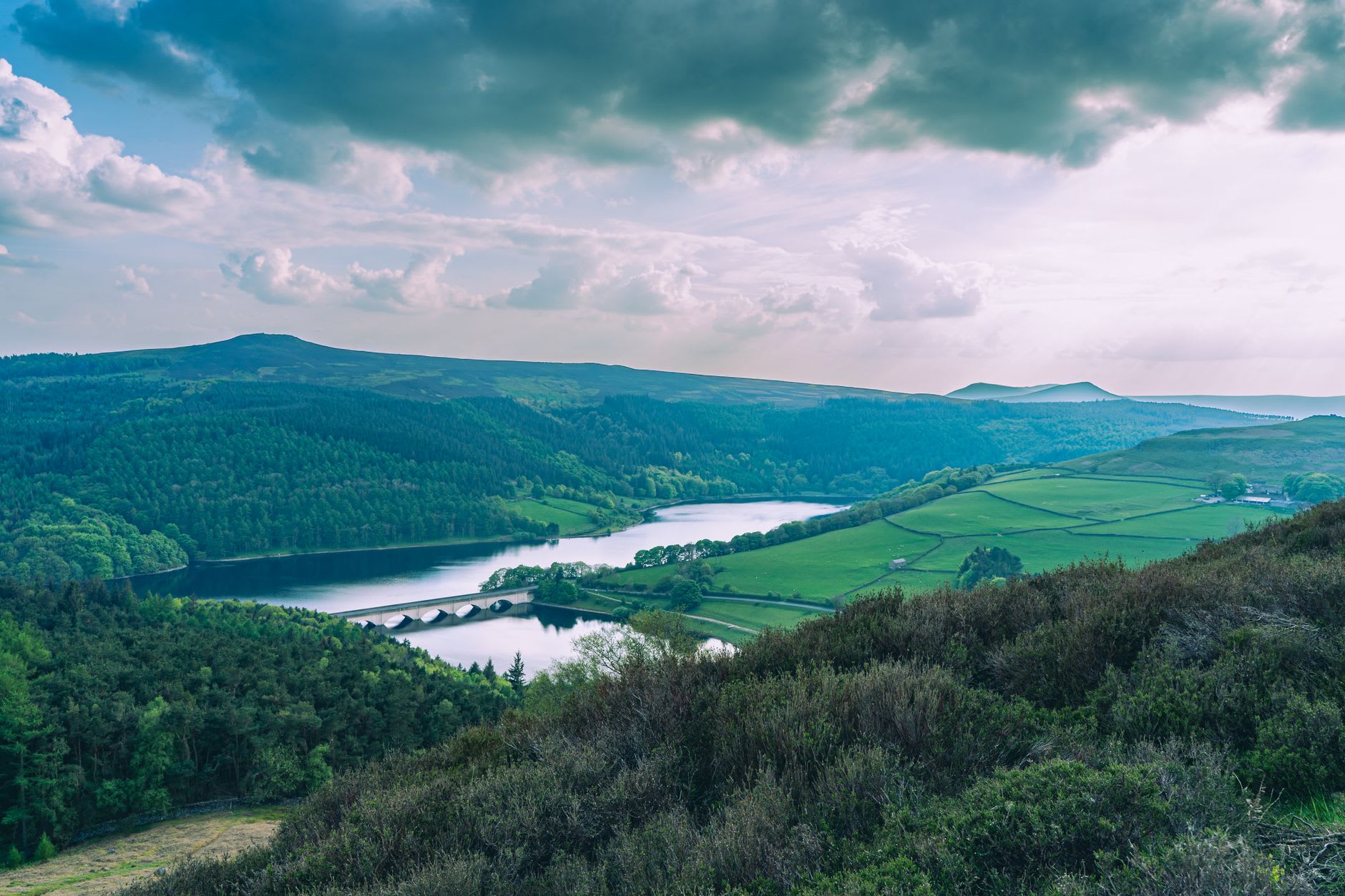
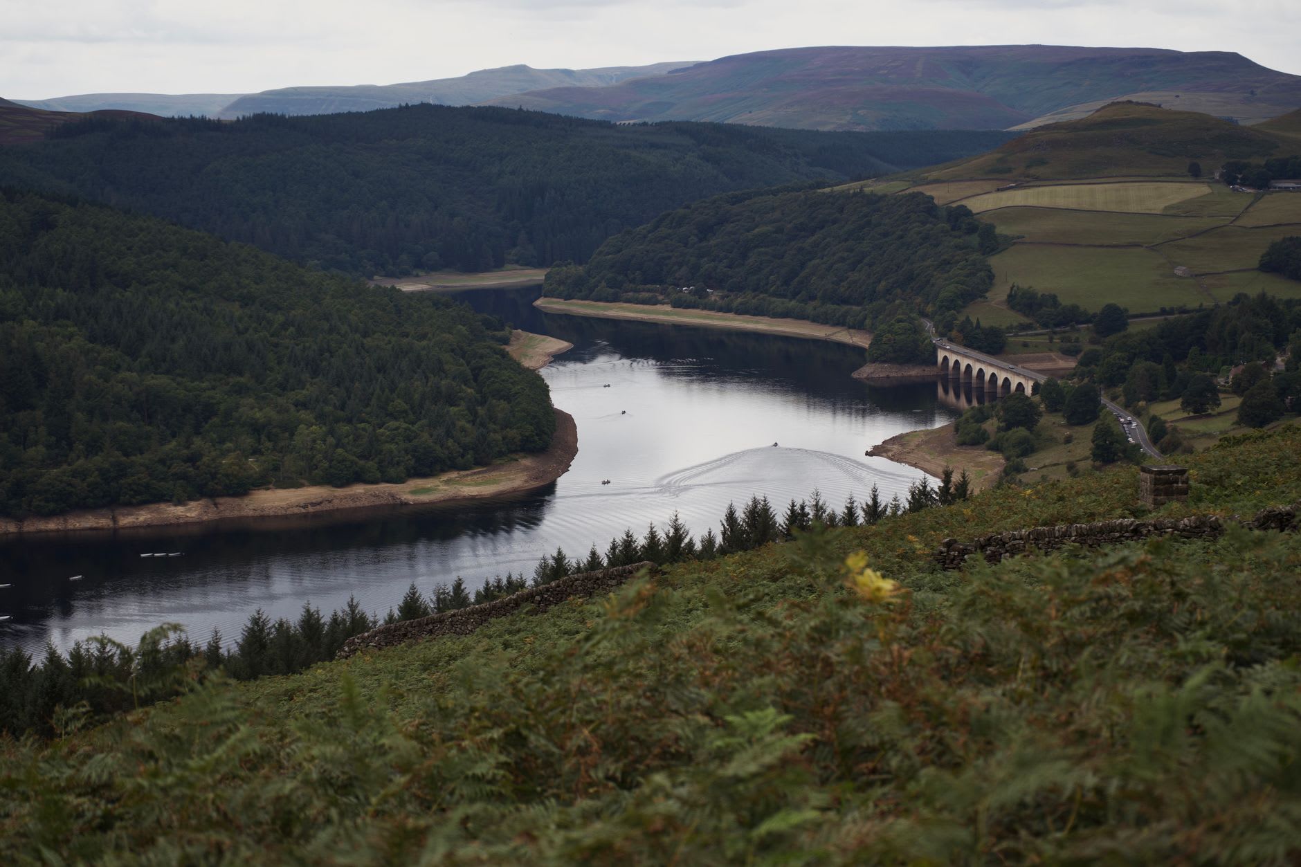
I drove up the A57 from Sheffield on an overcast morning in autumn when the moor had gone the colour of old copper and the reservoir was a shade of grey-blue that it shares with the sky above it, blurring the horizon between water and cloud. The first view from the road — where the A57 rounds a bend above the Ashopton viaduct and the full expanse of the reservoir appears below — is one of those English landscape moments that requires no preparation. It is simply vast. The reservoir holds 36,000 million litres when full, and the surrounding moorland of the Derwent Edges and Bleaklow fill the hills above it with the dark, heather-covered weight of the Dark Peak.
The reservoir has a second history that sits more comfortably: it was used by 617 Squadron — the Dambusters — to practise the low-level flying required for the Operation Chastise raids on the Ruhr dams in 1943. The twin sail-shaped overflow towers at the south end of the reservoir were the markers for the final approach practice runs. In May 1943, a few months after Ladybower was filled, the modified Lancaster bombers practised here at night, flying at 18 metres above the water with their landing lights on to judge height. The Derwent Dam further north in the valley was used for the actual training. There is a small museum at the Derwent Dam on selected weekends, and on the anniversary of the raids in May, a Lancaster and Spitfire from the Battle of Britain Memorial Flight sometimes make a pass over the valley in tribute, which I have never managed to time my visits to witness but which people who have describe with a particular quiet intensity.
Walking the circuit of the upper reservoir — the path that runs through the Hagg Farm woodland and along the eastern shore to the Derwent Dam — takes three hours at a comfortable pace and passes through every texture of Dark Peak landscape: conifer plantation, open heather moor, lakeside oak woodland, raw gritstone above. The water is always visible, always different — silver in morning light, black under cloud, the deep blue of an English summer afternoon that is somehow warmer in colour than the temperature justifies.
There are Yorkshire terriers in the car parks at weekends, brought by people who have come for the walk and ended up just standing at the water’s edge eating sandwiches. This is also a valid use of Ladybower. The Fairholmes visitor centre at the north end has a café that does hot chocolate in portions that acknowledge the climate. The cycling along the valley roads is excellent — the route north from Fairholmes to the upper reservoir is car-free on Sundays.
When to go: October and early November for the heather moor at its most atmospheric and the water reflecting autumn skies. July and August if the dry weather comes and you want a chance of seeing the village ruins emerge. Winter is extraordinary and stark — the valley empties of visitors and the water takes on a gunmetal quality that suits its history.