
Carretera Austral
"The Carretera doesn't take you through Patagonia — it takes you into it, slowly, by degrees."
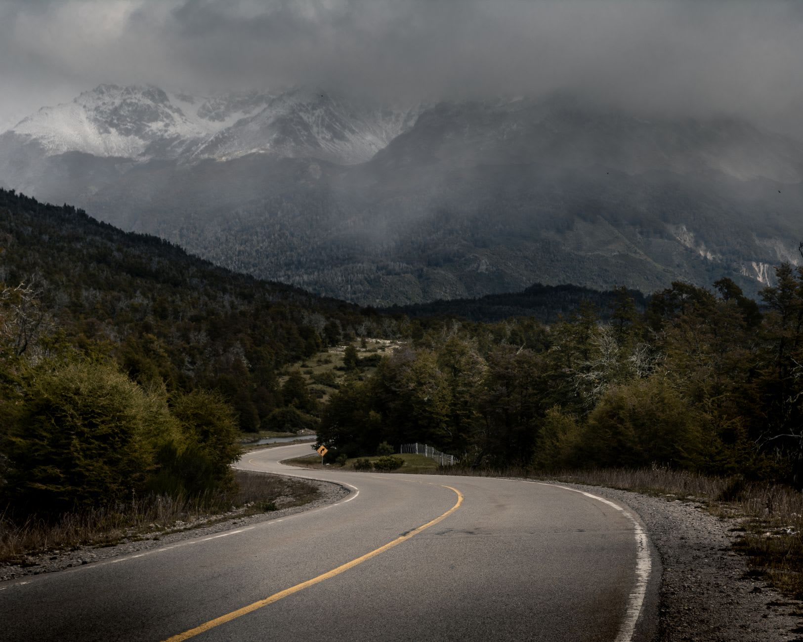
The section between Puyuhuapi and Villa Cerro Castillo is where the Carretera Austral stopped being a road I was driving and became something I was inside. The rain had been falling for two hours when the cloud lifted, briefly, to reveal a wall of hanging glacier to the east — ice blue and white against raw rock — and then a river valley to the west where the water was the colour of glacial milk, pale green, moving fast over a gravel bed the size of a highway median. I pulled onto the verge and turned off the engine and stood in the drizzle for fifteen minutes doing nothing useful. This is what the Carretera does to people. There is no shame in it.
Chile’s Highway 7 runs roughly 1,240 kilometres from Puerto Montt south to Villa O’Higgins, ending where the land eventually dissolves into channels and ice and there is no road left to build. Augusto Pinochet began constructing it in the 1970s using military labour and dynamite, which gives the highway a complicated history — this beauty built by conscripted men under a dictatorship — and the locals who live along it tend to discuss this when you give them the chance. The road passes through everything: coastal rainforest so dense the canopy closes above two-lane width, open steppe where guanacos watch from ridgelines, fishing villages accessible by no other route, thermal springs in a river bend that smell faintly of sulfur and feel extraordinary.
The thermal springs at Puyuhuapi are a particular pleasure. The hot pools face a fjord, and in the evening the mist comes off the cold water and mingles with the steam from the pools, and you sit in thirty-five degrees of mineral water watching the Patagonian dark close around the mountains. I went with a couple from Valparaíso who had been driving the Carretera for three weeks and who had settled into the road’s particular rhythm — early starts, slow days, stopping whenever something looked worth stopping for. They had about eight hundred photographs of similar gravel curves by this point, they told me, and couldn’t bring themselves to stop taking them. I understood completely.

The national parks along the route are not as famous as Torres del Paine and not as crowded, and this is entirely to their credit. Parque Nacional Queulat, centred on the Ventisquero Colgante — the hanging glacier — has trails through primary forest, ferns the size of small trees, and a lake at the base of the ice that mirrors the glacier perfectly on still mornings. I hiked there alone for three hours and saw seven people total, and the silence was broken only by the drip of condensation off giant leaves and one distant calving that arrived as a low rumble through the trees.
The practicalities of the Carretera require accepting uncertainty. Fuel stations are sparse and occasionally out of diesel. The road is unpaved in long sections and the river ferries run on schedules that weather sometimes overrides. This is not a drive you do on a deadline. The people who find the Carretera transformative are, almost universally, the ones who gave up trying to cover it efficiently and simply drove until they ran out of days.
When to go: November through March is the accessible window for most of the route, with the river ferries running reliably and the campgrounds open. December and January are the warmest months. October can be spectacular — the forest flowering, fewer vehicles, the road not yet dusty. Budget at minimum ten days for a meaningful section; three weeks if you want to do it with the attention it deserves.