North Cascades
"This is what the Pacific Northwest looks like when no one's been managing the scenery."
Highway 20 through the North Cascades closes every winter under metres of snowpack, and when it reopens in late spring, it does so quietly — no ceremony, just the plows finishing and a gate swinging open in the mountains east of Concrete, Washington. I drove it in May, the year after I first came to the Pacific Northwest, having been told by two separate people in Seattle that it was the most beautiful drive in the state and by one person that it was the most beautiful drive in the country. The road climbs out of the Skagit Valley into a world that has clearly not been consulted about what the rest of Washington is doing.
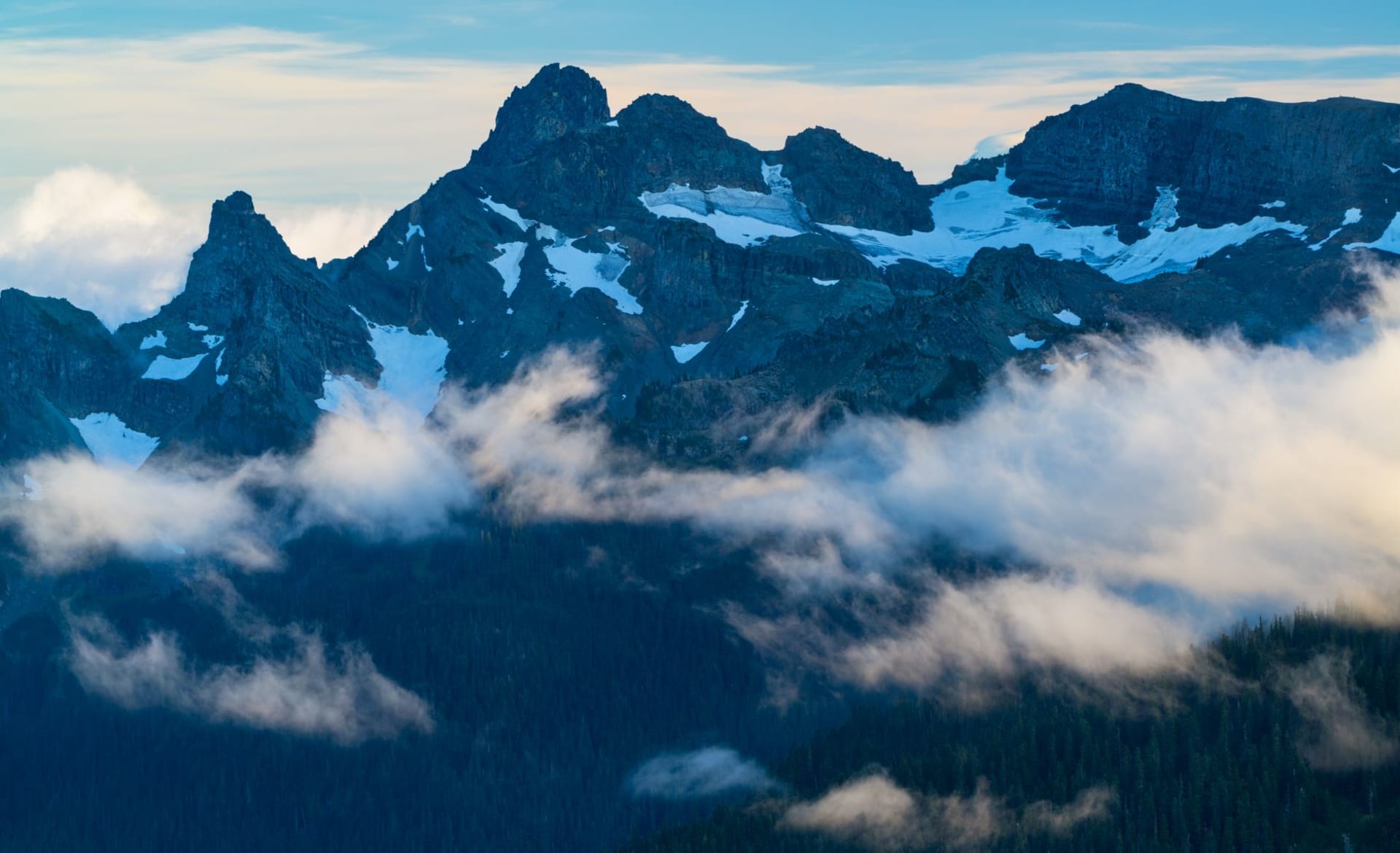
The North Cascades are geologically distinct from the volcanoes further south — older, more complex, folded and faulted and overthrust into a topography so jumbled that from the air the range looks less like a mountain chain and more like a crumpled piece of geological paper. There are over 300 glaciers in the North Cascades, more than in any other area of the contiguous United States. They are retreating, visibly and measurably, year by year, but they are still here, still grinding, still feeding the turquoise rivers below with the rock flour that gives them their impossible colour.
Diablo Lake, visible from the highway near the Diablo Dam, is the colour that painters add to skies to make them look unrealistic. The turquoise comes from the suspended glacial particles in the water catching the light at specific frequencies, and the effect is so vivid it reads as artificial. I stopped at the Diablo Lake Overlook and spent ten minutes convincing myself I was actually seeing it correctly and not some optical effect of the high altitude. I was seeing it correctly. The lake just looks like that.
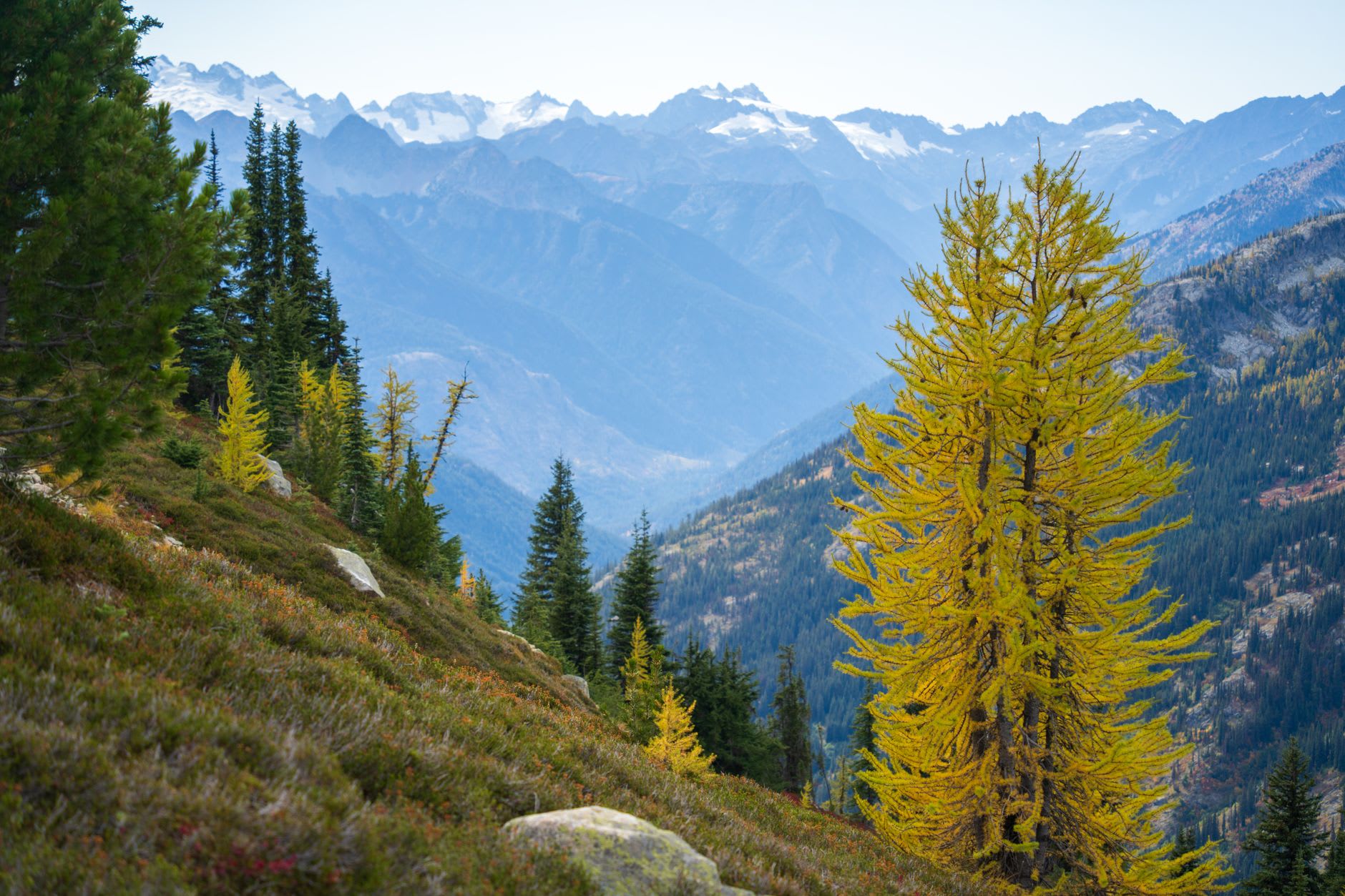
The main backcountry experience in the North Cascades is the Cascade Pass trail, which gains 1,700 feet in 3.7 miles and deposits you at a saddle between two glacier-hung peaks where the views in both directions are effectively the definition of alpine drama. I hiked it solo in early September and found the upper basin empty except for two marmots who watched me eat lunch with the professional curiosity of creatures that have long since decided humans are neither predator nor prey, merely entertainment. The silence at the pass had a quality I associate with very remote places — not absence of sound but a particular density of it, the kind that rings slightly.

The communities on the eastern approach — Winthrop and Twisp in the Methow Valley — are the other side of the Cascades experience, and they feel like a different climate, a different culture, a different relationship to the land. The rain shadow here drops annual precipitation to under a foot. Ponderosa pines replace Douglas fir. The valley is dry and golden in summer, and Winthrop has built itself into something like a Western frontier town (the wooden storefronts and boardwalks are actually genuine, established in the 1970s revival) where the coffee is also very good and the river in summer is full of fly fishermen doing what fly fishermen do: standing in cold water with extreme patience.
When to go: Highway 20 is typically open from late April to November. The peak hiking window is July through mid-September. The Methow Valley east of the pass is a Nordic skiing destination from December through March, with an extensive groomed trail network.