
Columbia River Gorge
"The gorge is where the west becomes the west — you feel the continent change on either side of the river."
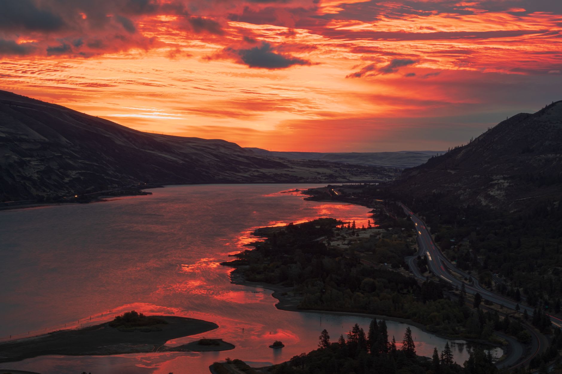
The first thing I noticed driving east from Portland on Highway 30 was the smell. The road follows the south bank of the Columbia through a canopy of big-leaf maple and Oregon white oak, and in late September the air through the open window carried the smell of damp basalt and rain on leaf litter and something else — a coolness that had nothing to do with temperature and everything to do with altitude and stone. The gorge wall rose on both sides and ahead the river opened and widened toward a flat east that I knew was coming but that still arrived as a surprise.
Multnomah Falls is the gorge’s most visited feature and deserves every visitor it gets, which is a thing I rarely say about waterfalls in the tourist circuit. The falls drop 189 metres in two stages over a basalt escarpment, and the old stone bridge spanning the lower tier was built in 1914 with a sense of proportion that modern visitor infrastructure rarely manages. I arrived at 7:30 in the morning on a weekday in October when the mist was still in the trees above, and the upper fall was barely visible through it. The sound was total. By the time I left, buses were arriving from Portland. I had timed it perfectly, and I would be lying if I said I wasn’t pleased with myself.

The gorge has seventy-seven named waterfalls on the Oregon side alone, and the Historic Columbia River Highway — the first scenic highway in the United States, built between 1913 and 1922 — passes most of them on a road that curves through the basalt with a restraint that modern engineering has entirely forgotten. I drove the upper section from Crown Point to Cascade Locks and pulled over at Latourell Falls, Shepperd’s Dell, Bridal Veil — each one a different character, a different relationship between rock and water, a different quality of the green that the gorge seems to manufacture at will. By Oneonta Gorge, a narrow slot canyon you can only enter by wading through a shallow stream, I had stopped trying to compare them.
The east end of the gorge is a different world. Hood River — the town at the gorge’s eastern opening — is the windsurfing and kiteboarding capital of North America, and on any afternoon with the west wind running, the Columbia near here is a chaos of colour: bright sails moving fast in both directions, the wind so consistent and reliable that athletes come from Europe specifically to train on this water. I don’t windsurf, but I sat on the waterfront at an outdoor table with a pint of Full Sail ale — brewed here since 1987 in a building that overlooks the river — and watched the sails cross and recross until the sun dropped behind the Oregon hills and the colours drained and the river went dark.
The Washington side of the gorge is quieter and wilder. The Beacon Rock State Park trail leads to the summit of an 848-foot basalt monolith above the river — the second-largest freestanding rock in North America, though exactly who is counting and by what measure I have never been fully clear on. From the top, the river spreads out below in both directions and the Cascade peaks line the horizon to the north and south, and you understand why the gorge was carved a national scenic area: not because anyone needed permission to see it, but because it needed protecting from the moment people understood what it was.
When to go: Spring (April–June) brings peak waterfall flow as snowmelt combines with rain. Summer weekends are genuinely crowded at Multnomah; go early or go east to Hood River. October delivers autumn colour, manageable crowds, and the west wind still running hard enough for the windsurfers.