Bend
"Bend is what happens when an outdoor town figures out it can also have a really good dinner."
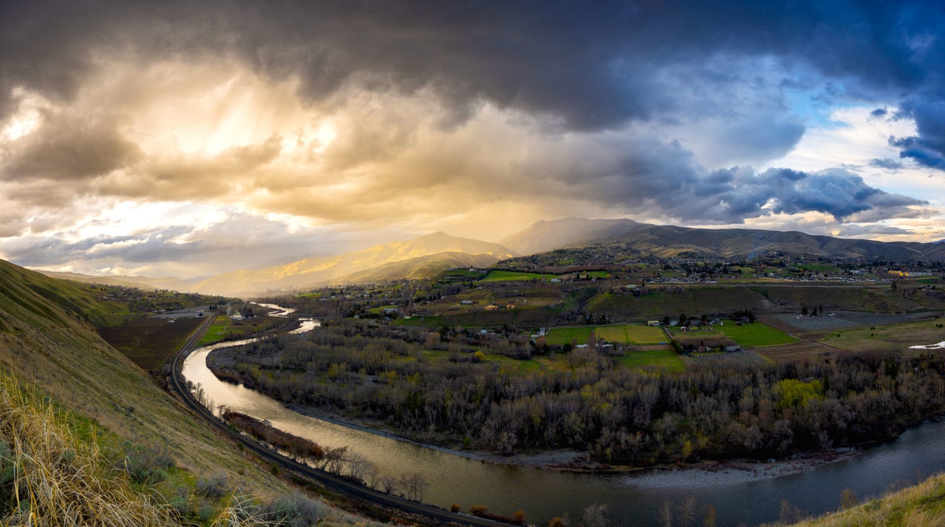
I crossed from the wet side of the Cascades to the dry side on Highway 20 out of Santiam Pass, and the change was not subtle. In fifty miles the Douglas fir gave way to ponderosa pine, the sky opened from grey to blue, the air dried out, and the earth went from green to ochre. By the time I dropped into the Deschutes River canyon above Bend I was in a different Oregon — the Oregon that the rain never reaches, the Oregon that smells of hot pine sap and juniper dust in July, the Oregon that requires sunscreen rather than a Gore-Tex jacket.
Bend sits at 1,100 metres in the high desert, on the eastern slope of the Cascades, and its relationship with the landscape around it is muscular and enthusiastic in a way that larger outdoor cities tend to lose. The Deschutes River runs through the downtown on its way south to Newberry Volcano country, and the stretch below the Old Mill District has been sculpted into a whitewater park where kayakers and stand-up paddleboarders perform their various acts of controlled falling on any given afternoon. I watched from a footbridge one July evening and counted seven different genres of human attempting to be vertical in moving water. Most succeeded. The ones who didn’t seemed to consider this a reasonable outcome.

The craft beer situation in Bend is, by any measure, excessive in the best way. There are more breweries per capita here than nearly anywhere else in the United States, and they are not all the same brewery with different names. Deschutes Brewery, the anchor institution, has been operating since 1988 and makes a Black Butte Porter that I have recommended to people who claim not to like dark beer and watched change their position. The smaller places along the Bend Ale Trail — yes, there is a trail, yes, it is taken seriously — range from experimental sours to West Coast IPAs with a hop punch that clears the sinuses and improves the afternoon.
Smith Rock State Park, twenty-five miles north of town, is the reason many climbers come to this part of Oregon and the reason I came back a second time. The Crooked River canyon cuts through old volcanic tuff formations into sheer walls of orange and red rock, and from the Misery Ridge trail the view down into the canyon and up at the Monkey Face formation — a volcanic spire with a naturally occurring hole that resembles, with some imagination, a primate — is one of the more spectacular pieces of landscape geometry in the West. The climbs here established sport climbing in the United States; the routes are still being used and new ones still being put up.

The downtown has settled into a version of prosperous western outdoor town that works because the foundation remains honest — the people here mostly actually do the things the gear shops sell equipment for. On a Saturday morning in August the trail running community passes through the river path like a slow moving event, and the conversation at the coffee shop on Wall Street is genuinely half about routes and conditions, not performed at half about routes and conditions. This is the difference between a place that has outdoor culture and a place that sells it.
When to go: June through September for the dry season, climbing, river activities, and trail running. Winter (November–March) brings skiing at Mount Bachelor — one of the best ski resorts in the Pacific Northwest — twenty minutes from downtown. Spring (April–May) is the sweet spot: the crowds are gone, the desert wildflowers are briefly extraordinary, and the rivers are running high and fast.