Trolltunga
"On Trolltunga's tip, looking down 700 metres: the rational mind knows you are fine. The rest of you disagrees."
The Trolltunga hike begins in the car park at Skjeggedal at six in the morning, in my case, which felt excessive until I started walking and understood that ten kilometres of elevation gain — roughly 800 metres up before the plateau — needed to be completed before the midday crowds would make the final ledge inaccessible. I had instant coffee from a thermos and the sound of the Ringedalsvassdraget river below and the particular quality of early mountain light that is simultaneously cold and luminous.
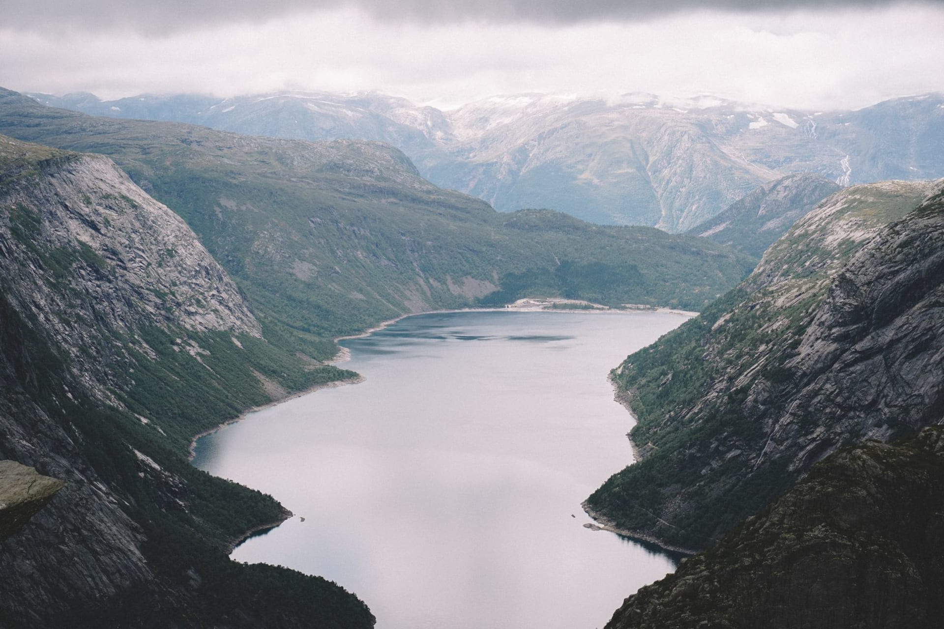
The trail is classified as difficult and that rating is accurate. The lower section climbs aggressively through birch and then heather and then bare rock, with metal handrails bolted into the cliff face at one point that you grip with genuine attention. I reached the high plateau after two and a half hours, breathing harder than I would like to admit, and the character of the hike changed entirely. The plateau is a high moorland of lakes and snowfields and flat rock, with the Hardangerfjord occasionally visible as a dark strip to the south, and you walk it for several kilometres before the ledge appears.

The ledge itself emerges from the cliff face as if the mountain is extending its tongue — which is what the name means, trolls’ tongue — and hangs over Ringedalsvatnet 700 metres below. The lake is a specific and vivid turquoise from the snowmelt that feeds it. The drop beneath the ledge is clean and vertical. When I arrived, three other hikers were waiting their turn for the ledge; by the time I had been there twenty minutes there were twenty people. The waiting is part of the experience, honestly — you watch others stand out there and observe what their bodies do with the height, the small adjustments of posture, the stiffening, the deliberate stillness.
I walked to the end of the ledge and stood there for perhaps two minutes. The turquoise lake below was extraordinarily clear, individual boulders visible on its bed even from 700 metres. The mountain walls across the water ran in horizontal bands of grey and rust. The wind was modest but present, and I was aware of it in a way that I normally do not register wind — each gust a negotiation. I took one photograph of the view and then put the phone away because looking at it through a screen was making the experience smaller rather than larger.

The return journey takes roughly the same time as the ascent but uses different muscles, and my knees were having a frank conversation with me by the time I descended back to the tree line. I had packed more food than I thought I needed and ate all of it — dense rye bread with hard cheese and a chocolate bar that had gone soft in my jacket pocket, consumed while sitting on a boulder at the edge of the plateau watching a cloud system move in from the west. There is a particular satisfaction in eating when you have genuinely earned your hunger.
When to go: Late June through mid-September, strictly — the trail is snow-covered and dangerous outside this window, and the mountain rescue operations this route has generated are extensive. Start no later than 7am in peak summer to reach the ledge before the queues extend beyond thirty minutes. Bring more layers than you think you need; the plateau is exposed and the temperature drops quickly when the cloud comes in, which it will.