Jostedalsbreen
"I put my bare hand on ice that predates every person I've ever met."
Mainland Europe's largest glacier, a vast white dome feeding icy arms down into green Norwegian valleys.
I didn’t fully understand the word “glacier” until I stood at the foot of Nigardsbreen and craned my neck to see where the ice actually ended. Jostedalsbreen is the largest glacier on the European mainland — something like 474 square kilometers of ice sitting across Sogn og Fjordane, thick enough in places to bury a 150-story building. Lia and I drove up from Sogndal on a gray June morning, and even the drive in felt like a slow unveiling: farmland, then forest, then suddenly this white mass hanging between two peaks like it had always been there and always would be, even though I already knew that wasn’t quite true anymore.
We took the short boat across the glacial lake to get closer to Nigardsbreen, one of the glacier’s most accessible arms, and the water had that specific milky turquoise color you only get from rock flour ground up by moving ice. Our guide, a Norwegian glaciologist’s former student, pointed out marker stones along the trail showing where the glacier’s edge had been in 1990, 2005, 2015 — each one further back than the last. It was the first time climate change felt less like a headline and more like a physical fact I could walk past.
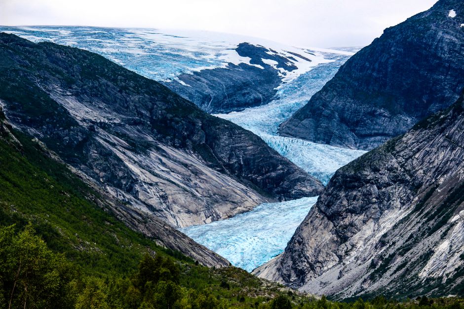
Later that trip we made the longer detour to Briksdalsbreen, on the other side of the ice cap, where you can take a “troll car” partway up the valley before hiking the rest. Lia found a spot where meltwater ran directly off the glacier tongue and just stood there for a while, hand in the current, saying nothing. I understood why. There’s something about touching ice that’s been accumulating snow, layer on layer, for centuries — sitting inside a national park that protects over 1,300 square kilometers of glacier and wild mountain around it — that makes you go quiet too.
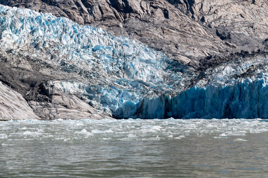
What stayed with me wasn’t the scale, though the scale is real — it’s the sense of watching something disappear in real time while you’re standing next to it. Norwegian glaciologists have been tracking Jostedalsbreen’s retreat since the early 1900s, and you don’t need their data to feel it; the guides just point at where the ice used to be and let the silence do the rest.
When to go: June through September is really your window here — that’s when both Nigardsbreen and Briksdalsbreen are properly accessible, the hiking trails are clear, and the Briksdalsbreen boat and troll-car service are actually running.
Keep exploring
More from Norwegian Fjords
 norwegian-fjords
 Kjerag
A brutal mountain plateau above Lysefjord where a single boulder wedged in a chasm has become the most terrifying photo opportunity in Norway.
Explore norwegian-fjords
 Nærøyfjord
The world's narrowest fjord, a UNESCO corridor where the cliffs lean close enough to feel like they're listening.
Explore norwegian-fjords
 Preikestolen
A flat rock shelf 604 metres above Lysefjord where the ground ends without apology and the view begins without limit.
Explore norwegian-fjords
 Runde Island
A wind-scoured island of 500,000 seabirds and sunken gold, where puffins nest on cliffs above the cold Norwegian Sea.
Explore norwegian-fjords
 Sognefjord
Norway's longest and deepest fjord stretches 205 kilometres inland — a body of water so vast it contains its own weather.
Explore norwegian-fjords
 Trolltunga
A rock ledge hanging over a 700-metre drop above Ringedalsvatnet — the hardest view in Norway to earn, and the most impossible to forget.
Explore